- Caballito, Buenos Aires
-
"Caballito" redirects here. For other uses, see Caballito (disambiguation).
Caballito — Barrio — Alberdi Avenue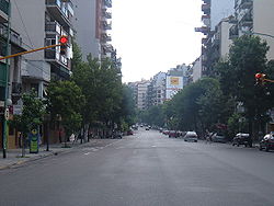 Location of Caballito within Buenos Aires
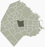
Country  Argentina
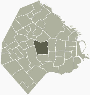
Autonomous City Buenos Aires Comuna C6 Important sites Ferro Carril Oeste Area – Total 7.1 km2 (2.7 sq mi) Population – Total 183,396 – Density 25,830.4/km2 (66,900.5/sq mi) Time zone ART (UTC-3) Caballito is a barrio (neighborhood) of the Argentine capital, Buenos Aires. It is the only barrio in the administrative division Comuna 6.
It's located in the geographical centre of the city, limited by the following streets and avenues: Rio de Janeiro, Av. Rivadavia, Av. La Plata, Av. Directorio, Curapaligüe, Av. Donato Álvarez, Av. Juan B. Justo, Av. San Martín, and Av. Ángel Gallardo.
The name is said to come from the horse-shaped (Spanish caballo) weather vane from a local pulpería (gauchos' bar); Caballito meaning "Little horse".
Places of interest
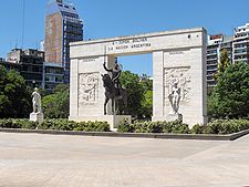
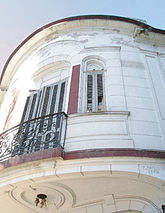
In Caballito there are numerous points of interest; the “English District” with beautiful British style “Fin de Siècle” architecture, the Ferro Carril Oeste football Club (or “Verdolaga”), the “Historical Tramway museum of Buenos Aires”, the old “Mercado del Progreso” (Market of Progress) a neighborhood favorite since 1890, the Italian Club and the Portuguese Club. Among the area's cultural points of interest are the Church of Caacupé, belonging to an order of Irish nuns although receiving its name to a sculpture dedicated to the Virgin of Caacupé, the Faculty of Philosophy and Literature of the University of Buenos Aires. Neighborhood commuters are served by Subway Line A. Opened in 1913 as the city's (and the Southern Hemisphere's) first subway line, it still features vintage Belgian rolling stock. Other places of interest are the Cid Campeador monument, located at the corner of San Martín Avenue, Gaona Avenue, H. Pueyrredón Avenue, A. Gallardo Avenue and Díaz Vélez Avenue; and the Red Building, located at the corner of Aranguren St. and Hidalgo St.
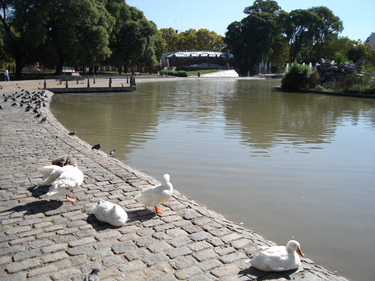
Area residents have relatively few large green spaces at their enjoyment; the two most important, however, are Parque Rivadavia, on Rivadavia Avenue, and Parque Centenario. Opened to the public in 1910, Parque Centenario was so christened in honor of the hundredth anniversary of 25 May 1810, proclamation that later led to independence. Designed by renown French-Argentine urbanist Charles Thays, the approximately 50-acre (200,000 m2) park is one of Buenos Aires' largest as well as home to a concentration of public facilities; along the mile-long perimeter (a popular jogging route), the park is home to Bernardino Rivadavia Natural Sciences Museum (Buenos Aires' most important), Marie Curie Hospital, the Leloir Research Institute and the local observatory. The park, in 2006, underwent extensive refurbishment, as well as the installation of a swan lake in replacement of the two existing smaller ones.
 Cat on sill in vintage Caballito chanfle corner.
 Regulars at the Parque Centenario lake.
External links
- www.infocaballito.com (Spanish)
- www.caballitoenlinea.com (Spanish)
- www.vivecaballito.com (Spanish)
- Historic Tramway in Caballito – Asociación Amigos del Tranvía (Spanish)
Barrios of Buenos Aires 
Agronomía · Almagro · Balvanera · Barracas · Belgrano · Boedo · Caballito · Chacarita · Coghlan · Colegiales · Constitución · Flores · Floresta · La Boca · La Paternal · Liniers · Mataderos · Monte Castro · Monserrat · Nueva Pompeya · Núñez · Palermo · Parque Avellaneda · Parque Chacabuco · Parque Chas · Parque Patricios · Puerto Madero · Recoleta · Retiro · Saavedra · San Cristóbal · San Nicolás · San Telmo · Vélez Sársfield · Versalles · Villa Crespo · Villa del Parque · Villa Devoto · Villa Lugano · Villa Luro · Villa Mitre · Villa Ortúzar · Villa Pueyrredón · Villa Real · Villa Riachuelo · Villa Santa Rita · Villa Soldati · Villa Urquiza
Landmarks of Buenos Aires Note: "Buenos Aires" denotes the city of Buenos Aires proper, not the entire Greater Buenos Aires metropolitan area.Public
& historic buildings
and structuresArgentine Congress · Torre Monumental · Cabildo · Café Tortoni · Casa Rosada · Central Post Office · City Hall · City Legislature · Customs House · Duhau Palace · Estrugamou Building · Floralis Genérica · Galerías Pacífico · Hotel de Inmigrantes · Kavanagh building · Libertador Building · Metropolitan Cathedral · Monument to Giuseppe Garibaldi · Obelisk of Buenos Aires · Palacio Barolo · May Pyramid · Pizzurno Palace · Plaza Hotel · Recoleta Cemetery · San Martín Palace · Sarmiento Frigate · Uruguay Corvette · The Water Company Palace · Women's BridgePrecincts
& neighbourhoodsAlmagro · Belgrano · Buenos Aires CBD · Caballito · City Centre · Colegiales · Montserrat · Núñez · Palermo · Puerto Madero · Recoleta · Retiro · San TelmoNature and parks Avellaneda Park · Botanical gardens · Buenos Aires Ecological Reserve · Chacabuco Park · Congressional Plaza · Japanese Gardens · Lezama Park · Palermo gardens · Plaza de la República · Plaza de Mayo · Plaza San Martín · Parque Centenario · Buenos Aires ZooCultural
InstitutionsEl Ateneo Bookstore · Argentine Automobile Club · Bernardino Rivadavia Natural Sciences Museum · Buenos Aires Museum of Modern Art · Café Tortoni · Fortabat Art Collection · House of Culture · Illuminated Block · Isaac Fernández Blanco Museum · King Fahd Cultural Center · Latin American Art Museum · Museum of Foreign Debt · National Library · National Museum of Decorative Arts · National Museum of Fine Arts · National Museum of History · Opera House · Paz Palace · Planetarium · Recoleta Cultural Center · San Martín Cultural Center · San Martín National Institute · Sarmiento Museum · Eduardo Sívori MuseumSport Bombonera Stadium · River Plate Stadium · Ducó Stadium · Maradona Stadium · Vélez Sársfield Stadium · Argentine Hippodrome of Palermo · Lawn Tennis Club · Polo Stadium · Race Circuit · Arena Obras Sanitarias · CeNARD · Estadio Ricardo EtcheverryTransportation Shopping
& entertainmentAbasto Mall · Avenida Theatre · Cervantes Theatre · Fishermen's Pier · Galerías Pacífico · Gran Rex Theatre · Luna Park Arena · Paseo La Plaza · Patio Bullrich · Opera Theatre · Parque de la Ciudad · La Trastienda ClubStreets
& avenues9 de Julio Avenue · Avenida Alvear · Avenida de Mayo · Avenida del Libertador · Callao Avenue · Caminito · Córdoba Avenue · Coronel Díaz Street · Corrientes Avenue · Figueroa Alcorta Avenue · Florida Street · General Paz Avenue · Leandro Alem Avenue · President Roque Sáenz Peña Avenue · Rivadavia Avenue · Santa Fe Avenue · Scalabrini Ortiz AvenueCategories:- Neighbourhoods of Buenos Aires


Wikimedia Foundation. 2010.