- Constitución, Buenos Aires
-
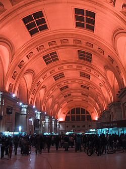
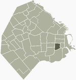
Constitución — Barrio — Ceiling in the main hall, Constitución station Location of Constitución within Buenos Aires Country  Argentina
Autonomous City Buenos Aires Comuna C1 Area – Total 2.1 km2 (0.8 sq mi) Population (2001) – Total 45,860 – Density 21,838.1/km2 (56,560.4/sq mi) Time zone ART (UTC-3) Constitución is a barrio or neighborhood of Buenos Aires, Argentina, approximately two kilometers south of the city's center.
It is centered around Constitución Station and the square of the same name and can be reached by subway, by bus (notably Colectivo 60) and enjoys easy access by car via 9 de Julio, San Juan and Caseros Avenues, as well as the 25 de Mayo toll road.
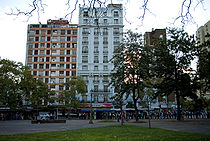
The area, on the outskirts of Buenos Aires in colonial times, was granted a parish in 1769 and incorporated into the city in 1777. Home to an important mission of Bethlehemites, they maintained a convalescent clinic there until their papal suppression in 1821. The area then became home to a large farmer's market and its relative elevation began attracting development. The market was renamed in honor of the recently promulgated Argentine Constitution in 1856 and the neighborhood, long centered around the market, soon acquired the name.
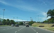
Work began in 1864 on the Buenos Aires Great Southern Railway led the opening of a station at the market and with it, the rapid growth of the area as an immigrants' quarter. Groundbreaking for a new railway terminal in 1885 was accompanied by the razing of the market in favor of Constitución Plaza. A non-profit clinic opened by the Anglican Reverend Barton Lodge in 1844 became the British Hospital in 1887 (still the borough's largest). The neighborhood was subsequently home to Hipólito Yrigoyen, a co-founder of the centrist Radical Civic Union in 1891 who tirelessly campaigned for and, in 1912, won the right to universal (male) suffrage in Argentina and the secret ballot. Elected president in 1916, his Constitución home was ransacked during a coup against him in 1930. The mayor appointed in 1976 by Argentina's last dictatorship, Osvaldo Cacciatore, had plans drawn up for eight freeways within the city proper, three of which were finished. The two busiest, the 25 de Mayo and 9 de Julio Freeways, meet at a junction north of Constitución station. The structures, though a great benefit to commuters, led to the exodus of much of the neighborhood's middle class.
External links
- Barriada: Constitución (Spanish)
Barrios of Buenos Aires 
Agronomía · Almagro · Balvanera · Barracas · Belgrano · Boedo · Caballito · Chacarita · Coghlan · Colegiales · Constitución · Flores · Floresta · La Boca · La Paternal · Liniers · Mataderos · Monte Castro · Monserrat · Nueva Pompeya · Núñez · Palermo · Parque Avellaneda · Parque Chacabuco · Parque Chas · Parque Patricios · Puerto Madero · Recoleta · Retiro · Saavedra · San Cristóbal · San Nicolás · San Telmo · Vélez Sársfield · Versalles · Villa Crespo · Villa del Parque · Villa Devoto · Villa Lugano · Villa Luro · Villa Mitre · Villa Ortúzar · Villa Pueyrredón · Villa Real · Villa Riachuelo · Villa Santa Rita · Villa Soldati · Villa Urquiza
Coordinates: 34°38′S 58°23′W / 34.633°S 58.383°W
Categories:- Neighbourhoods of Buenos Aires
- Argentina geography stubs
Wikimedia Foundation. 2010.


