- Avenida de Mayo
-
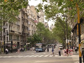 May Avenue
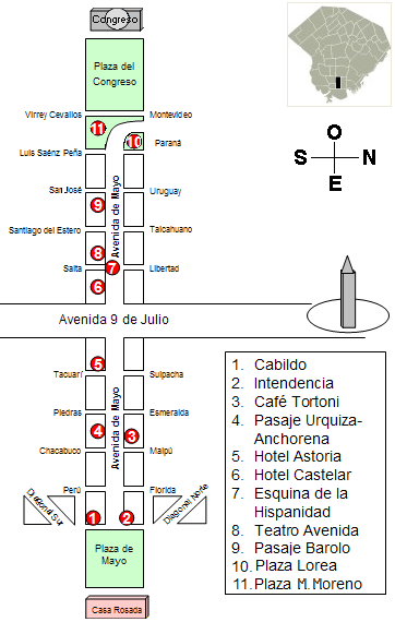
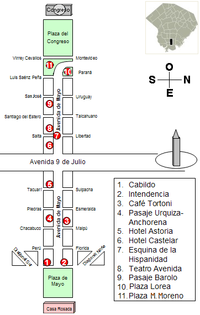 Map of the avenue
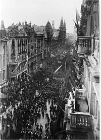 View of the avenue in 1910.
Avenida de Mayo (English: May Avenue), is an avenue in Buenos Aires, capital of Argentina. It connects the Plaza de Mayo with Congressional Plaza, and extends 1.5 km (0.93 mi) in a west-east direction before merging into Avenida Rivadavia.
History and overview
Built on an initiative by Mayor Torcuato de Alvear, work began in 1885 and was completed in 1894. The avenue is often compared with La Gran Vía in Madrid, although the Spanish avenue was built later (1910). It is also compared to those in Paris or Barcelona due to its sophisticated buildings of art nouveau, neoclassic and eclectic styles. The avenue was named in honor of the May Revolution of 1810 (the event that led to Argentine Independence). The site of the assembly that touched off the revolution (the Buenos Aires Cabildo) was partially demolished in 1888 to make way for the avenue's entry into Plaza de Mayo, ironically. The avenue's layout, built through existing urban blocks instead of via the widening of a parallel street, was designed by the Municipal public Works Director, Juan Antonio Buschiazzo. Buschiazzo was also commissioned to design a number of the buildings along the avenue (among them, City Hall) after Mayor Miguel Cané enacted strict architectural zoning laws for the area facing the new thoroughfare. The recession caused by the Panic of 1890 led to delays and a rollback of many of the more ornate plans for the avenue, which was inaugurated on July 9, 1894 (the 78th anniversary of Independence).
Mayor Cané's strict regulations initially governed architecture along the 30 m (99 ft)-wide avenue, which limited the height of real estate facing it to 24 m (79 ft). The Barolo Tower was the first to be granted an exception to this and since then, numerous office buildings have been built in excess of these stipulations (though they remain largely an exception). The Avenida de Mayo was the site of the first Buenos Aires Metro stations; opened in 1913, these were the first outside the United States or Europe. The avenue itself underwent its only significant alteration in 1937, when two blocks were demolished to make way for the perpendicular Avenida 9 de Julio (then the widest in the world). Seeking to halt future demolitions along the avenue, Decree 437/97 of the National Executive Branch declared the Avenue a National Historic Site in 1997 and, as a result, the aesthetics of the buildings, billboards, and marquees could not be changed. Any modifications must be approved by the National Commission of Monuments and Historic Sites (Comisión Nacional de Monumentos y Lugares Históricos). [1]
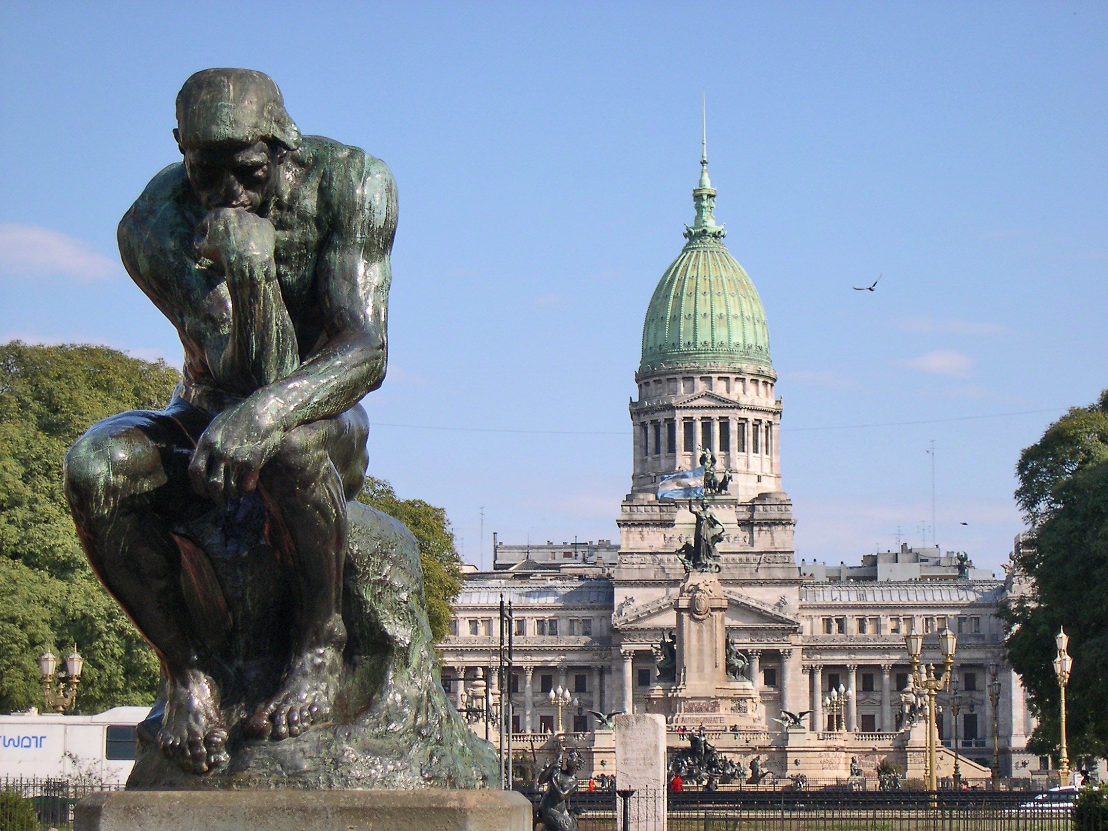
Architectural treasures in Avenida de Mayo  Congressional Plaza
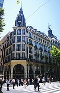 London City Café
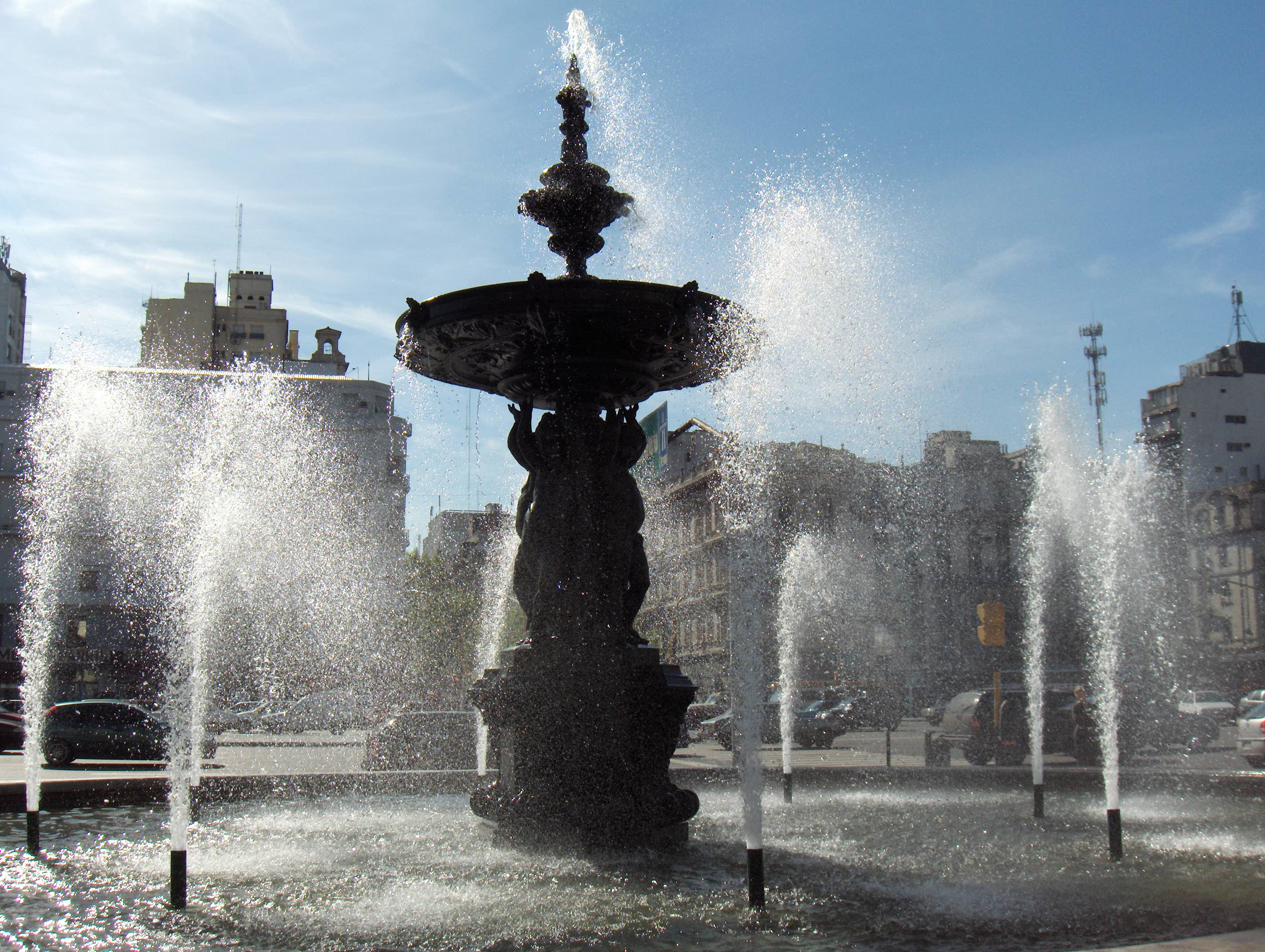
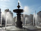 Fountain located at the intersection of Avenidas de Mayo and 9 de julio
External links
- (Spanish) Asociación Amigos de la Avenida de Mayo
-
Coordinates: 34°36′32″S 58°22′43″W / 34.60889°S 58.37861°W
Streets of Buenos Aires, Argentina Buenos Aires Avenida 9 de Julio • Avenida Alvear • Avenida de Mayo • Avenida del Libertador • Avenida Callao • Caminito • Avenida Córdoba • Avenida Coronel Díaz • Avenida Corrientes • Avenida Figueroa Alcorta • Florida Street • Avenida General Paz • Avenida Leandro N. Alem • Avenida Roque Sáenz Peña • Avenida Rivadavia • Avenida Santa Fe • Avenida Scalabrini OrtizLandmarks of Buenos Aires Note: "Buenos Aires" denotes the city of Buenos Aires proper, not the entire Greater Buenos Aires metropolitan area.Public
& historic buildings
and structuresArgentine Congress · Torre Monumental · Cabildo · Café Tortoni · Casa Rosada · Central Post Office · City Hall · City Legislature · Customs House · Duhau Palace · Estrugamou Building · Floralis Genérica · Galerías Pacífico · Hotel de Inmigrantes · Kavanagh building · Libertador Building · Metropolitan Cathedral · Monument to Giuseppe Garibaldi · Obelisk of Buenos Aires · Palacio Barolo · May Pyramid · Pizzurno Palace · Plaza Hotel · Recoleta Cemetery · San Martín Palace · Sarmiento Frigate · Uruguay Corvette · The Water Company Palace · Women's BridgePrecincts
& neighbourhoodsAlmagro · Belgrano · Buenos Aires CBD · Caballito · City Centre · Colegiales · Montserrat · Núñez · Palermo · Puerto Madero · Recoleta · Retiro · San TelmoNature and parks Avellaneda Park · Botanical gardens · Buenos Aires Ecological Reserve · Chacabuco Park · Congressional Plaza · Japanese Gardens · Lezama Park · Palermo gardens · Plaza de la República · Plaza de Mayo · Plaza San Martín · Parque Centenario · Buenos Aires ZooCultural
InstitutionsEl Ateneo Bookstore · Argentine Automobile Club · Bernardino Rivadavia Natural Sciences Museum · Buenos Aires Museum of Modern Art · Café Tortoni · Fortabat Art Collection · House of Culture · Illuminated Block · Isaac Fernández Blanco Museum · King Fahd Cultural Center · Latin American Art Museum · Museum of Foreign Debt · National Library · National Museum of Decorative Arts · National Museum of Fine Arts · National Museum of History · Opera House · Paz Palace · Planetarium · Recoleta Cultural Center · San Martín Cultural Center · San Martín National Institute · Sarmiento Museum · Eduardo Sívori MuseumSport Bombonera Stadium · River Plate Stadium · Ducó Stadium · Maradona Stadium · Vélez Sársfield Stadium · Argentine Hippodrome of Palermo · Lawn Tennis Club · Polo Stadium · Race Circuit · Arena Obras Sanitarias · CeNARD · Estadio Ricardo EtcheverryTransportation Shopping
& entertainmentAbasto Mall · Avenida Theatre · Cervantes Theatre · Fishermen's Pier · Galerías Pacífico · Gran Rex Theatre · Luna Park Arena · Paseo La Plaza · Patio Bullrich · Opera Theatre · Parque de la Ciudad · La Trastienda ClubStreets
& avenues9 de Julio Avenue · Avenida Alvear · Avenida de Mayo · Avenida del Libertador · Callao Avenue · Caminito · Córdoba Avenue · Coronel Díaz Street · Corrientes Avenue · Figueroa Alcorta Avenue · Florida Street · General Paz Avenue · Leandro Alem Avenue · President Roque Sáenz Peña Avenue · Rivadavia Avenue · Santa Fe Avenue · Scalabrini Ortiz Avenue
Categories:- Streets in Buenos Aires


Wikimedia Foundation. 2010.