- Mount Feathertop
-
Mount Feathertop 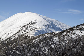
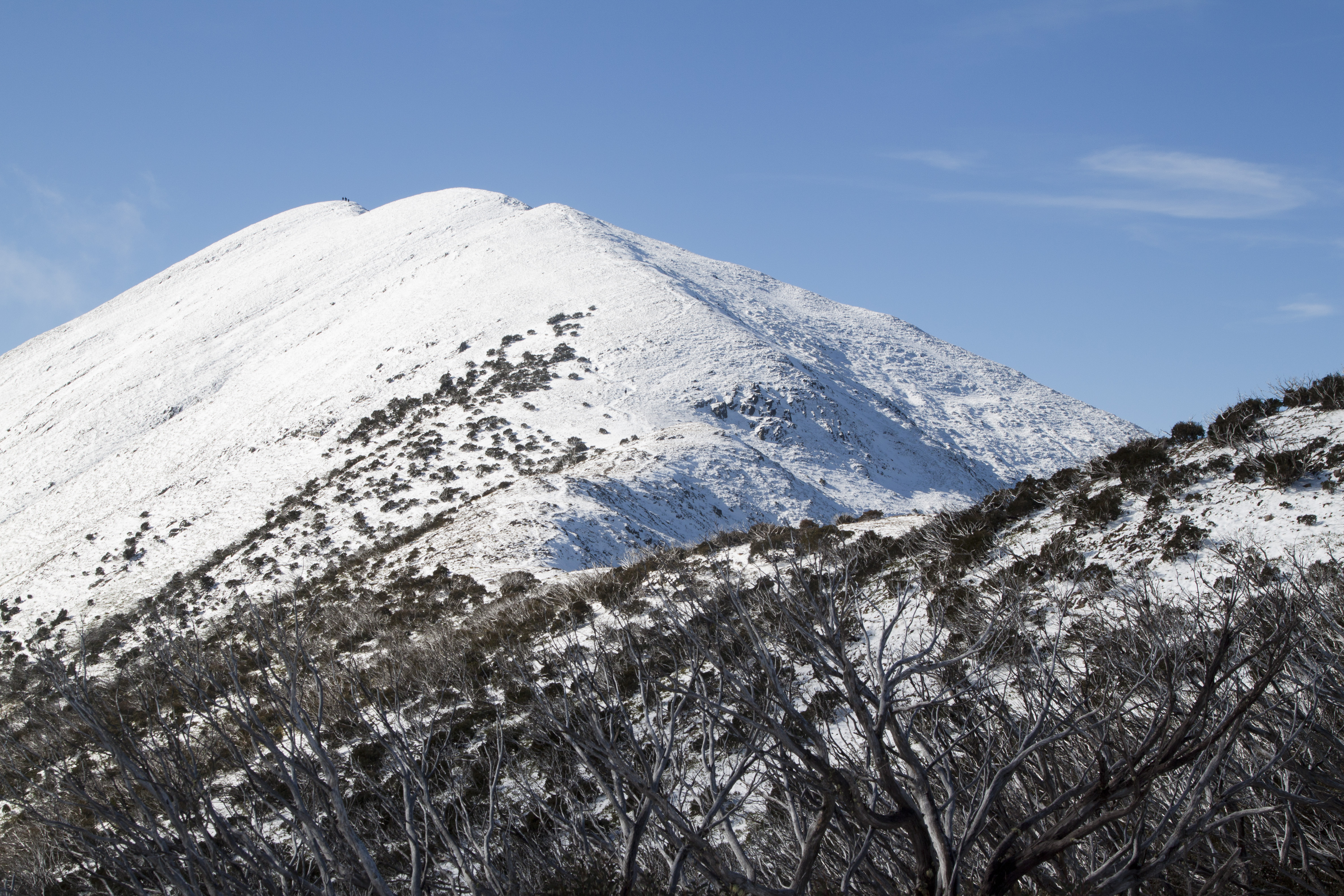
Mount Feathertop as seen from the summit track.Elevation 1,922 m (6,306 ft) AHD Location Location Victoria, Australia Range Great Dividing Range Coordinates 36°54′S 147°08′E / 36.9°S 147.133°ECoordinates: 36°54′S 147°08′E / 36.9°S 147.133°E Climbing Easiest route Hike/ski Mount Feathertop is the second-highest mountain in the Australian state of Victoria and is a member of the Australian Alps located entirely within the Alpine National Park. It rises to 1,922 metres (6,306 ft) and is usually covered in snow from June to September. Unlike many other Victorian mountains, Mount Feathertop has steep summit slopes instead of a rounded summit dome.
Mount Feathertop's proximity to the Mount Hotham ski resort has led to it becoming a popular backcountry skiing destination. A sizable cornice usually forms along the summit ridge in winter, the collapse of which has claimed the life of a number of people who stood on it. Snow remaining in the summit gullies in spring gives the appearance of feathers - hence the name "Feathertop".
Contents
History
Mount Feathertop was named in 1851 by Jim Brown and Jack Wells, stockmen who worked on Cobungra Station and were the first people to systematically explore the Bogong High Plains.
Dr (later Baron) Ferdinand von Mueller was the first person to climb Mount Feathertop. Unaware that the peak had already been named, he proposed that it might be named Mount La Trobe after Charles La Trobe who was Victoria's lieutenant-governor at the time. Members of the Bright Alpine Club made the first winter ascent in September 1889.
A track from Harrietville was cut in 1906 along a similar route to the current Bungalow Spur track and a rough shelter was built near a spring on a flat area below the treeline. The shelter was replaced by Feathertop Hut in 1912.
Vegetation
Forests of Mountain Ash cover the lower slopes of Mount Feathertop up to an altitude of about 1,000 metres (3,300 ft) where Snow Gums begin to dominate. Above the treeline at around 1,800 metres (5,900 ft), vegetation consists of alpine shrubland and grassland.
Access routes
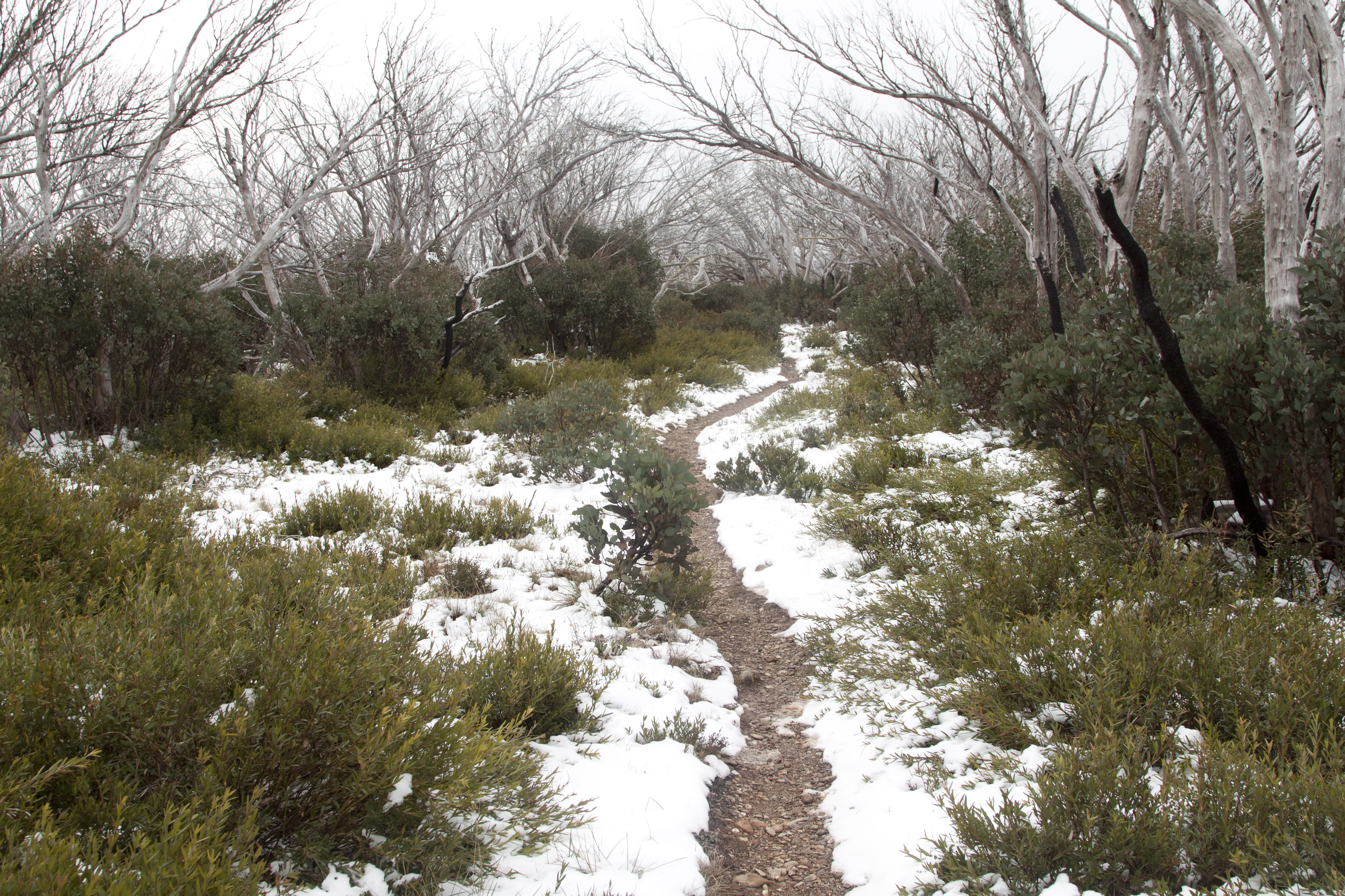
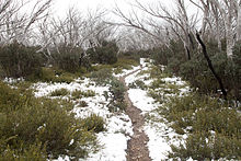 Snow on the Bungalow Spur track near Federation Hut.
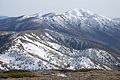
The main access routes on Mount Feathertop are the Razorback (north and south), Bon Accord Spur, Bungalow Spur, North-west Spur, and Diamantina Spur. Hiking on the East Ridge, North-east Spur, and Champion Spur has been possible at times after fires but the routes are now overgrown and rarely used.
The North Razorback track is the shortest and easiest route to Mount Feathertop but it is along a ridgeline and can be very exposed during bad weather. It is possible to drive to within 4 kilometres (2.5 mi) of the summit during summer but a winter road closure leaves a walk or ski of 7.3 kilometres (4.5 mi).
The South Razorback is a very popular walk in summer and it is a spectacular ski tour in winter. It starts at Diamantina Hut on the Great Alpine Road near the Mount Hotham ski resort and is relatively flat but is also very exposed during bad weather. The south Razorback track covers a distance of 11 kilometres (6.8 mi) from its start to the summit.
The Bon Accord Spur track starts in Harrietville and climbs up to the Razorback to join the South Razorback track near the Big Dipper, approximately 1.5 kilometres (0.93 mi) from Diamantina Hut.
The Bungalow Spur track also starts near Harrietville at an elevation of 480 metres (1,570 ft). It was built for pack horses servicing the former Feathertop Bungalow and climbs gradually but continually for 9 kilometres (5.6 mi) until it reaches Federation Hut. The track then continues for another 2 kilometres (1.2 mi) until reaching the summit, joining the Razorback and North West Spur tracks along the way.
The Tom Kneen track along the North West Spur is a steep and hard climb starting near Stony Creek and reaching the Melbourne University Mountaineering Club hut after 7.5 kilometres (4.7 mi). From the hut, it continues across Feathertop's west face to join the track from Federation Hut to the summit. This route was named after a skier who died in an avalanche on Feathertop during 1985.[1]
The Diamantina Spur track climbs from the Kiewa River West Branch for 4 kilometres (2.5 mi) before joining the South Razorback track about 3 kilometres (1.9 mi) from Mount Feathertop's summit. It offers great views of Mount Feathertop but climbs steeply (very in places) and involves some scrambling over loose shale.
Mountain huts
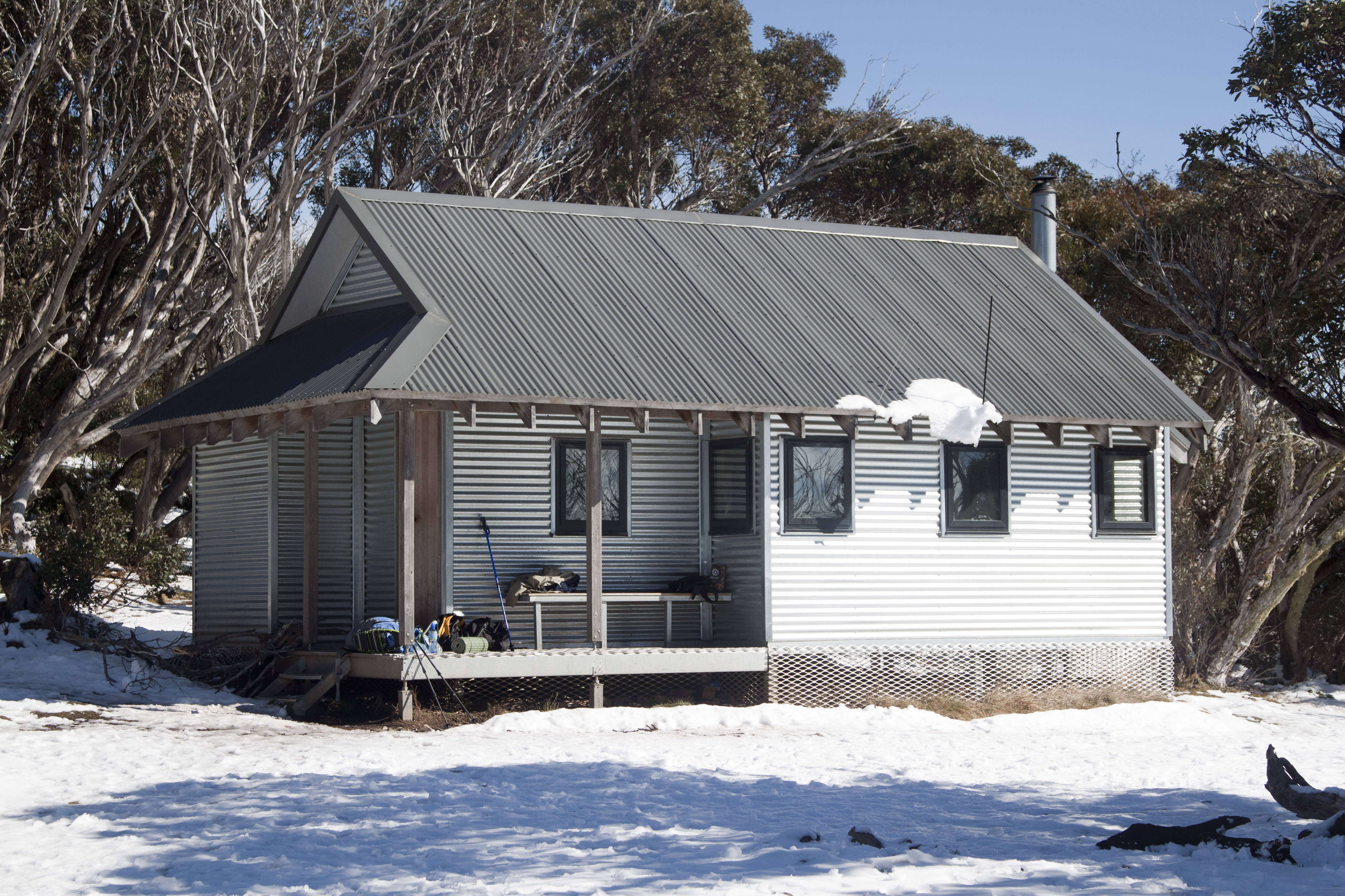
 Federation Hut after an early May snowfall
There are two intact huts on the mountain and the ruins of several more.
Federation Hut was originally built in 1968-69 by the Federation of Victorian Walking Clubs and is situated on the treeline at the top of Bungalow Spur near Little Feathertop. The hut was renovated and reclad in timber by Ian Stapledon in 1988 but was destroyed by the 2003 Eastern Victorian alpine bushfires before being rebuit in 2005 by Parks Victoria.
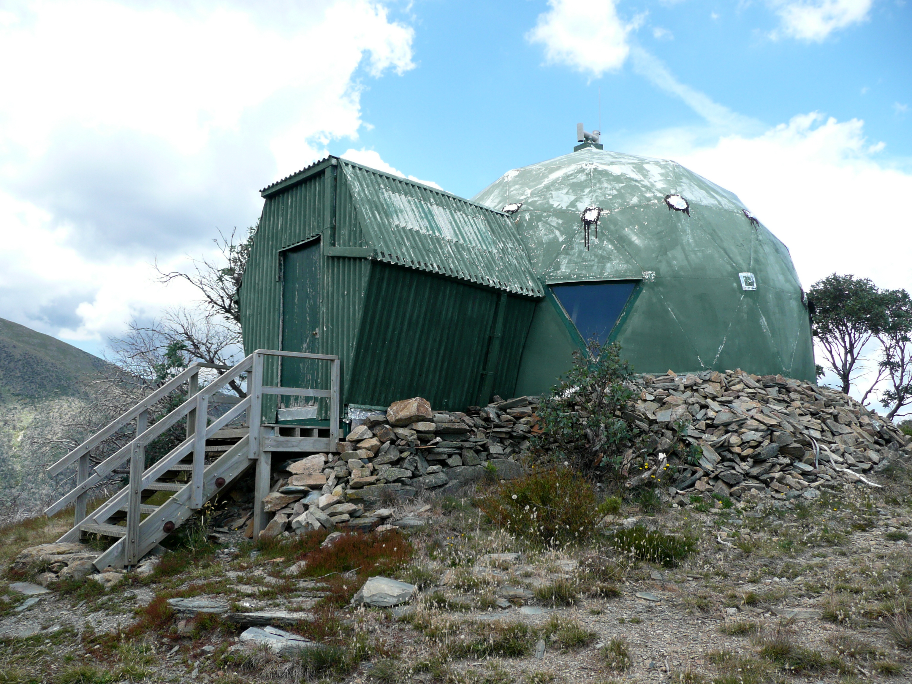
In 1966 the Melbourne University Mountaineering Club built a large hut at the top of the North-West Spur by carrying materials from the roadhead on the North Razorback track. It was designed by Peter Kneen, a final-year Civil Engineering student at Melbourne University and whose brother was to die 19 years later on Mount Feathertop, and was originally a shiny sliver colour before being repainted its current drab green. The hut has a unique dome shape and includes a spacious upstairs sleeping area.
The Feathertop Bungalow, where visitors in summer and winter could sleep and eat, was built in 1925 but burned down during the Black Friday bushfires of 1939 and was never rebuilt. The site is visible on the Bungalow Spur track but few signs of the bungalow remain.
Accidents
Victorian Minister Tim Holding disappeared at the mountain on 31 August 2009 when he failed to return from his solo hiking journey.[2] Sixty searchers were deployed in the field by Monday evening, 31 August 2009, including Victorian Police Search and Rescue, Bush Search and Rescue and the State Emergency Service.[3] He was found during the morning on Tuesday 1 September, one day after searchers were deployed on Monday. Uninjured, he reported that he had lost his footing on an icy slope, and slid down into a gully. Disoriented, and with poor visibility, he waited for rescue, using a reflective space blanket to attract attention.
Graeme Nelson, a 56-year-old doctor from Eden in south-eastern New South Wales, died on 24 August 2011 while skiing with friends in Avalanche Gully on Mount Feathertop[4]. Dr Nelson is believed to have slipped in icy conditions and fell 700 metres down an icy slope, dying before his skiing companions could climb down to reach him.
Gallery
-
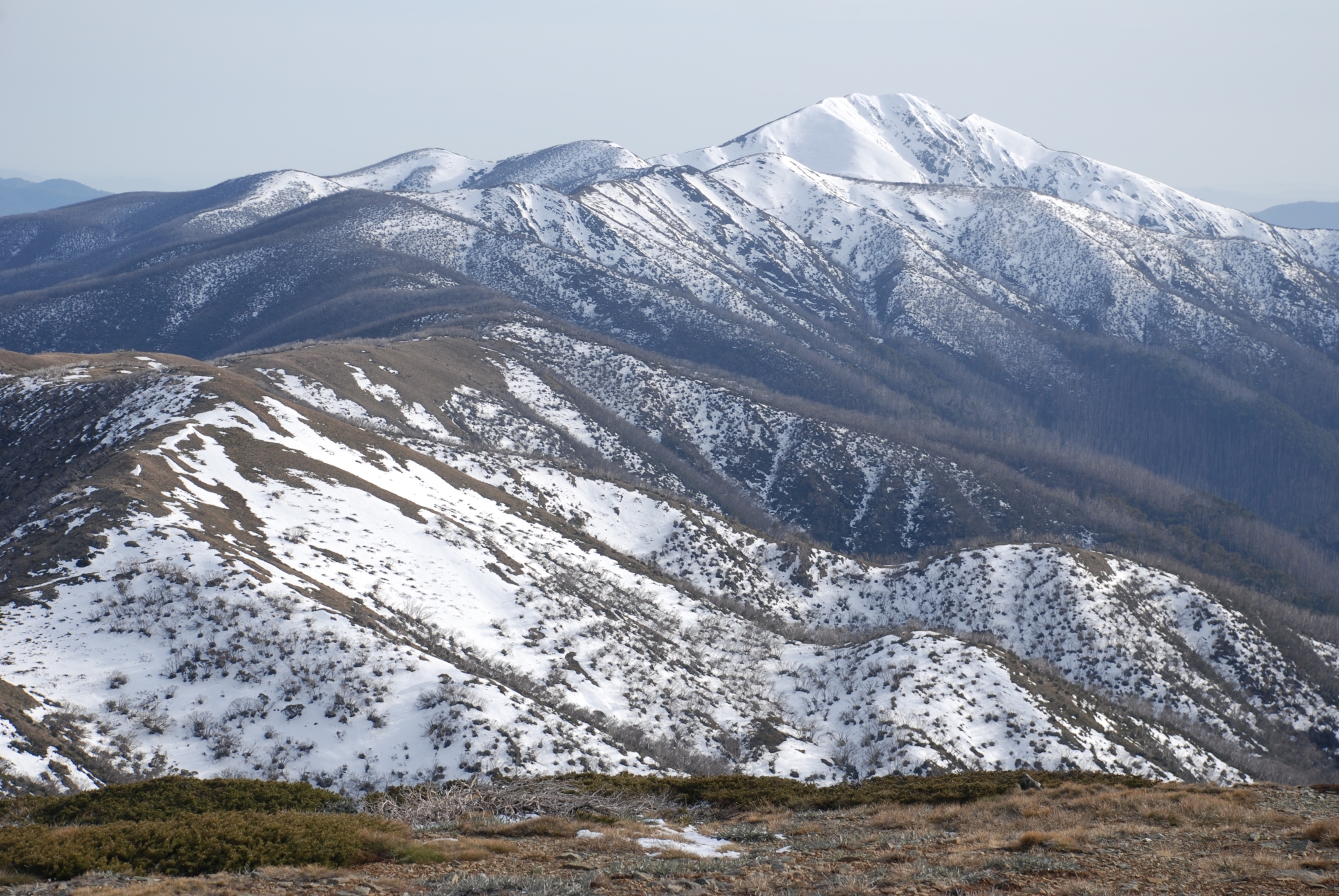
Mount Feathertop and Razorback in spring.
-

Easterly view from the peak in late spring.
-
Mount Feathertop as seen from the saddle to the South in early spring.
-

Melbourne University Mountaineering Club hut.
Notes
- ^ Melbourne University Mountaineering Club history
- ^ Schulz, Matthew; McMahon, Stephen; Wallace, Rick; Roberts, Brendan; Wotherspoon, Sarah (31 August 2009). "Tim Holding missing on Mt Feathertop after failing to return from hike". The Herald Sun. http://www.theage.com.au/national/water-minister-tim-holding-missing-on-freezing-mountain-20090831-f488.html. Retrieved 2009-08-31.
- ^ Search at Mount Feathertop on Monday 31 August 2009, Bush Search and Rescue Victoria, 31 August 2009
- ^ Levy, Megan. "Extreme ski challenge turns deadly for doctor". The Age. http://www.theage.com.au/victoria/extreme-ski-challenge-turns-deadly-for-doctor-20110825-1jb4g.html.
External links
- "Mount Feathertop". Australia Total Travel Guide. http://www.totaltravel.com.au/travel/vic/legendswinecountry/skicountry/travel-guides/destinations/mount-feathertop. Retrieved 2010-09-03.
- History of the Feathertop Bungalow on WikiSki
Categories:- Mountains of Victoria (Australia)
- Alpine National Park
-

Wikimedia Foundation. 2010.