- Duckhole
-
Coordinates: 51°37′48″N 2°31′01″W / 51.630°N 2.517°W
Coordinates: 51°37′48″N 2°31′01″W / 51.630°N 2.517°W
Duckhole 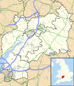
 Duckhole
Duckhole shown within GloucestershireOS grid reference ST6421992532 Unitary authority South Gloucestershire Ceremonial county Gloucestershire Region South West Country England Sovereign state United Kingdom Post town BRISTOL Postcode district BS35 Dialling code 01454 Police Avon and Somerset Fire Avon Ambulance Great Western EU Parliament South West England UK Parliament Thornbury and Yate List of places: UK • England • Gloucestershire Duckhole is a small village within view of Oldbury Nuclear Power Station in South Gloucestershire, England. It has a population of less than fifty.
External links
 Media related to Duckhole at Wikimedia CommonsCategories:
- Villages in South Gloucestershire
- South Gloucestershire geography stubs

Wikimedia Foundation. 2010.