- Old Clee
-
Coordinates: 53°33′24″N 0°02′54″W / 53.556578°N 0.048308°W
Old Clee 
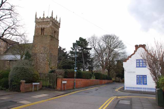
Church Lane, Old Clee
 Old Clee
Old Clee shown within LincolnshireOS grid reference TA293084 District North East Lincolnshire Shire county Lincolnshire Region East Midlands Country England Sovereign state United Kingdom Postcode district DN35 Police Lincolnshire Fire Lincolnshire Ambulance East Midlands EU Parliament East Midlands UK Parliament Cleethorpes List of places: UK • England • Lincolnshire Old Clee is located in the Clee Road (A46) and Carr Lane area of eastern Grimsby, North East Lincolnshire, England and adjoins the neighbouring town of Cleethorpes, with which it has historic links. Previously a separate village, its parish church of Holy Trinity and Saint Mary, claimed to be the oldest building in Grimsby, has a Saxon tower dating from 1050 AD. Located in the area are the Old Clee infants/junior schools (Colin Avenue) and the Havelock Specialist Engineering College (Holyoake Road). Nearby is the King George V Stadium.
Contents
History
The settlement of Clee was in existence by the time of the Norman conquest. It formed part of the wider ancient parish of Clee [1] that also included Weelsby to the west and Oole, Itterby and Thrunscoe to the east. The latter three settlements later joined to form the town of Cleethorpes. The southern boundary with Humberston was at Buck Beck.
A long-standing dispute with Grimsby, over the position of the boundary stone near what is now Bath Street, was legally settled in favour of Clee in 1830. Until the mid 19th century Clee parish operated the open field system of agriculture. Under the Enclosure award of 1846 land in Clee village and Cleethorpes was divided between various landowners, mainly G.F Heneage, Richard Thorold and Sidney Sussex College.
As trade in the Grimsby commercial and fishing docks expanded so did the population, which led to a shortage of land for housing within Grimsby. From the 1860s there was a movement of people across the town's eastern boundary into the almost uninhabited northern part of Clee (called New Clee) near Grimsby docks. This area lay between Humber Street and Park Street, which formed the boundary with the Cleethorpes section of the parish.
By the 1880s the population of New Clee had reached over 9,000, nearly all dependent on the fishing trades. From this built-up area, about a mile to the south-east, lay the sparsely populated rural area of Old Clee, with its medieval church, farms, cottages and grammar school.
The western boundary of Clee parish with Grimsby ran along the eastern side of what is now Scartho Road cemetery, crossed Weelsby Road, through the Peoples Park, then veered north-east into Welholme Road. From there it continued north along the length of and included Willingham Street, also taking in part of Pasture Street, Bradley Street to Hainton Square.
From Hainton Square the boundary then crossed Wellington Street to the junction with Albion Street. Albion Street was on the Grimsby side of the boundary whereas neighbouring Charles Street (later renamed Hope Street) was in Clee. Moving north the line continued to Bath Street, Cleethorpe Road, ending at Humber Street near Grimsby docks.
In 1889 New Clee, Old Clee and the northern part of Weelsby were absorbed by Grimsby. In 1894 this area was re-constituted as the civil parish of Clee [2] within the borough of Grimsby (a status it retained until 1928). During the following years the open space between New Clee and Old Clee village disappeared as housing developments spread into the Grant Thorold and Carr Lane areas. Also in 1894 the area south of Weelsby Road and Clee Road became the separate parish of Weelsby [3], which remained outside the enlarged borough. Cleethorpes became an urban district.
History of the church
The parish church which was built in 1050 AD was purposely built to watch for Viking invaders and to protect the villagers from Viking invasion. When the tower was being built the builders decided to form a face out of the building materials which they placed half way on the tower on one of the adjacent sides.
References
- Clee and the Thorpes of Clee, by C. Ernest Watson
- A History of Grimsby, by Edward Gillet, ISBN 0859584534
- The Great Grimsby Story, by Edward Drury
- Grimsby register of electors (parish of Clee section until 1928)
External links
Categories:- Villages in Lincolnshire
- Grimsby
- North East Lincolnshire

Wikimedia Foundation. 2010.