- Colwick
-
Coordinates: 52°55′59″N 1°04′59″W / 52.933°N 1.083°W
Colwick 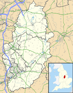
 Colwick
Colwick shown within NottinghamshireDistrict Gedling Shire county Nottinghamshire Region East Midlands Country England Sovereign state United Kingdom Post town NOTTINGHAM Postcode district NG4 Dialling code 0115 Police Nottinghamshire Fire Nottinghamshire Ambulance East Midlands EU Parliament East Midlands UK Parliament Gedling List of places: UK • England • Nottinghamshire Colwick is a suburb in the east of Greater Nottingham in England. It forms part of the Nottinghamshire borough of Gedling, although Colwick Country Park is actually within the city boundary. It lies between the River Trent and the railway line, with nearby places being Netherfield (to the east), Bakersfield (to the north-west), and Carlton (to the north). Colwick has a population of about 2,000. There is one Church – an anglican church – St. John the Baptist.
The etymology of the place-name is from Old English wic "specialised industrial farm" with an uncertain first element, possibly col "coal".[1]. Although there have never been coal mines in the area.
The village dates back to the Domesday book and before, since when the De-Colwick, Musters and Byron families have all owned the village. The village has a very rich history, which can be read about in Alan Cook's 'A History of Colwick' http://www.nottshistory.org.uk/books/colwick/contents.htm Colwick has been home to many world famous firms such as William Lawrence & Co. Ltd. and Sands and Burgess and was the site for the rather gruesome murder at 'Saville's Spinney' involving William Saville who murdered his wife and 3 children in the woods where they were found 3 days later. The crowd for his hanging numbered thousands and 17 were killed in the crush as they were leaving.
Colwick was formerly famous as the birthplace of Colwick cheese, a soft and creamy curd cheese, allegedly invented in the village in the 17th century. By the 18th century, it was already being made at a number of other locations, persisting in manufacture until the late 20th century.[1]
Colwick has won the right to be recognised as a village again. It follows a campaign by members of Colwick Parish Council, who believe village status will be a boost for the community. Highways officials have granted permission for the area to call itself "Colwick village", similar to Bestwood village, Gedling village, and other spots in Notts.
Colwick Park is a 50 hectare (125 acres) designated Local Nature Reserve on the edge of the village.[2]
The episode of The Upper Hand in which Caroline and Charlie are married was filmed at the derelict church adjacent to Colwick Hall.
Colwick is a primarily industrial region; the Colwick Loop Road runs through the area.
Buses Services
- Nottingham City Transport
- 44: Nottingham - Colwick - Netherfield - Gedling - Mapperley - Nottingham.
- 44: Nottingham - Colwick - Netherfield - Gedling (from September 2010)
- 45: Nottingham - Wooborough Road - Mapperley - Gedling - Netherfield - Colwick - Nottingham.
- Citylink 2: Nottingham - Racecourse Park and Ride - Colwick Industrial Estate - Victoria Park.
- Premiere
- 5: Nottingham - Colwick - Netherfield - Burton Joyce - Lowdham - Oxton
References
- ^ History of Colwick
- ^ "Local Nature Reserve". naural England. http://www.lnr.naturalengland.org.uk/Special/lnr/lnr_details.asp?C=0&N=colwick&ID=1104. Retrieved 1 February 2011.
External links
Ceremonial county of Nottinghamshire Unitary authorities Boroughs or districts Major settlements Arnold · Beeston · Bingham · Bircotes · Blidworth · Carlton · Cotgrave · Eastwood · Harworth · Hucknall · Kimberley · Kirkby-in-Ashfield · Mansfield · Mansfield Woodhouse · Netherfield · Newark · Nottingham · Ollerton · Rainworth · Retford · Ruddington · Stapleford · Southwell · Sutton-in-Ashfield · West Bridgford · Worksop
See also: List of civil parishes in NottinghamshireTopics Categories:- Villages in Nottinghamshire
- Districts of Nottingham
- Nottinghamshire geography stubs

Wikimedia Foundation. 2010.