- Alwal
-
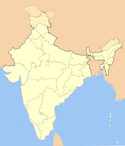
Alwal — neighbourhood — Coordinates 17°30′11″N 78°30′25″E / 17.503°N 78.507°ECoordinates: 17°30′11″N 78°30′25″E / 17.503°N 78.507°E Country India State Andhra Pradesh District(s) Hyderabad Parliamentary constituency Malkajgiri Assembly constituency Malkajgiri Planning Agency Cantonment Board, Secunderabad Time zone IST (UTC+05:30) Codes-
• Pincode • 500 010
Alwal is a major residential suburb of Secunderabad, the twin city of Hyderabad city. It has a population of 106,424 (2001 census) and forms part of the Greater Hyderabad agglomeration.
A part of the British cantonment, Alwal got its name after alvars who were tamil poets, the proponets of bhakti and devotees of lord Venkateshwara. Alwal is home to a historic Venkateshwara Temple, which is located near Alwal Municipal office. There are a number of other temples in the vicinity, at the nearby cantonment (Lalbazar) including one built in the style of the Lotus Temple, Delhi.
This area is booming as residents of central Hyderabad are moving to Alwal to escape traffic congestion and pollution. The nearby cantonment (military) area offers good lung space for walkers[citation needed].
Contents
Commercial area
Alwal is major shopping hub for nearby suburbs and villages. It has many shopping malls like Reliance Fresh, Spencer shopping mall, Moore etc. Alwal is just 3 km away from Tirumalgiri.
There is an e-seva centre, a service provided for paying bills and other government services. A farmers vegetables market, Rythu bazaar is located here.
There are four cinema halls here. Some of the major resorts like The Celebrity Club, Alankrita, The Orange Bowl, Dhola-Ri-Dhani and Runway-9 are 10 km away.
Transport
Alwal is 8 km away from Secunderabad Railway station and just 12 km from away from the Old Hyderabad Airport in Begumpet Begumpet Airport and about 40 km from New International Airport in Shamshabad Rajiv Gandhi International Airport.
APSRTC runs buses here connecting Alwal to all parts of the city.
The local train service, MMTS has a train station called as Alwal Railway Station .
Schools
Alwal is also home to some of the famous schools in Secunderabad like the St.Ann's High School, Bolarum which was set up in 1876[1] by a group of nuns from Italy. The other schools in the area are Valerian Grammar School (Bollarum), Loyola Academy.(Loyola Public High School,Father Balaiah Nagar,Alwal.Prinicipal: B.Annama Estb:-1985,Famous School in Alwal Area), Model Mission High School, KV Bolarum and the Raja Praja High School,triveni talent school.
Events in Alwal
Jatra: In December Alwal hosts a carnival (Jatra) which attracts people from the near-by areas. Several shopkeepers, vendors and entertainers flock a complete 1 km stretch of the road selling a variety of items ranging from decorated pots to show-piece items. Children get their piece of amusement by riding the merry-go-round, toy-cars, swings, etc.[2] TRIVENI SCHOOL.
Noted people in Alwal
Shyam Benegal, director and screenwriter was born here[3][4] and used to live here. It was here that he lived when he formed the Hyderabad Film Society which was run from Osmania University.[5]
M.R.Krishna, Central Minister as Defence Minister of INDIA under Indira Gandhi government has a road[6] named on him in Alwal on his respect towards people helped many middle class people for which his statue is inaugurated in Yapral near Alwal .
Greater Alwal Allied Service Association(GAASA)
GAASA was formed by residents of Alwal in 1987. In the past GAASA pursued the authorities concerned with various issues of common interest affecting the residents of Greater Alwal (comprising the Ex-Panchayats forming the Alwal Municipality viz: Alwal, Yapral, Kowkoor, Turkapally etc.).
References
- ^ http://www.stannshsbol.org/annals_of_the_institute.html#1
- ^ http://alwal.org/index2.php?option=com_content&do_pdf=1&id=83
- ^ http://www.hindu.com/pp/2006/08/26/stories/2006082600400100.htm
- ^ http://www.imdb.com/name/nm0070867/
- ^ http://www.ffsi.org.in/next.htm
- ^ http://www.bing.com/mapindia/default.aspx?v=2&FORM=LMLTCC&cp=17.498668~78.507668&style=r&lvl=17&tilt=-90&dir=0&alt=-1000&phx=0&phy=0&phscl=1&encType=1
Categories:- Neighbourhoods of Hyderabad, India
-
Wikimedia Foundation. 2010.

