- Pottinger (District Electoral Area)
-
Pottinger
District Electoral Area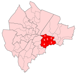
Map showing Pottinger wards within BelfastArea 6.17 km2 (2.38 sq mi) Population 31,272 (2008 Estimate) - Density 5,068 /km2 (13,130 /sq mi) District Belfast City Council County County Down Country Northern Ireland Sovereign state United Kingdom EU Parliament Northern Ireland UK Parliament Belfast South NI Assembly Belfast South List of places: UK • Northern Ireland • Down Pottinger is one of the nine district electoral areas (DEA) in Belfast, Northern Ireland. Located in the east of the city, the district elects six members to Belfast City Council and contains the wards of Ballymacarrett; Bloomfield; Orangefield; Ravenhill; The Mount and Woodstock.
The wards of Ravenhill and Woodstock are part of the Belfast South constituencies for the Northern Ireland Assembly and UK Parliament, while the other four are part of the Belfast East Assembly and Parliamentary constituencies.
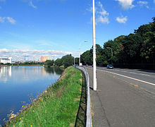
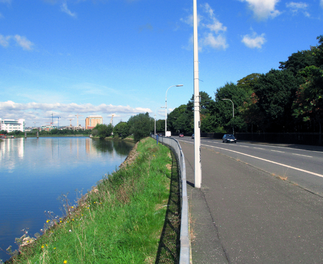
The district is bounded to the west by the River Lagan and the Ormeau Road, to the north by the Newtownards Road, to the east by Greenville Park and North Road and Castlereagh Borough Council to the south.
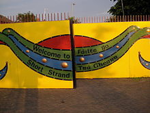
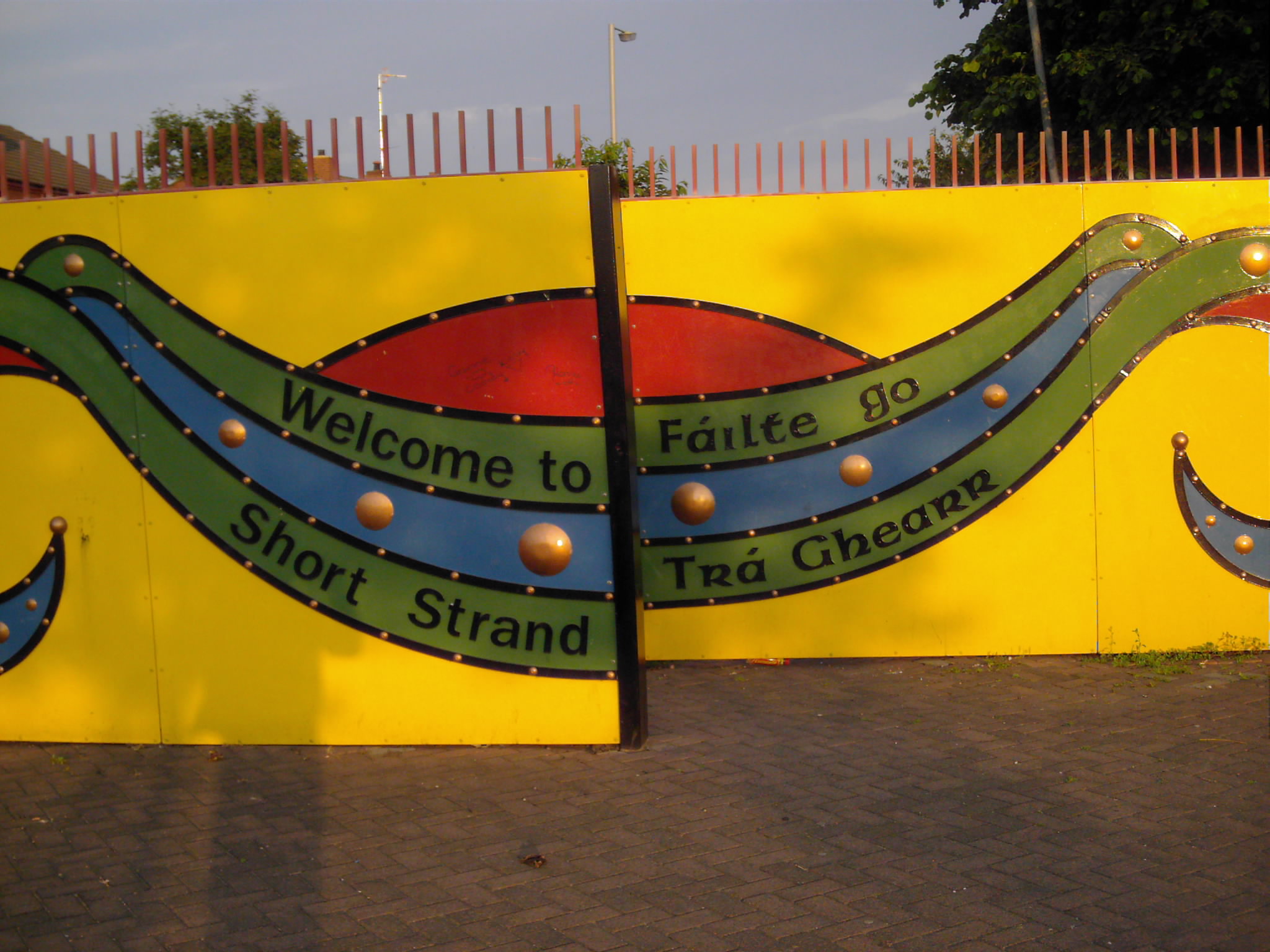
At the 2001 census the district had a Protestant majority, however there is also a large Catholic minority, particularly in areas such as the Short Strand, which is separated from the mainly unionist Cluan Place by one of the many peace lines in the district.
Contents
History
The DEA was created for the 1985 local elections, when it largely replaced the former electoral Area A. Five of the six wards came from Area A with the Bloomfield ward added from Area B.
Amenities
Amenities in the Pottinger district electoral area include:
- Ormeau Golf Club
- Ormeau Park
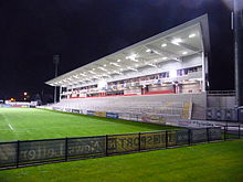
- Ravenhill Stadium, home of the Ulster Rugby team
- St Michael's Primary School
Wards
Map Ward Population
(2008 Estimate)Population
(2001 Census)Catholic Protestant Other Area Density NI Assembly UK Parliament Ref 1 Ballymacarrett 4,797 4,942 50.7% 46.8% 2.8% 0.78 km2 6,336 /km2 Belfast East Belfast East [1] 2 Bloomfield 5,483 5,537 5.1% 87.6% 7.3% 0.74 km2 7,482 /km2 Belfast East Belfast East [2] 3 Orangefield 5,565 5,496 3.3% 91.0% 5.7% 1.46 km2 3,764 /km2 Belfast East Belfast East [3] 4 Ravenhill 5,610 5,500 25.5% 67.3% 7.2% 1.88 km2 2,926 /km2 Belfast South Belfast South [4] 5 The Mount 4,893 4,259 4.0% 89.7% 6.3% 0.75 km2 5,679 /km2 Belfast East Belfast East [5] 6 Woodstock 4,924 5,133 6.2% 86.7% 7.1% 0.56 km2 9,166 /km2 Belfast South Belfast South [6] Pottinger 31,272 30,687 15.7% 78.2% 6.1% 6.17 km2 4,974 /km2 Councillors
Election Councillor
(Party)Councillor
(Party)Councillor
(Party)Councillor
(Party)Councillor
(Party)Councillor
(Party)2011 Máire Hendron
(Alliance)May Campbell
(DUP)Gavin Robinson
(DUP)John Kyle
(PUP)Niall Ó Donnghaile
(Sinn Féin)Adam Newton
(DUP)2005 Sammy Wilson
(DUP)David Ervine
(PUP)Reg Empey
(UUP)Margaret McKenzie
(DUP)2001 Joseph O'Donnell
(Sinn Féin)Harry Toan
(DUP)Margaret Clarke
(UUP)1997 Mervyn Jones
(Alliance)Robert Clelland
(DUP)1993 Jim Walker
(DUP)Sandy Blair
(UUP)1989 Dorothy Dunlop
(Independent Unionist)Margaret Clarke
(UUP)1985 F Leslie
(DUP)2011 Elections
Belfast City Council elections, 2011[7] Party Candidate 1st Pref Alliance Máire Hendron 1,895 Democratic Unionist Gavin Robinson 1,523 Sinn Féin Niall Ó Donnghaile 1,077 Democratic Unionist May Campbell 1,051 Progressive Unionist John Kyle 1,022 Democratic Unionist Adam Newton 936 Ulster Unionist Philip Robinson 786 SDLP Séamas de Faoite 456 Green (NI) David Newman 223 Traditional Unionist Voice John Hiddleston 191 Socialist Party Thomas Black 150 Workers' Party Kevin McNally 104 People Before Profit Donna McCusker 70 Independent Karl Hedley 33 Procapitalism Samuel Smyth 9 Turnout 9,526 Sinn Féin gain from Ulster Unionist See also
- Belfast City Council
- Electoral wards of Belfast
- Local government in Northern Ireland
- Members of Belfast City Council
- Belfast Pottinger (UK Parliament constituency)
- Belfast Pottinger (Northern Ireland Parliament constituency)
- Belfast Willowfield (Northern Ireland Parliament constituency)
References
- ^ "Ward Information for Ballymacarrett ward 95GG04". NISRA. http://www.ninis.nisra.gov.uk/mapxtreme/pf_report.asp?sLevel=WARD&sID=95GG04&sName=Ballymacarrett. Retrieved 13 June 2011.
- ^ "Ward Information for Bloomfield (Belfast) ward 95GG11". NISRA. http://www.ninis.nisra.gov.uk/mapxtreme/pf_report.asp?sLevel=WARD&sID=95GG11&sName=Bloomfield%20(Belfast). Retrieved 13 June 2011.
- ^ "Ward Information for Orangefield ward 95GG36". NISRA. http://www.ninis.nisra.gov.uk/mapxtreme/pf_report.asp?sLevel=WARD&sID=95GG36&sName=Orangefield. Retrieved 13 June 2011.
- ^ "Ward Information for Ravenhill ward 95GG37". NISRA. http://www.ninis.nisra.gov.uk/mapxtreme/pf_report.asp?sLevel=WARD&sID=95GG37&sName=Ravenhill. Retrieved 13 June 2011.
- ^ "Ward Information for The Mount ward 95GG44". NISRA. http://www.ninis.nisra.gov.uk/mapxtreme/pf_report.asp?sLevel=WARD&sID=95GG44&sName=The%20Mount. Retrieved 13 June 2011.
- ^ "Ward Information for Woodstock ward 95GG50". NISRA. http://www.ninis.nisra.gov.uk/mapxtreme/pf_report.asp?sLevel=WARD&sID=95GG50&sName=Woodstock. Retrieved 13 June 2011.
- ^ Elections 2011: Pottinger, Belfast City Council

Castle Victoria Victoria Laganbank 
Victoria  Pottinger

Laganbank Castlereagh Borough Council Castlereagh Borough Council Belfast City Council General 
People District Electoral Areas Amenities Parks and gardens Cemeteries Elections Categories:- Electoral wards of Belfast


Wikimedia Foundation. 2010.