- Ormeau Park
-
Coordinates: 54°35′08.39″N 05°54′52.24″W / 54.5856639°N 5.9145111°W
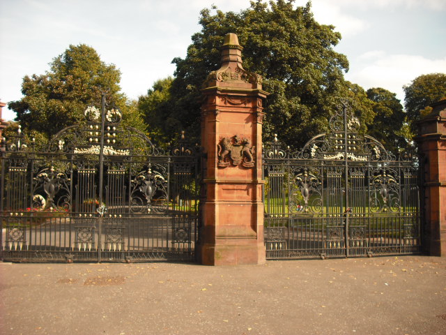
 Entrance gates to the Ormeau Park, 2009
Ormeau Park is the oldest municipal park in Belfast, Northern Ireland, having been officially opened to the public in 1871. It is owned and run by Belfast City Council and is one of the largest and busiest parks in the city and contains a variety of horticulture, woodland, wildlife and sporting facilities[1].
The park is open daily from dawn to dusk. It features a bandstand, basketball, netball, football and tennis facilities, bowling greens, pavilions, car parking, cycling (and BMX track), ecotrails, horticultural displays, an orienteering course, a playground, seasonal bedding, specimen trees, and multiple walks. The park opens on to the Ormeau Road, the Ormeau Embankment, Park Road, and the Ravenhill Road. Access to Belfast city centre is available on Metro bus routes 7A - 7D[1].
Contents
History
The land for Ormeau Park was formerly part of the Donegall family estate. It became their home in 1807, when the family moved to Ormeau Cottage from their town house in Donegall Place. The building was extended by George Chichester, 2nd Marquess of Donegall, who lived there until his death in 1844. Eventually the family was forced to sell the estate to pay its spiralling debt. In 1869, the area was purchased by Belfast Corporation and it was opened as a park to the public in 1871. The opening of Belfast's first public park was marked with a parade from Carlisle Circus through Belfast which attracted a large crowd and finished with speeches in the park[2].
The park was designed by Timothy Hevey, a successful young architect of the day. He won a competition for the best design for 100 acres (0.40 km2) of parkland. The present-day park still roughly follows his design with several alterations[2]. Some of the land is home to the 9-hole course of Ormeau Golf Club, and other nearby land near Ravenhill was laid out in playing fields. The embankment road cut off the river frontage of the park in the 1920s.
Future plans
Along with the old Maysfield Leisure Centre site, the Ormeau Park site is one of two sites that have emerged in recent months as alternatives to the Maze as a site for a new Northern Ireland stadium. A consortium advocating Ormeau Park as the best venue has completed a feasibility study. It is still in the discussion stage with Belfast City Council. The debate continues as the Government insists that the Maze is the only possible location for a new multi-sport stadium. The proposed City of Belfast Stadium would initially accommodate a capacity of 25,000 seats with the option to extend to 35,000 seats as required. The plans say that the site would not occupy any of the park land currently used by the local community but that the new stadium would replace and occupy the site currently housing the Ozone leisure facility.As Of Now There Is a family that live in ormeau park in the famous, victorian house.
Culture
The park hosted the Tennents ViTal festival for the first time in August 2007.
References
- ^ a b "Ormeau Park". Belfast City Council. http://www.belfastcity.gov.uk/parksandopenspaces/parksdetails.asp?id=25. Retrieved 3 March 2009.
- ^ a b "Ormeau Park - History". Belfast City Council. http://www.belfastcity.gov.uk/parkshistory/ormeau.asp. Retrieved 3 March 2009.
External links
Belfast City Council General 
People District Electoral Areas Amenities Parks and gardens Cemeteries Elections See also: Local government in Northern Ireland • Category Categories:- Parks and gardens in Belfast

Wikimedia Foundation. 2010.