- Ishigaki Airport
-
Ishigaki Airport
Ishigaki Jima Airport
石垣空港
Ishigaki Kūkō
IATA: ISG – ICAO: ROIG Summary Operator Ministry of Land, Infrastructure and Transport Location Ishigaki, Okinawa, Japan Elevation AMSL 86 ft / 26 m Coordinates 24°20′41″N 124°11′13″E / 24.34472°N 124.18694°ECoordinates: 24°20′41″N 124°11′13″E / 24.34472°N 124.18694°E Map Location in Japan
 ROIG
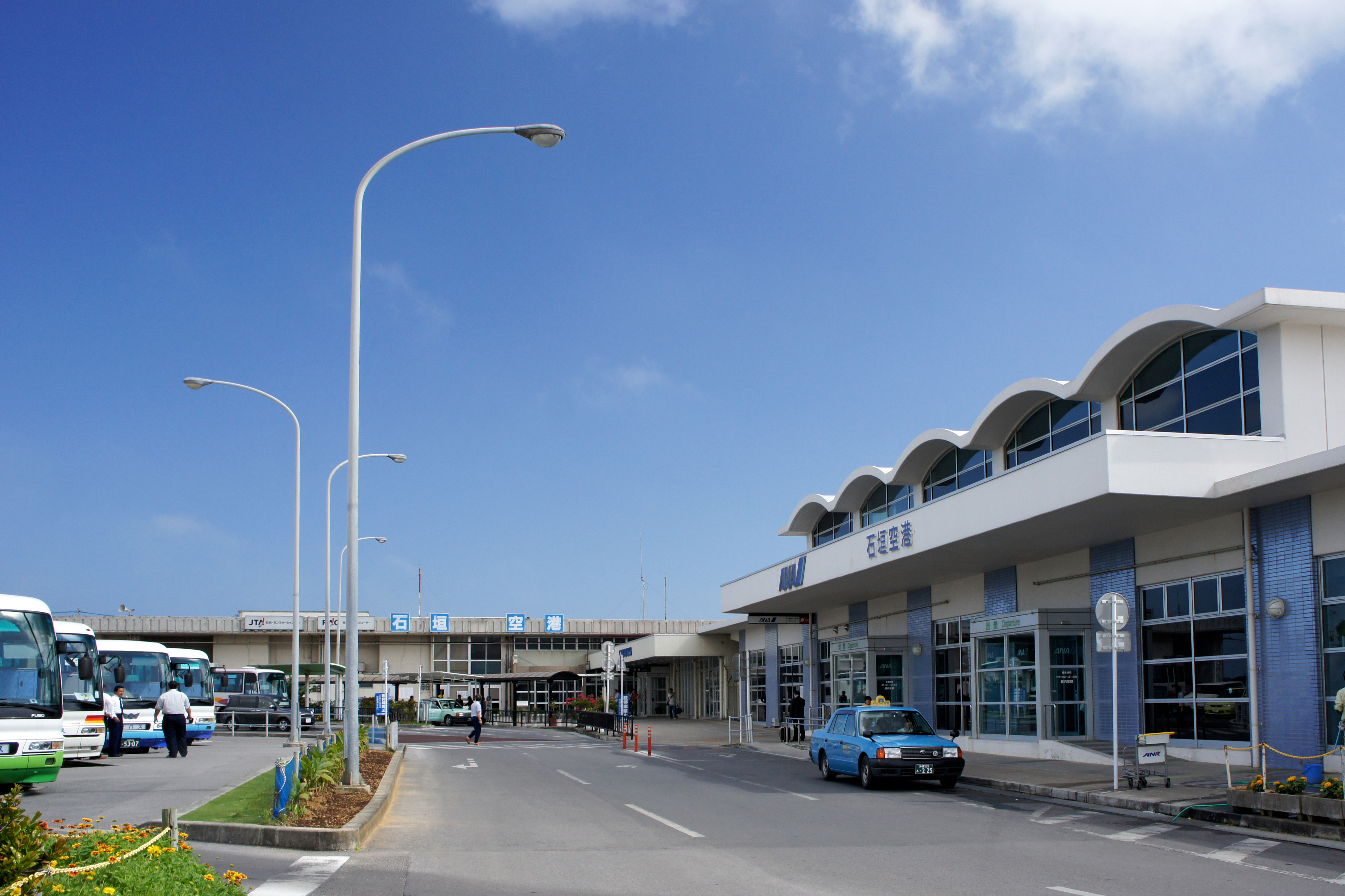
ROIGRunways Direction Length Surface m ft 04/22 1,500 4,921 Asphalt/Concrete Source: Japanese AIP at AIS Japan[1] Ishigaki Airport (石垣空港 Ishigaki Kūkō), (IATA: ISG, ICAO: ROIG) is a third-class airport located 1 NM (1.9 km; 1.2 mi) from Ishigaki city centre in Okinawa Prefecture, Japan. The airport fields flights to major cities on the Japanese mainland as well as destinations throughout Okinawa Prefecture and the Yaeyama Islands.
Contents
History
The airport was opened in 1943 for military use, and converted to a civilian airport in 1956. The runway was extended from 1,200 to 1,500 m (3,937 to 4,921 ft) in 1968, allowing YS-11 aircraft to land.
Future
The airport presently serves about 1.8 million passengers a year, making it the second busiest third-class airport in Japan, behind Kobe Airport, and traffic has been growing steadily as the Yaeyama Islands have become a popular tourist destination. However, the current runway cannot accommodate planes larger than a Boeing 737, and the present site is not suitable for expansion due to urban encroachment. The airport also does not have facilities for handling standard cargo containers.
To meet these needs, New Ishigaki Airport (新石垣空港 Shin-Ishigaki Kūkō) is under construction on the eastern side of the island. Plans for the new airport date back to 1979, when the prefectural government planned to build a 2,500 m (8,202 ft) runway by the shore at Shiraho (白保). However, due to concerns about coral, the residents of Shiraho have long opposed the project. In addition, historical artifacts from the Shiraho Saonetabaru Cave Ruins some 18,000 to 15,000 years old have been dug up, impacting the timeline of the project.
The new airport is supposed to have a 2,000 m (6,562 ft) runway, expandable to 2,500 m (8,202 ft). Construction started in October 2006, for completion by 2013. However, due to delays it is expected to be pushed out.
Airlines and destinations
Airlines Destinations Air Dolphin Hateruma, Naha, Tarama All Nippon Airways operated by Air Nippon Naha Japan Airlines operated by Japan Transocean Air Chubu-Centrair, Osaka-Kansai, Miyakojima, Naha, Tokyo-Haneda, Yonaguni Japan Transocean Air operated by Ryukyu Air Commuter Miyako, Yonaguni Mandarin Airlines Seasonal Charters: Taipei-Taoyuan Transasia Airways Charters: Hualien References
External links
- Ishigaki Airport
- New Ishigaki Airport (in Japanese)
- Ishigaki Airport Guide from Japan Airlines
- Current weather for ROIG at NOAA/NWS
- Accident history for ISG at Aviation Safety Network
Japanese airports First class airports Chūbu Centrair International · Kansai International · Narita International · Osaka International (Itami) · Tokyo International (Haneda)Second class airports Third class airports Aguni · Amami · Aomori · Fukue · Fukui · Fukushima · Hachijojima · Hanamaki · Hateruma · Ibaraki (Hyakuri) · Iejima · Iki · New Ishigaki · Ishigaki · Iwami · Izumo · Kamigoto · Kerama · Kikai · Kitadaito · Kobe · Kōzushima · Kumejima · Matsumoto · Memanbetsu · Minami-Daito · Miyakejima · Miyako · Monbetsu · Nakashibetsu · Nanki-Shirahama · New Tanegashima · Niijima · Noto · Odate-Noshiro · Ojika · Okayama · Oki · Okinoerabu · Okushiri · Oshima · Rebun · Rishiri · Sado · Saga · Shimojishima · Shizuoka · Shonai · Tarama · Tokunoshima · Tottori · Toyama · Tsushima · Yakushima · Yonaguni · YoronOther airports Amakusa · Chofu · Hiroshima-Nishi · Honda · Kasaoka · Kōnan · Komatsu* · Makurazaki · Miho-Yonago* · Misawa Air Base/Misawa Airport* · Nagoya · Oitakenou · Okadama* · Tajima · Teshikaga · Tokushima*
(*: dual military/civilian use)Military only airfields Akeno · Asahikawa · Ashiya · Atsugi · Chitose · Futenma · Gifu · Hachinohe · Hamamatsu · Hōfu · Hyakuri · Iruma · Iwakuni · Kanoya · Matsushima · Metabaru · Iwo Jima · Kadena · Kasumigaura · Kasuminome · Kisarazu · Minami Torishima · Nyutabaru · Ōminato · Ozuki · Shimofusa · Shizuhama · Tachikawa · Tateyama · Tokachi · Tsuiki · Utsunomiya · YokotaHeliports Defunct airports Categories:- Airports in Okinawa
- Airports established in 1943

Wikimedia Foundation. 2010.