- Nawnghkio
-
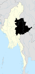
Nawnghkio Location in Burma
 Nawnghkio
Coordinates: 22°19′N 96°48′E / 22.317°N 96.8°ECoordinates: 22°19′N 96°48′E / 22.317°N 96.8°E Country Burma Division Shan State Government - Mayor Population (2005) - Ethnicities Shan, Bamar - Religions Buddhism Time zone MST (UTC+6.30) Nawnghkio, variously spelt Naunghkio, Naungcho or Nawngcho, is a town in northern Shan State, Burma. It is connected to Mandalay, Pyin U Lwin, Kyaukme, Hsipaw and Lashio by road and rail and by road to Taunggyi via National Road 43.[1][2] Asia World Company, led by Tun Myint Naing, won the contract to rebuild part of the road in 2002.[3] Originally on the Mandalay-Lashio Road, after Pyin U Lwin and before Kyaukme, Nawnghkio is on what is now the Mandalay-Muse Road, part of the Asian Highway Route 14 (AH14).[1]
Approximately 2,900 acres (12 km2) of land in the area were reclaimed and allotted to coffee growers in 1999-2000.[4]
Women of reproductive age (15-49) in Kyaukme and Nawnghkio have been targeted for improvement in reproductive health in the community in collaboration with Japan. A study mission was started in June 2004, with the project continuing for the period January 2005- December 2009.[5][6]
Notes
- ^ a b "Asian Highway in Myanmar". unescap.org. http://www.unescap.org/ttdw/Publications/TIS_pubs/pub_2303/MyanmarB5.pdf. Retrieved 2009-02-01.
- ^ "Train travel in Myanmar(Burma)". seat61.com. http://www.seat61.com/Burma.htm#Mandalay%20-%20Pyin%20Oo%20Lwin. Retrieved 2009-02-01.
- ^ "Road construction contract signed". New Light of Myanmar. 16 August 2002. http://www.myanmar.gov.mm/NLM-2002/enlm/august16.htm#(4). Retrieved 2009-02-01.
- ^ "Coffee: a promising export item". New Light of Myanmar. 7 November 2003. http://www.burmalibrary.org/docs/NLM2003-11-07.pdf. Retrieved 2009-02-01.
- ^ "Preparation for the New Project on Reproductive Health with Community Initiative in Myanmar". Japanese Organization for International Cooperation in Family Planning (JOICFP). September 2004. http://www.joicfp.or.jp/eng/e-news/2004_sep/08-MyanmaJoicfpEnews040828.html. Retrieved 2009-03-24.
- ^ Dr Kyee Myint. "Country Presentation:The 4th Asean & Japan High Level Officials Meeting on Caring Societies, 28.8.2006.to 31.8.2006". Ministry of Health. http://www.jicwels.or.jp/about_jicwels/ASEAN&JapanHighLevelOfficialsMeeting/4th%20Mtg.%20Country%20Report%202006%20-Support%20to%20Vulnerable%20People-/Myanmar%20Health.pdf. Retrieved 2009-03-24.
External links
Shan State Capital: Taunggyi Taunggyi District 
Loilem District Loilem Township · Nansang Township · Kunhing Township · Lai-Hka Township · Kyethi Township · Mong Kung Township · Mong Hsu TownshipLashio District Mu Se District Kyaukme District Kunlong District Kengtung District Mong Hsat District Tachileik District Mong Hpayak District Langkho District Danu Self-Administered Zone Pa-O Self-Administered Zone Pa Laung Self-Administered Zone Kokang Self-Administered Zone Konkyan Township · Laukkaing TownshipWa Self-Administered Division Hopang Township · Mongmaw Township · Panwai Township · Nahpan Township · Metman Township · Pangsang TownshipMain cities and towns Taunggyi · Ayetharyar · Nyaungshwe · Hopong · Hsi Hseng · Kalaw · Aungban · · Lawksawk · Pinlaung · Pekon · Loilen · Pang Long · Langkho · Nansang · Kunhing · Mong Nai · Lai-Hka · Mawkmai · Mong Pan · Hong Pai · Kyethi · Mong Kung · Mong Hsu · Mong Ton · Lashio · Hseni · Mongyai · Tangyan · Muse · Mongko · Nanhkan · Kutkai · Kyaukme · Nawnghkio · Hsipaw · Namtu · Namhsan · Mongmit · Mabein · Mantong · Kunlong · Hopang · Laukkaing · Chinshwehaw · Kengtung · Mong Khet · Mong Yang · Mong Hsat · Mong Ping · Tachileik · Mong Hpayak · Mong YawngCategories:- Township capitals of Burma
- Populated places in Shan State


Wikimedia Foundation. 2010.