- Mong Hpayak
-
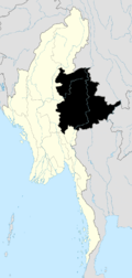
Mong Hpayak Location in Burma
 Mong Hpayak
Coordinates: 20°52′35″N 99°55′23″E / 20.87639°N 99.92306°ECoordinates: 20°52′35″N 99°55′23″E / 20.87639°N 99.92306°E Country Burma (Myanmar) Division Shan State Districts Mong Hpayak Township Mong Hpayak Government – Mayor Population – Religions Buddhism Time zone MST (UTC+6.30) WOEID 1017631 Mong Hpayak[1] (also Mong Hpyak, Mongphyat, Maingbyat, and Meng-pen-ma) is a town in Mong Hpayak District of Shan State of Burma (Myanmar). It is the principal town of and administrative center for both the district and Mong Hpayak Township. The town is located on the Tachilek–Kengtung paved road.[2] As of 2005[update], a paved road was under construction from Mong Hpayak east to Mong Yawng.[2]
Notes
- ^ "Möng Hpāyāk (Approved)" Mong Hpayak at GEOnet Names Server, United States National Geospatial-Intelligence Agency
- ^ a b "Road Construction in Shan State: A Lucrative Way to Turn Illegal Drug Profits into Legal Revenues" Undercurrents: Monitoring Development on Burma’s Mekong January 2005: pages 12-13
External links
- "Mong Hpayak Map — Satellite Images of Mong Hpayak" Maplandia World Gazetteer
Shan State Capital: TaunggyiTaunggyi District 
Loilem District Loilem Township · Nansang Township · Kunhing Township · Lai-Hka Township · Kyethi Township · Mong Kung Township · Mong Hsu TownshipLashio District Mu Se District Kyaukme District Kunlong District Kengtung District Mong Hsat District Tachileik District Mong Hpayak District Langkho District Danu Self-Administered Zone Pa-O Self-Administered Zone Pa Laung Self-Administered Zone Kokang Self-Administered Zone Konkyan Township · Laukkaing TownshipWa Self-Administered Division Hopang Township · Mongmaw Township · Panwai Township · Nahpan Township · Metman Township · Pangsang TownshipMain cities and towns Taunggyi · Ayetharyar · Nyaungshwe · Hopong · Hsi Hseng · Kalaw · Aungban · · Lawksawk · Pinlaung · Pekon · Loilen · Pang Long · Langkho · Nansang · Kunhing · Mong Nai · Lai-Hka · Mawkmai · Mong Pan · Hong Pai · Kyethi · Mong Kung · Mong Hsu · Mong Ton · Lashio · Hseni · Mongyai · Tangyan · Muse · Mongko · Nanhkan · Kutkai · Kyaukme · Nawnghkio · Hsipaw · Namtu · Namhsan · Mongmit · Mabein · Mantong · Kunlong · Hopang · Laukkaing · Chinshwehaw · Kengtung · Mong Khet · Mong Yang · Mong Hsat · Mong Ping · Tachileik · Mong Hpayak · Mong YawngCategories:- Township capitals of Burma
- Populated places in Shan State
- Shan State geography stubs


Wikimedia Foundation. 2010.