- National Tourist Routes in Norway
-
 County Road 55 passes by Kvinnafossen
 Sign for a National Tourist Route
National Tourist Routes in Norway (Norwegian: Nasjonale turistveger) is a Norwegian Public Roads Administration designation for road routes that offer a picturesque trip and have been upgraded with tourist-friendly infrastructure, such as rest stops and viewpoints. Eighteen routes have been selected, of which six have been completed and are signposted as such.[1] The routes cover 1,850 kilometers (1,150 mi) and are located along the West Coast, in Northern Norway and in the mountains of Southern Norway.[2] The routes have been selected based on their unique natural surroundings, status as alternatives to main roads, and availability of viewpoints and tourist services.[1] In combination with the routes, the authorities have coordinated the establishment of accommodation, cultural activities, dining, sale of local arts and crafts, and natural experiences.[2]
The project started in 1994 with projects on Sognefjellsvegen, Gamle Strynefjellsveg, Hardanger and the Helgeland Coast. In 1997, these were officially designated National Tourist Routes, and the following year Parliament decided to expand the project. Municipalities were asked to nominate roads, resulting in 52 nominees covering 8,000 kilometers (5,000 mi). In 2004, eighteen routes were selected,[3] with the goal of completing the necessary upgrades and officially opening them as National Tourist Routes by 2015. The upgrades are estimated to cost 800 million Norwegian krone.[2] The upgrades include building resting places, parking lots, viewpoints, and clearing vegetation. The stops are seen as art projects that use design to enhance the experience. While most of the architecture has been designed by young Norwegians, Louise Bourgeois and Peter Zumthor have designed stops in Varanger and Ryfylke.[1]
Two routes constitute part of the International E-road network, E10 through Lofoten and E75 through Varanger.[4][5] Mountain pass roads, such as Sognefjellsvegen, Valdresflye and Trollstigen, are closed during winter.[6][7][8] Both sections of the Helgeland Coast Route have two ferries in them,[9][10] while there is one ferry on Geiranger–Trollstigen[8] and three each on the routes through Ryfylke and Hardanger.[11][12] The Andøya and Senja routes are connected via the Andenes–Gryllefjord Ferry.[13]
List
The following is a list of National Tourist Routes in Norway that have officially opened or have been approved and are under upgrade.[3] It contains an image, the name of the road, the start and finish locations of the route, the county or counties the route runs through, the road numbers the route follows, the length of the road and a description.
Image Name Route County(s) Road(s) Length Description Refs 
Andøya Åkneskrysset–Andenes Nordland 974, 976, 82 51 km/32 mi The road runs along the west coast of Andøya, the northernmost island of the Vesterålen archipelago, featuring fishing hamlets between the unsheltered white beaches. The islands has Norway's largest marshes, and whales, seals and bird rocks can be spotted in the Norwegian Sea. The route connects to National Tourist Route Senja by ferry. [13][14] 
Atlantic Ocean Road Kårvåg–Bud Møre og Romsdal 64, 242, 663, 235, 238 36 km/22 mi From Kårvåg to Vevang, the Atlantic Ocean Road is built on several small unsheltered islands and skerries, and is spanned by eight bridges, several causeways and viaducts. The National Tourist Route continues along the coast of Hustadvika—infamous as a ship graveyard. [15][16] 
Aurlandsfjellet Aurlandsvangen–Lærdalsøyri Sogn og Fjordane 243 47 km/29 mi The crossing of Aurlandsfjellet allows the route to bypasses the Lærdal Tunnel—the world's longest road tunnel. The barren mountain plateau offers views 600 m (2,000 ft) down on the Aurlandsfjord. [17][18] 
Gamle Strynefjellsvegen Grotli–Ospeli Oppland, Sogn og Fjordane 258 27 km/17 mi Opened in 1894, the road connects the mountain village of Skjåk and the fjord village of Stryn. It passes round, glaciated forms in the east and steep, rugged typography in the west. Skiing is possible far into the summer and the road is not opened until June. [19][20] 
Gaularfjellet Balestrand–Moskog Sogn og Fjordane 13, 55 92 km/57 mi The route over Gaularfjellet offers an alternative route between Sogn and Sunnfjord. Starting at Sognefjord, it passes lakes, rapids and waterfalls, and varies between steep mountain climbs, clinging to fjord and running through sheltered valleys. [21][22] 
Geiranger–Trollstigen Langevatn–Sogge Bridge Møre og Romsdal 63 104 km/65 mi The route climbs the mountainside along Trollstigen with its hairpin bends before dropping down to Geirangerfjord, a World Heritage Site, and clinging to the fjordside until reaching Geiranger. [8][23] 
Hardanger Halne–Steinsdalsfossen,
Jondal–Utne,
Kinsarvik–TyssedalHordaland 7, 550, 13 195 km/121 mi The route consists of three sections in Hardanger, which varies between fjordlandscape, moorlands, mountainsides and glaciers. Two prominent waterfalls include Vøringsfossen and Steindalsfossen. The region is the hallmark of Norwegian romantic nationalism with roadside sale of traditional handicrafts and fruit. [12][24] 
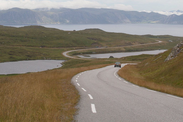
Havøysund Russelv–Havøysund Finnmark 889 66 km/41 mi The route runs through a deserted area of the Arctic with the sea on the one side and barren mountains on the other. The area in unpopulated except for the fishing village of Havøysund. [25][26] 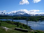
Helgeland Coast North Stokkvågen–Storvika Nordland 17 129 km/80 mi A coastal alternative to E6, the route runs north–south through Helgeland. On the sea-side lays 14,000 islands, while on the land-side lays the glacier Svartisen and its branch, Engabreen, which falls 1,200 m (3,900 ft) from the mountains to the coast. To the north lays Saltstraumen, one of the world's most powerful tidal currents. [10][27] 
Helgeland Coast South Holm–Alstahaug Nordland 17 97 km/60 mi The coastal alternative to E6 runs through a vast archipelago, many accessible by ferry, and crowned by Vega, a World Heritage Site. Unique mountains include the Torghatten with its hole through it and the Seven Sisters of Alstahaug. [9][28] 
Jæren Ogna–Bore Rogaland 44, 507 41 km/25 mi Running along the endless ocean of the Jæren coastline, the route passes endless sandy beaches and sand dunes. Norway's largest lowland region is dominated by agriculture and a well-kept cultural landscape. The coastline features several lighthouse. [29][30] 
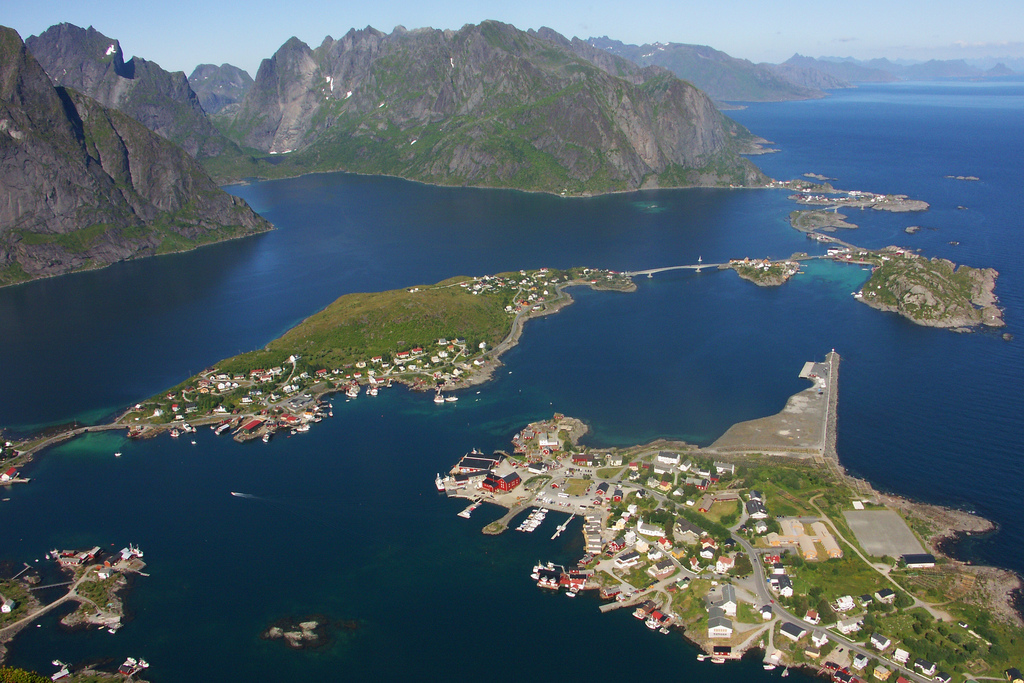
Lofoten Fiskebøl–Å Nordland E10, 82 164 km/102 mi The Lofoten archipelago combines the open sea, current sounds, white beaches and steep, pointed mountains. The fishing hamlets not only retain an active industry but preserve the cultural heritage, such as rorbu cabins. [4][31] 
Rondane Enden–Folldal Hedmark 27 48 km/30 mi The route runs along the east border of Rondane National Park, protecting the Rondane massif, and west of a cultural landscape. The mountains are dry and well-suited for hiking and summit tours, including many marked paths and cabins. Along the route are also the mines at Folldal. [32][33] 
Ryfylke Oanes–Sauda–Horda Rogaland 13, 46, 520 183 km/114 mi The southern part of Ryfylke has fertile landscape and calm skerries, in contrast to the rockslides, cliffs, fjords and mountains in the north. The nature is supplemented with smelting plants in Sauda and the zinc mines in Allmannajuvet. Preikestolen and the view of Lysefjord is a short side-trip away. [11][34] 
Senja Gryllefjord–Botnhamn Troms 86, 862 84 km/52 mi The route follows the west coast of Senja. It connects to National Tourist Route Andøy via a ferry, which combined offer an alternative to the E6. The route passes through several fishing villages, [35][36] 
Sognefjellsvegen Lom–Gaupne Oppland, Sogn og Fjordane 55 108 km/67 mi The mountain pass over Sognefjellet reaches 1,434 m (4,705 ft) above mean sea level, the highest mountain pass in northern Europe. Only open in the summer, in May the snow banks on the side of the road can be 10 m (33 ft) tall. The route has views of emerald green mountain lakes, glaciers and peaks. It provides access to Jotunheimen National Park and Jostedalsbreen National Park. [6][37] 
Valdresflye Garli–Besstrond Oppland 51 37 km/23 mi Valdresflye is a mountain plateau where the road reaches 1,389 m (4,557 ft) above mean sea level. On the plateau the route has views towards Jotunheimen National Park, while further down the road passes through cultivated landscape with mountain pastures. [7][38] 
Varanger Varangerbotn–Hamningberg Finnmark E75, 341 160 km/99 mi The route follows the east coast of Varanger, which borders the Barents Sea. To the south the road runs through sheltered birtch forests and bogs, but by the time it reaches Vadsø, the landscape has become lunar and jagged. During winter, the coastline is rampaged with storms, freezing sea fog and the Arctic night. In summer, the short Siberian heat blends with the never-ending day. The area has rich traditions within trade and is a melting pot of Russian, Finnish, Norwegian and Sami culture. [5][39] References
- ^ a b c "Om nasjonale turistveger" (in Norwegian). Norwegian Public Roads Administration. Archived from the original on 5 October 2011. http://www.vegvesen.no/Vegprosjekter/Om+vegprosjekter/Turistveger/Nasjonale+turistveger. Retrieved 5 October 2011.
- ^ a b c Fonbæk, Dag (3 August 2008). "Her er de norske «Postkortveiene»" (in Norwegian). Verdens Gang. Archived from the original on 5 October 2011. http://www.vg.no/reise/artikkel.php?artid=198141. Retrieved 5 October 2011.
- ^ a b "Historikk" (in Norwegian). Norwegian Public Roads Administration. Archived from the original on 5 October 2011. http://www.vegvesen.no/Vegprosjekter/Om+vegprosjekter/Turistveger/Historikk. Retrieved 5 October 2011.
- ^ a b "Nasjonal turistveg Lofoten" (in Norwegian). Norwegian Public Roads Administration. Archived from the original on 5 October 2011. http://www.vegvesen.no/Vegprosjekter/lofoten/Om+strekningen. Retrieved 5 October 2011.
- ^ a b "Nasjonal turistveg Varanger" (in Norwegian). Norwegian Public Roads Administration. Archived from the original on 5 October 2011. http://www.vegvesen.no/Vegprosjekter/varanger/Om+strekningen. Retrieved 5 October 2011.
- ^ a b "Sognefjellet". Norwegian Public Roads Administration. Archived from the original on 5 October 2011. http://www.turistveg.no/en/sognefjellet#desc. Retrieved 5 October 2011.
- ^ a b "Valdresflye". Norwegian Public Roads Administration. Archived from the original on 5 October 2011. http://www.turistveg.no/en/valdresflye#desc. Retrieved 5 October 2011.
- ^ a b c "Geiranger–Trollstigen". Norwegian Public Roads Administration. Archived from the original on 5 October 2011. http://www.turistveg.no/en/geiranger-trollstigen#desc. Retrieved 5 October 2011.
- ^ a b "Helgelandskysten sør". Norwegian Public Roads Administration. Archived from the original on 5 October 2011. http://www.turistveg.no/en/helgelandskysten-sor#desc. Retrieved 5 October 2011.
- ^ a b "Helgelandskysten nord". Norwegian Public Roads Administration. Archived from the original on 5 October 2011. http://www.turistveg.no/en/helgelandskysten-nord#desc. Retrieved 5 October 2011.
- ^ a b "Ryfylke". Norwegian Public Roads Administration. Archived from the original on 5 October 2011. http://www.turistveg.no/en/ryfylke#desc. Retrieved 5 October 2011.
- ^ a b "Hardanger". Norwegian Public Roads Administration. Archived from the original on 5 October 2011. http://www.turistveg.no/en/hardanger#desc. Retrieved 5 October 2011.
- ^ a b "Nasjonal turistveg Andøya" (in Norwegian). Norwegian Public Roads Administration. Archived from the original on 5 October 2011. http://www.vegvesen.no/Vegprosjekter/andoya/Om+strekningen. Retrieved 5 October 2011.
- ^ "Andøya". Norwegian Public Roads Administration. Archived from the original on 5 October 2011. http://www.turistveg.no/en/andoya#desc. Retrieved 5 October 2011.
- ^ "Nasjonal turistveg Atlanterhavsveien" (in Norwegian). Norwegian Public Roads Administration. Archived from the original on 5 October 2011. http://www.vegvesen.no/Vegprosjekter/atlanterhavsvegen/Om+strekningen. Retrieved 5 October 2011.
- ^ "Atlanterhavsveien". Norwegian Public Roads Administration. Archived from the original on 5 October 2011. http://www.turistveg.no/en/atlanterhavsvegen#desc. Retrieved 5 October 2011.
- ^ "Nasjonal turistveg Aurlandsfjellet" (in Norwegian). Norwegian Public Roads Administration. Archived from the original on 5 October 2011. http://www.vegvesen.no/Vegprosjekter/aurlandsfjellet/Om+strekninga. Retrieved 5 October 2011.
- ^ "Aurlandsfjellet". Norwegian Public Roads Administration. Archived from the original on 5 October 2011. http://www.turistveg.no/en/aurlandsfjellet#desc. Retrieved 5 October 2011.
- ^ "Nasjonal turistveg Gamle Strynefjellsvegen" (in Norwegian). Norwegian Public Roads Administration. Archived from the original on 5 October 2011. http://www.vegvesen.no/Vegprosjekter/strynefjellsvegen/Om+strekninga. Retrieved 5 October 2011.
- ^ "Gamle Strynefjellsvegen". Norwegian Public Roads Administration. Archived from the original on 5 October 2011. http://www.turistveg.no/en/gamle-strynefjellsvegen#desc. Retrieved 5 October 2011.
- ^ "Nasjonal turistveg Gaularfjellet" (in Norwegian). Norwegian Public Roads Administration. Archived from the original on 5 October 2011. http://www.vegvesen.no/Vegprosjekter/gaularfjellet/Om+strekninga. Retrieved 5 October 2011.
- ^ "Gaularfjellet". Norwegian Public Roads Administration. Archived from the original on 5 October 2011. http://www.turistveg.no/en/gaularfjellet#desc. Retrieved 5 October 2011.
- ^ "Nasjonal turistveg Geiranger–Trollstigen" (in Norwegian). Norwegian Public Roads Administration. Archived from the original on 5 October 2011. http://www.vegvesen.no/Vegprosjekter/geiranger/Om+strekninga. Retrieved 5 October 2011.
- ^ "Nasjonal turistveg Hardanger" (in Norwegian). Norwegian Public Roads Administration. Archived from the original on 5 October 2011. http://www.vegvesen.no/Vegprosjekter/hardanger/Om+strekninga. Retrieved 5 October 2011.
- ^ "Nasjonal turistveg Havøysund" (in Norwegian). Norwegian Public Roads Administration. Archived from the original on 5 October 2011. http://www.vegvesen.no/Vegprosjekter/havoysund/Om+strekningen. Retrieved 5 October 2011.
- ^ "Havøysund". Norwegian Public Roads Administration. Archived from the original on 5 October 2011. http://www.turistveg.no/en/havoysund#desc. Retrieved 5 October 2011.
- ^ "Nasjonal turistveg Helgelandskysten nord" (in Norwegian). Norwegian Public Roads Administration. Archived from the original on 5 October 2011. http://www.vegvesen.no/Vegprosjekter/helgelanskystennord/Om+strekningen. Retrieved 5 October 2011.
- ^ "Nasjonal turistveg Helgelandskysten sør" (in Norwegian). Norwegian Public Roads Administration. Archived from the original on 5 October 2011. http://www.vegvesen.no/Vegprosjekter/helgelandskystensor/Om+strekningen. Retrieved 5 October 2011.
- ^ "Nasjonal turistveg Jæren" (in Norwegian). Norwegian Public Roads Administration. Archived from the original on 5 October 2011. http://www.vegvesen.no/Vegprosjekter/jaeren/Om+strekninga. Retrieved 5 October 2011.
- ^ "Jæren". Norwegian Public Roads Administration. Archived from the original on 5 October 2011. http://www.turistveg.no/en/jaeren#desc. Retrieved 5 October 2011.
- ^ "Lofoten". Norwegian Public Roads Administration. Archived from the original on 5 October 2011. http://www.turistveg.no/en/lofoten#desc. Retrieved 5 October 2011.
- ^ "Nasjonal turistveg Rondane" (in Norwegian). Norwegian Public Roads Administration. Archived from the original on 5 October 2011. http://www.vegvesen.no/Vegprosjekter/rondane/Om+strekningen. Retrieved 5 October 2011.
- ^ "Rondane". Norwegian Public Roads Administration. Archived from the original on 5 October 2011. http://www.turistveg.no/en/rondane#desc. Retrieved 5 October 2011.
- ^ "Nasjonal turistveg Ryfylke" (in Norwegian). Norwegian Public Roads Administration. Archived from the original on 5 October 2011. http://www.vegvesen.no/Vegprosjekter/ryfylke/Om+strekninga. Retrieved 5 October 2011.
- ^ "Nasjonal turistveg Senja" (in Norwegian). Norwegian Public Roads Administration. Archived from the original on 5 October 2011. http://www.vegvesen.no/Vegprosjekter/senja/Om+strekningen. Retrieved 5 October 2011.
- ^ "Senja". Norwegian Public Roads Administration. Archived from the original on 5 October 2011. http://www.turistveg.no/en/senja#desc. Retrieved 5 October 2011.
- ^ "Nasjonal turistveg Sognefjellsvegen" (in Norwegian). Norwegian Public Roads Administration. Archived from the original on 5 October 2011. http://www.vegvesen.no/Vegprosjekter/sognefjellsvegen/Om+strekninga. Retrieved 5 October 2011.
- ^ "Nasjonal turistveg Valdresflye" (in Norwegian). Norwegian Public Roads Administration. Archived from the original on 5 October 2011. http://www.vegvesen.no/Vegprosjekter/valdresflye/Om+strekninga. Retrieved 5 October 2011.
- ^ "Varanger". Norwegian Public Roads Administration. Archived from the original on 5 October 2011. http://www.turistveg.no/en/varanger#desc. Retrieved 5 October 2011.
External links
National Tourist Routes in Norway Andøya (974 · 976 · 82) · Atlantic Ocean Road (64 · 242 · 663 · 235 · 238) · Aurlandsfjellet · Gamle Strynefjellsvegen · Gaularfjellet · Geiranger–Trollstigen · Hardanger (7 · 550 · 13) · Havøysund · Helgeland Coast · Jæren (44, 507) · Lofoten · Rondane · Ryfylke (13 · 46 · 520) · Senja (86 · 862) · Sognefjellsvegen · Valdresflye · Varanger (E75 · 341) Categories:
- Roads in Norway
- National Tourist Routes in Norway


Wikimedia Foundation. 2010.