- Lon Cambria
-
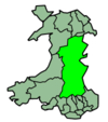
Lon Cambria is a 113-mile cycle route in the National Cycle Network which runs from Aberystwyth on the west coast of Wales, to Shrewsbury in England. It crosses the remote, breathtaking scenery of the Cambrian Mountains, takes in the tranquil Elan Valley reservoirs, and continues through the rolling country lanes and picturesque towns of Mid Wales and Shropshire, finally climbing over the Long Mountain near Welshpool. It is often paired with Lon Teifi which continues down to Fishguard in southwest Wales. The name Lon Cambria is Welsh for "Cambrian Road". The main route, National Cycle Route 81, travels in a mainly diagonal direction from southwest to northeast, except for a sizable detour through the Elan Valley and the town of Rhayader. Route 818 makes a shortcut to bypass these through a difficult mountain pass.
Route
Aberystwyth | Pont-rhyd-y-groes | Cwmystwyth
Including the Ystwyth Trail (a Rail trail).
Cambrian Mountains | Elan Valley | Rhayader | Llangurig
Including the Cwmystwyth Mines, Elan Valley Visitor Centre, Wind farms.
Llanidloes | Caersws | Newtown
Welshpool | Long Mountain | Shrewsbury
External links
Sustrans' National Cycle Network Main routes: Other routes: 11 · 12 · 13 · 14 · 15 · 16 · 17 · 18 · 20 · 21 · 22 · 23 · 24 · 25 · 26 · 27 · 28 · 32 · 33 · 41 · 42 · 43 · 44 · 45 · 46 · 47 · 48 · 50 · 51 · 52 · 53 · 54 · 55 · 56 · 57 · 61 · 62 · 63 · 64 · 65 · 66 · 67 · 68 · 69 · 71 · 72 · 73 · 74 · 75 · 76 · 77 · 78 · 79 · 81 · 82 · 83 · 84 · 85 · 88 · 91 · 92 · 93 · 94 · 95 · 96Transport in Powys Road 
Footpaths Beacons Way · Cambrian Way · Epynt Way · Glyndŵr's Way · Marches Way · Offa's Dyke Path · Sarn Helen · Severn Way · Usk Valley Walk · Wye Valley WalkCycle routes Celtic Trail · Elan Valley Trail · Lake Vyrnwy Road Circuit · Lon Cambria · Lôn Las Cymru · Radnor Ring · Taff TrailRailway stations Cambrian Line Heart of Wales Line Builth Road · Cilmeri · Dolau · Garth (Powys) · Knucklas · Llanbister Road · Llandrindod · Llangammarch · Llangynllo · Llanwrtyd · Pen-y-Bont · Sugar Loaf
Welshpool and Llanfair
Light RailwayCastle Caereinion · Cyfronydd · Heniarth · Llanfair Caereinion · Sylfaen · Welshpool Raven Square
Categories:- National Cycle Routes
- Cycleways in Wales
- Transport in Ceredigion
- Cycleways in Powys
- Transport in Shropshire
- Elenydd
- United Kingdom road stubs
- Cycling stubs
Wikimedia Foundation. 2010.
