- National Cycle Route 23
-
National Cycle Route 23 (or NCR 23) is a route of the National Cycle Network, running from Reading to Sandown. The partially signed route passes through Basingstoke, Eastleigh and Southampton; once across the Solent, it continues through Cowes and Newport.
Contents
Route
Reading to Basingstoke
Basingstoke to Alton/Winchester
Basingstoke | Alton | Winchester
Winchester to Southampton
Winchester | Eastleigh | Southampton
Cowes to Sandown
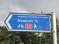
Traffic sign for NCR 23 on the Isle of Wight
 NCR 23, south of Merstone.
East Cowes | Cowes | Newport | Sandown[1]
Upon arrival at East Cowes, one must continue ahead around the one-way system in order to reach the Cowes Floating Bridge, which allows the route to cross the River Medina. There is no toll for cyclists, and a 2-3 minute crossing brings you to Cowes. The Floating Bridge does not operate a 24-hour service, so this section of the route is not available during late night.
A short distance along the Ferry Road takes you to the junction with Arctic Road, where the cycle route turns to the left, away from the coast. At the end of Arctic Road, past the industrial estate, the route leaves road for the first time on the Island. A short ascent takes you onto the first cyclepath built on the Island, the Cowes to Newport Cyclepath. This route was constructed on the old railway embankment of the Southern Railway's Cowes branch. About half way along the route to Newport, the route crosses an inlet of the River Medina, which the route follows all the way to Newport.
The Cyclepath ends at the edge of the Riverway Industrial Estate, near the town centre. From there, there are limited signs that direct the cyclist around the Town Quay to St. Thomas' Square. The route from there is badly signed and difficult to legally follow, but eventually the route reaches Shide.
In Shide, the route joins the Sandown to Newport Cyclepath - this again follows the route of a disused railway line (with minor deviations) all the way to Sandown. The route initially follows the River Medina, now a small stream, across the main road at Blackwater. There is no traffic control at this flat crossing, but it is within a speed limited area. Beyond here, the route leaves the railway embankment for about one mile, skirting neighbouring farmyards, then returning to the old route in good time for Merstone.
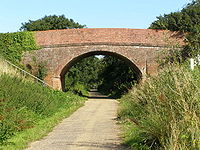
The old station at Merstone consisted of a single island platform, which still stands. Past this is Merstone Lane, a narrow but heavily used road, which must be crossed with care. Shortly after this, the route passes under a road bridge and multiplexes with the Sunshine Trail. The route then slopes significantly downhill, until it is parallel with the course of a different river, the Eastern Yar. Shortly after this, the route again leaves the railway embankment for a short detour, caused by limited development along the route ahead. At this point, the surface changes from tarmac to planked duckboards, until reaching the edge of Arreton. At this point, the route crosses the main A 3020 road, and a toucan crossing is provided.
The route then follows the old railway line across the Yar's floodplain until Horringford, at the edge of Newchurch, where a slight deviation to the North is required, again due to development on the old route. Beyond Newchurch lies the village of Alverstone, with a final flat crossing with the minor road there before the route arrives at Sandown, on the edge of town between two holiday camp sites. The railway station and town centre can be reached by turning right onto the through road there then following the Sunshine Trail.Sustrans' National Cycle Network Main routes: Other routes: 11 · 12 · 13 · 14 · 15 · 16 · 17 · 18 · 20 · 21 · 22 · 23 · 24 · 25 · 26 · 27 · 28 · 32 · 33 · 41 · 42 · 43 · 44 · 45 · 46 · 47 · 48 · 50 · 51 · 52 · 53 · 54 · 55 · 56 · 57 · 61 · 62 · 63 · 64 · 65 · 66 · 67 · 68 · 69 · 71 · 72 · 73 · 74 · 75 · 76 · 77 · 78 · 79 · 81 · 82 · 83 · 84 · 85 · 88 · 91 · 92 · 93 · 94 · 95 · 96References
Categories:- National Cycle Routes
- Transport in Kent
- Transport on the Isle of Wight
Wikimedia Foundation. 2010.

