- Sardar Sarovar Dam
-
Sardar Sarovar Dam 
The Sardar Sarovar Dam,
partially completed in August 2008Official name The Sardar Sarovar Dam Location Navagam, Gujarat Coordinates 21°49′49″N 73°44′50″E / 21.83028°N 73.74722°E Construction began 1964 Dam and spillways Type of dam Concrete gravity dam Height Design Full reservoir level (FRL): 138 m (453 ft)
Maximum water level: 146.5 m (481 ft)Length 1,210 m (3,970 ft) Base width 100 m (330 ft) Impounds Narmada River Spillway capacity 84,949 m3/s (2,999,900 cu ft/s) Reservoir Capacity 4,700,000 acre feet (5.8 km3) Catchment area 88,000 km2 (34,000 sq mi) Surface area 375.33 km2 (144.92 sq mi) Power station Owner(s) Narmada Control Authority Operator(s) Sardar Sarovar Narmada Nigam Limited Commission date June, 2006 Installed capacity 1,450 MW (River bed power house-1200 MW, Canal head power house-250 MW)[1] Maximum capacity Firm power: 439 MW Website
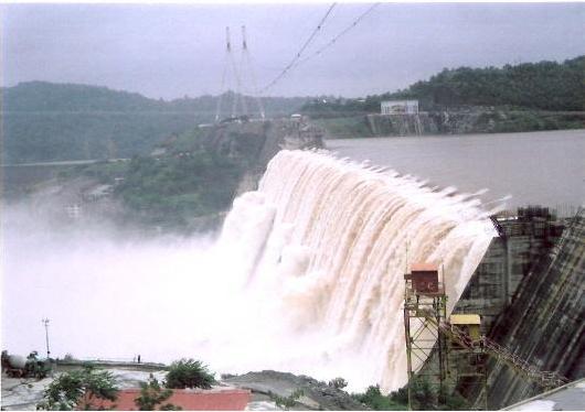
Sardar Sarovar DamThe Sardar Sarovar Dam is a dam on the Narmada River near Navagam, Gujarat, India. It is the largest dam and part of the Narmada Valley Project, a large hydraulic engineering project involving the construction of a series of large irrigation and hydroelectric multi purpose dams on the Narmada River. The project took form in 1979 as part of a development scheme to increase irrigation and produce hydroelectricity.
It is the 30th largest dams planned on river Narmada, Sardar Sarovar Dam (SSD) is the largest structure to be built. It has a proposed final height of 136.5 m (448 ft). The project will irrigate more than 18,000 km2 (6,900 sq mi), most of it in drought prone areas of Kutch and Saurashtra. Critics maintain that its negative environmental impacts outweigh its benefits. It has created discord between its government planners and the citizens group Narmada Bachao Andolan.
Contents
Projected benefits
The benefits of the dam as listed in the Judgement of Supreme Court of India in 2000 were:
"The argument in favour of the Sardar Sarovar Project is that the benefits are so large that they substantially outweigh the costs of the immediate human and environmental disruption. Without the dam, the long term costs for people would be much greater and lack of an income source for future generations would put increasing pressure on the environment. If the waters of the Narmada river continuous to flow to the sea unused there appears to be no alternative to escalating human deprivation, particularly in the dry areas of Gujarat.
The project has the potential to feed as many as 20 million people, provide domestic and industrial water for about 30 million, employ about 1 million, and provide valuable peak electric power in an area with high unmet power demand (farm pumps often get only a few hours power per day). In addition, recent research shows substantial economic multiplier effects (investment and employment triggered by development) from irrigation development. Set against the futures of about 70,000 project affected people, even without the multiplier effect, the ratio of beneficiaries to affected persons is well over 100:1."[2]
The dam will irrigate 17,920 km2 (6,920 sq mi) of land spread over 12 districts, 62 talukas and 3393 villages (75% of which is drought-prone areas) in Gujarat and 730 km2 (280 sq mi) in the arid areas of Barmer and Jalore districts of Rajasthan. The dam will also provide flood protection to riverine reaches measuring 30,000 ha (74,000 acres) covering 210 villages and Bharuch city and a population of 400,000 in Gujarat.[1]
Height issues


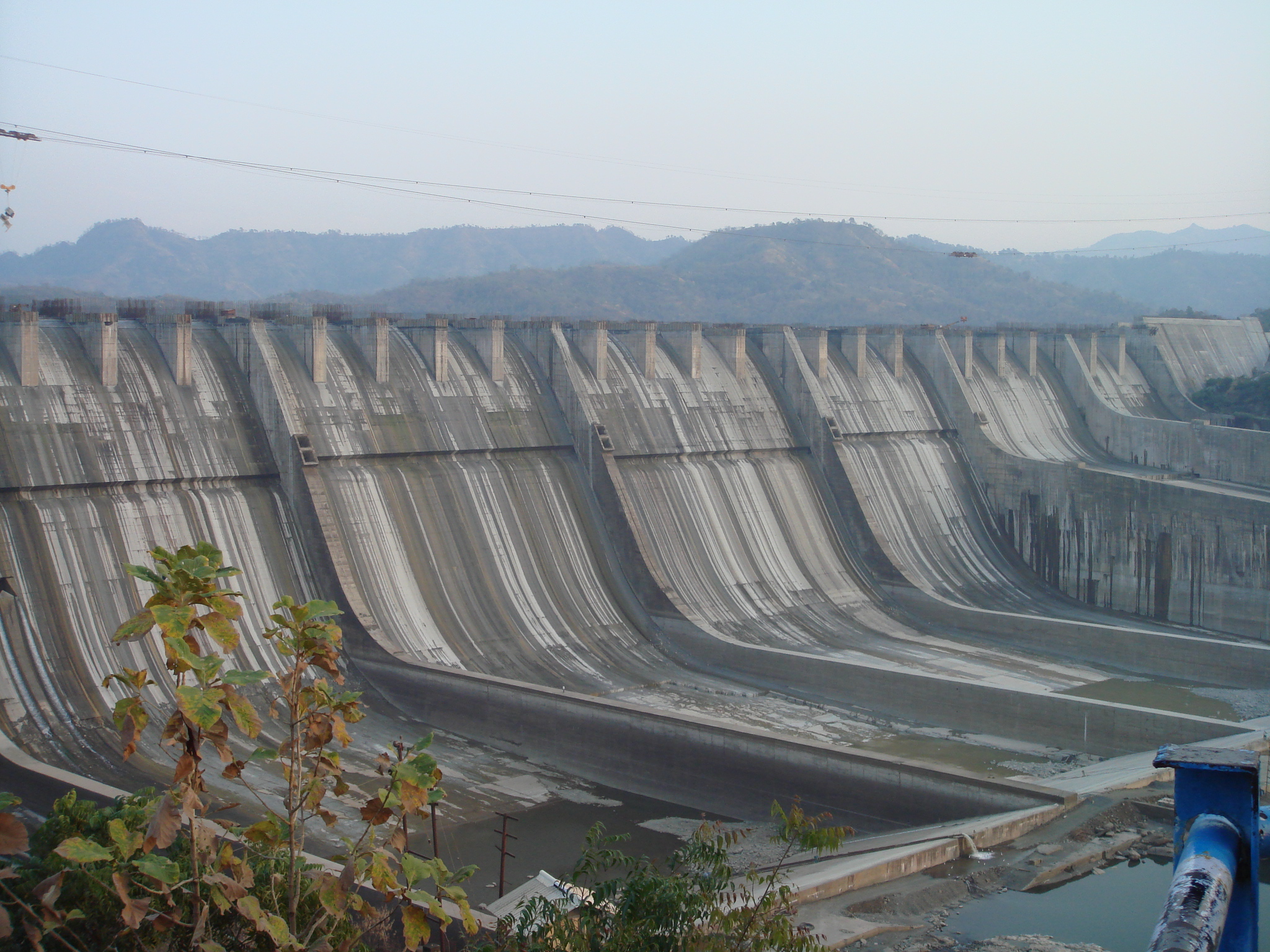
The Sardar Sarovar Dam,
undergoing height increase in 2006.- In February 1999, the Supreme Court of India gave the go ahead for the dam's height to be raised to 88 m (289 ft) from the initial 80 m (260 ft).
- In October 2000 again, in a 2 to 1 majority judgment in the Supreme Court, the government was allowed to construct the dam up to 90 m (300 ft).[3]
- In May 2002, the Narmada Control Authority approved increasing the height of the dam to 95 m (312 ft).
- In March 2004, the Authority allowed a 15 m (49 ft) height increase to 110 m (360 ft).
- In March 2006, the Narmada Control Authority gave clearance for the height of the dam to increased from 110.64 m (363.0 ft) to 121.92 m (400.0 ft). This came after 2003 when the Supreme Court of India refused to enlargen the height of the dam again.
Controversy
Main article: Narmada Bachao AndolanProtest
The dam is one of India's most controversial dam projects and its environmental impact and net costs and benefits are widely debated. The World Bank was initially a funder of the SSD, but withdrew in 1994. The Narmada Dam has been the centre of controversy and protest since the late 1980s.[4]
One such protest takes center stage in the Spanner films documentary Drowned Out (2002), which follows one tribal family who decide to stay at home and drown rather than make way for the Narmada Dam.[5] An earlier documentary film is called A Narmada Diary (1995) by Anand Patwardhan and Simantini Dhuru. The efforts of NBA to seek social and environmental justice for those most directly affected by the Sardar Sarover Dam construction feature prominently in this award winning film (Filmfare Award for Best Documentary-1996).[6]
The figurehead of much of the protest is Medha Patkar, the leader of the "Narmada Bachao Andolan," the "Save Narmada Movement."[7] The movement was cemented in 1989, and was awarded the Right Livelihood Award in 1991.[8]
Support for the protests also came from Indian author Arundhati Roy, who wrote the extended essay "The Greater Common Good" in protest of the Narmada Dam Project;[9] the essay was reprinted in her book The Cost of Living. In that essay, Roy states:
Big Dams are to a Nation's 'Development' what Nuclear Bombs are to its Military Arsenal. They're both weapons of mass destruction. They're both weapons Governments use to control their own people. Both Twentieth Century emblems that mark a point in time when human intelligence has outstripped its own instinct for survival. They're both malignant indications of civilisation turning upon itself. They represent the severing of the link, not just the link - the understanding - between human beings and the planet they live on. They scramble the intelligence that connects eggs to hens, milk to cows, food to forests, water to rivers, air to life and the earth to human existence.The Supreme Court decision
Despite popular protest, the Supreme Court gave clearance for the height to be increased to 121.92 m (400 ft), but in the same judgment Mr. Justice Bharucha gave directions to Madhya Pradesh and Maharashtra (the Grievance Redressal Authorities of Gujarat) that before further construction begins, they should certify (after inspection) that all those displaced by the raise in height of 5 metres have already been satisfactorily rehabilitated, and also that suitable vacant land for rehabilitating them is already in the possession of the respective States. This process shall be repeated for every successive five metre increase in height.
Report of the Ministry of Environment and Forests (MoEF)
The Second Interim Report of the Experts' Committee set up by the Ministry of Environment and Forests (MoEF) of the Government of India to assess the planning and implementation of environmental safeguards with respect to the Sardar Sarovar (SSP) and Indira Sagar projects (ISP) on the Narmada River. It is a clear finding of the egregious failure of the government machinery on virtually all the aspects studied.
The report covers the status of compliances on catchment area treatment (CAT), flora and fauna and carrying capacity upstream, command area development (CAD), compensatory afforestation and human health aspects in project impact areas. The report is a severe indictment of the governments of Gujarat, Madhya Pradesh and Maharashtra and of the bodies set up by these governments to implement the projects for the ‘integrated development' of the Narmada Valley. The report is peppered with phrases like ‘gross violation', ‘negligence', ‘highly unsatisfactory,' ‘inadequate,' ‘serious lapse' and ‘non compliance'.
It states in strong and unequivocal terms that, with respect to virtually all of the aspects under consideration, compliance is either highly inadequate or absent altogether. A partial exception is compensatory afforestation. Construction, on the other hand, has been proceeding apace: the ISP is complete and the SSP nearing completion. The report recommends that no further reservoir-filling be done at either SSP or ISP; that no further work be done on canal construction; and that even irrigation from the existing network be stopped forthwith until failures of compliance on the various environmental parameters have been fully remedied.[10]
Solar power generation
Government of Gujarat plans to generate solar power from placing solar panels over the canal making it beneficial for the villages around to get power and also helping to reduce the evaporation of precious water. The first phase consists of covering 25 km to generate 25MW of power.[11]
References
- ^ a b "Main Features of the Dam". supportnarmadadam.org. http://www.supportnarmadadam.org/features-narmada-canal-india.htm. Retrieved 15 April 2010.
- ^ Judgement of the Supreme Court of India 2000
- ^ Go-ahead for India dam project
- ^ Scudder T. (2003) (SSP), Unpublished Manuscript, retrieved 7/9/2007 India’s Sardar Sarovar Project
- ^ http://tv.oneworld.net/2009/07/28/drowned-out-the-first-10-mintues/ The first 10 minutes of Drowned Out on OneWorldTV
- ^ "A Narmada Diary". http://www.frif.com/cat97/k-o/a_narmad.html. Retrieved 2008-06-13.
- ^ Friends of River Narmada, retrieved 7/9/2007 The Sardar Sarovar Dam: a Brief Introduction
- ^ In an opinion piece in The Guardian, the campaign led by the NBA activists was accused of holding up the project's completion, even of physically attacking on local people who accepted compensation for moving.Kirk Leech (3 March 2009). "The Narmada dambusters are wrong". The Guardian. http://www.guardian.co.uk/commentisfree/2009/mar/03/india-narmada-dams. Retrieved 2009-03-04.
- ^ Roy, Arundhati (April 1999). "The Greater Common Good". Friends of River Narmada. http://www.narmada.org/gcg/gcg.html. Retrieved 2009-05-29.
- ^ "A damaging report". The Hindu (Chennai: "Kasturi & Sons Ltd). 2010-04-31. http://www.hindu.com/2010/03/31/stories/2010033153791100.htm. Retrieved 15 April 2010.
- ^ Soon, solar power panels on Narmada canal: Narendra Modi
- Sardar Saroval Narmada Nigam. (01/2002) retrieved 7/9/2007 Narmada for People and Environment
- Dam-Affected Resettlement in Gujarat, by Chhandasi Pandya, retrieved July 13, 2007 Article
External links
- Friends of River Narmada
- Official Website of NVDA - Narmada Valley Development Authority
- Official website of Sardar Sarovar Narmada Nigam Limited
- Regularly updated news clippings about Narmada dams
- Concluding letter from Independent Review (also known as Morse Committee) constituted by World Bank in 1992 to assess Sardar Sarovar Dam Project djvu format or in pdf format.
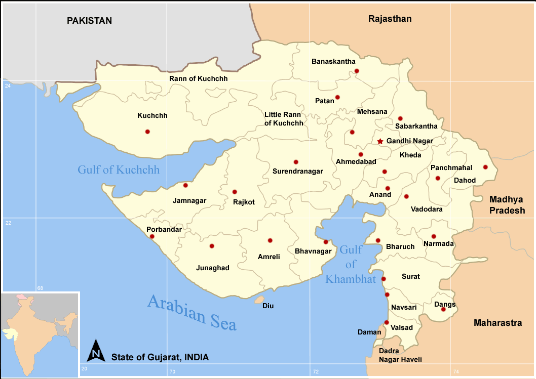
 State of Gujarat
Capital : Gandhinagar Major Corporations 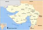
Districts Ahmedabad · Amreli · Anand · Banaskantha · Bharuch · Bhavnagar · Dahod · Dang · Gandhinagar · Jamnagar · Junagadh · Kheda · Kachchh · Mehsana · Narmada · Navsari · Panchmahal · Patan · Porbandar · Rajkot · Sabarkantha · Surat · Surendranagar · Tapi · Vadodara · Valsad
Villages Telnar
Topics History · Politics · Government · Economy · Education · People · Culture · Cuisine · Geography · National parks and sanctuaries · Cinema · Tourism
Major Projects of Gujarat Ahmedabad BRTS · Gujarat International Finance Tec-City · Sabarmati Riverfront Development Project · Sardar Sarovar Project · GSWAN ·
Regions of Gujarat Bhal region · Kathiawar region · Gohilwad region · Zhalawad region · Charotar region · Ghed region
Portal : Gujarat Categories:- Hydroelectric power stations in India
- Economy of Madhya Pradesh
- Economy of Gujarat
- Jalore district
- Buildings and structures in Madhya Pradesh
- Buildings and structures in Maharashtra
- Buildings and structures in Gujarat
- Narmada River
- Dams in Gujarat
Wikimedia Foundation. 2010.