- Nakhon Thai District
-
Nakhon Thai
นครไทย— Amphoe — Amphoe location in Phitsanulok Province
Coordinates: 17°6′3″N 100°50′16″E / 17.10083°N 100.83778°ECoordinates: 17°6′3″N 100°50′16″E / 17.10083°N 100.83778°E Country  Thailand
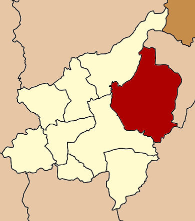
Province Phitsanulok Seat Tambon Muban Amphoe established Area – Total 2,220.374 km2 (857.3 sq mi) Population (2005) – Total 85,842 – Density 38.7/km2 (100.2/sq mi) Time zone THA (UTC+7) Postal code 65120 Geocode 6502 Nakhon Thai (Thai: นครไทย) is a district (amphoe) in the eastern part of Phitsanulok Province, northern Thailand.
Contents
Geography
Neighboring districts are (from the southwest clockwise) Wang Thong, Chat Trakan of Phitsanulok Province, Na Haeo, Dan Sai of Loei Province and Khao Kho of Phetchabun Province.
The Phu Hin Rong Kla National Park is located in Nakhon Thai district.
Nakhon Thai lies within the Nan Basin, which is part of the Chao Phraya Watershed. The Khwae Noi River flows through the district, as well as the lesser Fia (Thai: ลำน้ำเฟี้ย) and Kaem (Thai: ลำน้ำแขม) Rivers.
Administration
The district is subdivided into 11 subdistricts (tambon), which are further subdivided into 142 villages (muban). Nakhon Thai is a township (thesaban tambon) which covers parts of the tambon Nakhon Thai. There are further 10 Tambon administrative organizations (TAO).
No. Name Thai name Villages Inh. 1. Nakhon Thai นครไทย 13 10,236 2. Nong Kathao หนองกะท้าว 26 15,470 3. Ban Yaeng บ้านแยง 12 9,170 4. Noen Phoem เนินเพิ่ม 17 12,136 5. Na Bua นาบัว 15 8,000 6. Nakhon Chum นครชุม 8 3,239 7. Nam Kum น้ำกุ่ม 7 2,626 8. Yang Klon ยางโกลน 10 5,056 9. Bo Pho บ่อโพธิ์ 14 7,124 10. Ban Phrao บ้านพร้าว 10 6,428 11. Huai Hia ห้วยเฮี้ย 10 6,357 Temples
There are 23 Buddhist temples in Amphoe Nakhon Thai.
External links
Categories:- Amphoe of Phitsanulok
- Phitsanulok Province geography stubs
Wikimedia Foundation. 2010.