- Nakhon Luang District
-
Nakhon Luang
นครหลวง— Amphoe — Amphoe location in Ayutthaya Province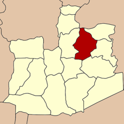
Coordinates: 14°27′51″N 100°36′20″E / 14.46417°N 100.60556°ECoordinates: 14°27′51″N 100°36′20″E / 14.46417°N 100.60556°E Country  Thailand
Province Ayutthaya Seat Nakhon Luang Area – Total 198.917 km2 (76.8 sq mi) Population (2009) – Total 35,713 – Density 166.9/km2 (432.3/sq mi) Time zone THA (UTC+7) Postal code 13260 Geocode 1403 Nakhon Luang (Thai: นครหลวง; IPA: [náʔkʰɔ̄ːn lǔaŋ]) is a district (amphoe) in the northeastern part of Ayutthaya Province, central Thailand.
Contents
History
The district was originally part of Nakhon Luang Noi district (now named Bang Pahan), and was established as a separate district in 1895.
In 1903 the district office was moved into Nakhon Luang subdistrict, and therefore the district was renamed from Nakhon Klang to Nakhon Luang.[1]
Geography
Neighboring districts are (from the north clockwise) Don Phut of Saraburi Province, Tha Ruea, Phachi, Uthai, Phra Nakhon Si Ayutthaya and Bang Pahan of Ayutthaya Province.
Administration
The district is subdivided into 12 subdistricts (tambon), which are further subdivided into 74 villages (muban). There are two subdistrict municipalities (thesaban tambon)in the district - Nakhon Luang covers the subdistricts Nakhon Luang and parts of Bang Rakam and Bang Phra Khru; Aranyik (อรัญญิก) the subdistricts Tha Chang, Sam Thai and Phra Non. There are further 6 Tambon administrative organizations (TAO), for each tambon except the two completely covered by the municipalities, except Mae La which includes the non-municipal parts of Bang Rakam and Bang Phra Khru subdistrict.
No. Name Thai Villages Inh.[2] 1. Nakhon Luang นครหลวง 9 4,680 2. Tha Chang ท่าช้าง 8 4,551 3. Bo Phong บ่อโพง 7 4,912 4. Ban Chung บ้านชุ้ง 7 3,581 5. Pak Chan ปากจั่น 6 3,276 6. Bang Rakam บางระกำ 6 2,742 7. Bang Phra Khru บางพระครู 4 2,138 8. Mae La แม่ลา 6 2,022 9. Nong Pling หนองปลิง 5 2,121 10. Khlong Sakae คลองสะแก 5 2,319 11. Sam Thai สามไถ 4 1,282 12. Phra Non พระนอน 7 2,089 References
- ^ "แจ้งความกระทรวงมหาดไทย เรื่อง เปลี่ยนนามอำเภอนครกลาง เป็นอำเภอนครหลวง" (in Thai). Royal Gazette 20 (22): 352–353. 1903-08-30. http://www.ratchakitcha.soc.go.th/DATA/PDF/2446/022/352_2.PDF.
- ^ "Population statistics 2009". Department of Provincial Administration. http://www.dopa.go.th/xstat/p5214_01.html.
External links
- amphoe.com (Thai)
Phra Nakhon Si Ayutthaya · Tha Ruea · Nakhon Luang · Bang Sai · Bang Ban · Bang Pa-in · Bang Pahan · Phak Hai · Phachi · Lat Bua Luang · Wang Noi · Sena · Bang Sai · Uthai · Maha Rat · Ban Phraek
Categories:- Amphoe of Ayutthaya
- Central Thailand geography stubs

Wikimedia Foundation. 2010.