- Mueang Nakhon Ratchasima District
-
Mueang Nakhon Ratchasima
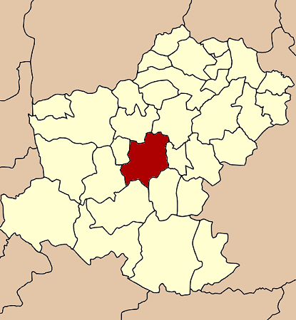
อำเภอเมืองนครราชสีมา— Amphoe — Amphoe location in Nakhon Ratchasima Province
Coordinates: 14°58′16″N 102°5′59″E / 14.97111°N 102.09972°ECoordinates: 14°58′16″N 102°5′59″E / 14.97111°N 102.09972°E Country  Thailand
Province Nakhon Ratchasima - Established AD.1895 - Tambon 25 - Muban 243 - Local Admin. 9 Municipality,18 SAO. Government - District Chief Officer Samarn Wongvanayuth Area - Total 755.6 km2 (291.7 sq mi) Population (2009 (p1)) - Total 454,647 - Density 601/km2 (1,556.6/sq mi) Time zone THA (UTC+7) Postal code 30000, 30280, 30310 Geocode 3001 Mueang Nakhon Ratchasima (Thai: อำเภอเมืองนครราชสีมา) (amphoe mueang) is one of 32 districts of Nakhon Ratchasima Province, Northeastern Thailand. Including the center city of district is City of Nakhon Ratchasima.
Contents
Introduction
Mueang Nakhon Ratchasima is an ancient city. The present city was built in the reign of King Narai the Great of Ayutthaya kingdom. The king merged the two ancient cities, Mueang Sema and Mueang Khorakha Pura (Khorat) and moved to the present area. He named the new city Nakhon Ratchasima and set it as the eastern frontier city of Ayutthaya. The landscape and city planning of Nakhon Ratchasima city designed by French architect.
The city of various Khmer ruins and the famous statute of Khun Ying Mo named Nakhon Ratchasima or commonly known as "Khorat" is situated on Khorat plateau, the lower part of Northeastern plateau of Thailand. The city itself serves as the gateway to the Northeastern Region. From Bangkok, it is 259 km. by car and 264 km by train. It has and area 755.60 km² or about 468,704 rai (185,311 acre) with residential registration population 433,838 inhabitants(2008 census).[1]
Geography
Neighboring districts are (from the north clockwise) Non Thai, Non Sung, Chaloem Phra Kiat, Chok Chai, Pak Thong Chai, Sung Noen and Kham Thale So.
The main river through the district is the Lam Takhong.
Transportation
Car
Travelling by car from Bangkok to Nakhon Ratchasima is most convenient, there are three alternative routes to choose depending on the starting point in Bangkok.
- First route Phahonyothin Road (Route 1) passing Don Muang Airport, Wang Noi, till arriving Saraburi. At Saraburi, turns right along Mittraphap Road (Route 2) which finally leads to Nakhon Ratchasima. The total distance of this route is 256 km.
- Second route Ram Inthra Road (Route 304) via Min Buri, Chachoengsao, Phanom Sarakham, Kabin Buri, Pak Thong Chai and finally Nakhon Ratchasima. The total distance is 273 km. This alternative route is a little longer in distance but interesting towns and cities passing is a worth compensation.
- Third route Rangsit-Nakhon Nayok Road (Route 305) passing Thanyaburi, Ongkharak to Nakhon Nayok. From Nakhon Nayok, take Suwannason Road 33 to Kabin Buri and turn left along Kabin Buri-Nakhon Ratchasima Road (Route 304) passing Pak Thong Chai to Nakhon Ratchasima.
Bus
There are several air-conditioned (Coach Standard-1 and 2) buses leaving from the Northeastern Bus Terminal (Kampaeng Phet 2 Road) to Nakhon Ratchasima Bus Terminal 1 (Burin Rd.) and 2 (Mittraphap Rd.) with 3 service agencies; Air Korat Pattana, Ratchasima Tour and Suranaree Air. Air-conditioned buses leave every 20 minutes throughout 24 hours.
Train
There are several trains leaving Bangkok Railway Station (Hua Lampong) daily to the two major train stations (Nakhon Ratchasima And Thanon Chira train stations) in the city.
Administration
The district is subdivided into 25 subdistricts (tambon) with 27 local administration.[2]
There are contains 10 municipalities, which 1 city municipality (thesaban nakhon) - City of Nakhon Ratchasima or Korat City covers the whole area of Nai Mueang subdistrict (tambon) and parts of Ban koh subdistrict, the 9 township municipalities (thesaban tambon) - Pho Klang covers whole area of Pho Klang subdistrict, Hua Thale covers whole area of Hua Tale subdistrict, Nong Phai Lom covers whole area of Nong Phai Lom subdistrict, Cho Ho covers parts of Cho Ho subdistricts and parts of Ban Koh subdistrict, Khok Sung covers whole area of Khok Sung subdsitrict, Paru Yai covers whole area of Paru Yai subdistrict, Khok Kruat & Mueang Mai Khok Kruat covers of Khok Kruat subdistrict, Nong Khai Nam covers whole area of Nong Khai Nam subdistrict.
Local Admin. Unit Type Subdistricts Population
(2010 census)Area
(km²)Distance To
District Office(km.)Pop.density
(inh. per km²)House Hold
(unit)1. City of Nakhon Ratchasima Municipality Nai Mueang, Ban Koh 141,714 37.50 1.3 3,779 61,184 2. Pho Klang Municipality Pho Klang 25,632 55.23 8.5 464 10,121 3. Hua Thale Municipality Hua Thale 24,587 15.59 8 1,577 10,404 4. Nong Phai Lom Municipality Nong Phai Lom 19,744 17.89 3 1,104 10,285 5. Cho Ho Municipality Cho Ho, Ban Koh 15,239 9.50 8 1,604 7,428 6. Mueang Mai Khok Kruat Municipality Khok Kruat 12,576 64.17 13 193 4,671 7. Khok Sung Municipality Khok Sung 9,758 30.56 15 302 3,098 8. Paru Yai Municipality Paru Yai 9,365 16.63 11 601 3,939 9. Khok Kruat Municipality Khok Kruat 7,160 3.00 18 2,387 2,951 10. Nong Khai Nam Municipality Nong Khai Nam 5,835 43.44 19 134 1,434 And 17 Subdistrict Administrative Organization (SAO) - Ban Koh, Ban Mai, Ban Pho, Chai Mongkhon, Cho Ho, Maroeng, Muen Wai, Nong Bua Sala, Nong Chabok, Nong Krathum, Nong Rawiang, Phanao, Phon Krang, Putsa, Si Num, Suranaree and Talat responsible for the non-municipal areas.[3]
Local Admin. Unit Type Subdistricts Population
(2010 census)Area
(km²)Distance To
District Office(km.)Pop.density
(inh. per km²)House Hold
(unit)1. Ban Mai SAO Ban Mai 17,544 19.55 8 897 5,934 2. Nong Bua Sala SAO Nong Bua Sala 17,155 36.61 10 468 9,177 3. Suranaree SAO Suranaree 16,070 49.90 15 322 7,299 4. Cho Ho SAO Cho Ho 12,447 26.97 12.5 462 4,403 5. Nong Chabok SAO Nong Chabok 11,637 23.56 7 494 4,643 6. Nong Rawiang SAO Nong Rawiang 10,828 54.77 16 199 3,287 7. Ban Koh SAO Ban Koh 10,715 11.30 6 948 4,932 8. Muen Wai SAO Muen Wai 10,077 9.76 5 1,032 4,489 9. Putsa SAO Putsa 9,512 39.46 11 241 2,655 10. Ban Pho SAO Ban Pho 8,931 44.36 18 201 3,096 11. Maroeng SAO Maroeng 7,063 10.25 10.5 689 2,239 12. Nong Krathum SAO Nong Krathum 6,957 18.50 8 376 2,978 13. Chai Mongkhon SAO Chai Mongkhon 6,738 60.18 18 112 2,645 14. Si Mum SAO Si Mum 6,301 15.0 15 420 1,812 15. Tatat SAO Talat 6,187 22.20 15 279 2,448 16. Phanao SAO Phanao 4,872 18.16 9 268.28 1,407 17. Phon Krang SAO Phon Krang 4,796 18.65 17 257 1,103 References
- ^ Introduction to Korat
- ^ 2008 Statistic Data Center, Department of Provincial Administration, The Ministry of Interior
- ^ The Local Administration Data Center, Department of Local Administration, The Ministry of Interior
External links
Mueang Nakhon Ratchasima · Khon Buri · Soeng Sang · Khong · Ban Lueam · Chakkarat · Chok Chai · Dan Khun Thot · Non Thai · Non Sung · Kham Sakaesaeng · Bua Yai · Prathai · Pak Thong Chai · Phimai · Huai Thalaeng · Chum Phuang · Sung Noen · Kham Thale So · Sikhio · Pak Chong · Nong Bun Mak · Kaeng Sanam Nang · Non Daeng · Wang Nam Khiao · Thepharak · Mueang Yang · Phra Thong Kham · Lam Thamenchai · Bua Lai · Sida · Chaloem Phra Kiat
Categories:- Nakhon Ratchasima
- Amphoe of Nakhon Ratchasima
Wikimedia Foundation. 2010.