- Mueang Sa Kaeo District
-
Mueang Sa Kaeo
เมืองสระแก้ว— Amphoe — Amphoe location in Sa Kaeo Province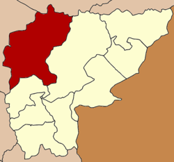
Coordinates: 13°48′53″N 102°4′19″E / 13.81472°N 102.07194°ECoordinates: 13°48′53″N 102°4′19″E / 13.81472°N 102.07194°E Country  Thailand
Province Sa Kaeo Seat Tambon Muban Amphoe established Area - Total 1,832.034 km2 (707.4 sq mi) Population (2008) - Total 107,092 - Density 58.0/km2 (150.2/sq mi) Time zone THA (UTC+7) Postal code 27000 Geocode 2701 Amphoe Mueang Sa Kaeo (Thai: เมืองสระแก้ว) is the capital district (Amphoe Mueang) of Sa Kaeo Province, eastern Thailand.
Contents
Geography
Neighboring districts are (from the north clockwise) Khon Buri of Nakhon Ratchasima Province, Watthana Nakhon and Khao Chakan of Sa Kaeo, and Kabin Buri and Na Di of Prachinburi Province.
The Sankambeng Range mountainous area is located in the northern section of this district, within its forested hills at the boundary between Sa Kaeo and Prachinburi Province is the Pang Sida National Park.
History
1909 the minor district (King Amphoe) Sa Kaeo was established as a subordinate of Kabinburi district. It was upgraded to a full district on July 23 1958.[1] When in 1993 the new province Sa Kaeo was created, the district became the capital district of the province and was therefore renamed to Mueang Sa Kaeo.[2]
Administration
The district is subdivided into 8 subdistricts (tambon), which are further subdivided into 124 villages (muban). Sa Kaeo itself has town status (thesaban mueang) and covers parts of the tambon Sa Kaeo and Tha Kasem. There are also two subdistrict municipalities (thesaban tambon) - Tha Kasem and Sala Lamduan both covering parts of the same-named tambon. There are further 8 Tambon administrative organizations (TAO).
No. Name Thai Villages Inh. 1. Sa Kaeo สระแก้ว 18 19,432 2. Ban Kaeng บ้านแก้ง 15 13,115 3. Sala Lamduan ศาลาลำดวน 15 12,736 4. Khok Pi Khong โคกปี่ฆ้อง 18 12,496 5. Tha Yaek ท่าแยก 14 12,345 6. Tha Kasem ท่าเกษม 12 13,412 8. Sa Khwan สระขวัญ 20 16,456 11. Nong Bon หนองบอน 12 7,100 Missing numbers are tambon now forming Khao Chakan district.
References
- ^ "พระราชกฤษฎีกาจัดตั้งอำเภอกระสัง อำเภอกระนวน อำเภอบางกอกใหญ่ อำเภอขุนหาร อำเภอพนา อำเภอปากช่อง อำเภอวังเหนือ อำเภอวังชิ้น อำเภอแม่ทา อำเภอหนองหมู อำเภอสระแก้ว อำเภออมก๋อย อำเภอบางซ้าย อำเภอทับสะแก อำเภอบุณฑริก อำเภอลานสะกา อำเภอจอมบึง อำเภอท่ายาง อำเภอสามเงา อำเภอฟากท่า อำเภอบ้านเขว้า อำเภอชานุมาน อำเภอแม่พริก อำเภอท่าสองยาง อำเภอสะเมิง อำเภอหนองแขม อำเภอพระแสง พ.ศ. ๒๕๐๑" (in Thai). Royal Gazette 75 (55 ก): 321–327. 1958-07-22. http://www.ratchakitcha.soc.go.th/DATA/PDF/2501/A/055/321.PDF.
- ^ "พระราชบัญญัติตั้งจังหวัดสระแก้ว พ.ศ. ๒๕๓๖" (in Thai). Royal Gazette 110 (125 ก ฉบับพิเศษ): 1–3. 1993-09-02. http://www.ratchakitcha.soc.go.th/DATA/PDF/2536/A/125/1.PDF.
External links
- amphoe.com (Thai)
Mueang Sa Kaeo · Khlong Hat · Ta Phraya · Wang Nam Yen · Watthana Nakhon · Aranyaprathet · Khao Chakan · Khok Sung · Wang SombunCategories:- Amphoe of Sa Kaeo

Wikimedia Foundation. 2010.