- Litchfield Municipality
-
Litchfield Municipality
Northern Territory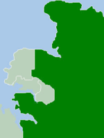
Population: 18,847(2009)[1] Established: 1985 Area: 2914.3 km² (1,125.2 sq mi) Mayor: Mary Walshe Council Seat: Bees Creek Region: Outer Metropolitan Darwin Federal Division: LGAs around Litchfield Municipality: Darwin
PalmerstonVan Diemen Gulf Wagait Litchfield Municipality Coomalie The Litchfield Municipality is a Local Government Area located in the Northern Territory of Australia on the eastern and southeastern outskirts of the Darwin-Palmerston urban area. The municipality covers an area of 2,914.3 square kilometres (1,125.2 sq mi), and was created by the Northern Territory government on 6 September 1985.
Contents
History
The original inhabitants of the Litchfield area were the Larakia, Woolner and Djowei Aboriginal people. The arrival of European settlers dates from 1864. Litchfield is named after Frederick Henry Litchfield who with William Patrick Auld was a member of an early survey and settlement party and who explored areas of the Northern Territory from Escape Cliffs on the Timor Sea to the Daly River. Some growth took place during the 1870s and 1880s, after the construction of the Overland Telegraph Line. There was more substantial growth during the post-war years, especially during the 1970s.
The Litchfield Shire was proclaimed by an Act of the NT Parliament on 6 September 1985. On 7 December 1985 an election was held to elect the first Council composed of a Shire President and four Councillors each representing a ward - North, South, East and Central.
This first elected body formulated a series of objectives under which Council was to operate. The objectives were based upon the provision of services in what is traditionally known as the 3R's ( Roads, Rubbish and Recreation) and on the principle of contracting out the provision of these services. The level of services under these functions were to be commensurate with a philosophy of low rates.
In 2008 Litchfield Shire became a Municipality under the new Local Government Act 2008, which saw changes in the structure of Local Government across the Northern Territory.
On 1 July 2008 Litchfield Councils responsibilities also included management of the Thorak Regional Cemetery.
Geography
 Litchfield Municipality.
The Litchfield Municipality is bounded by the Adelaide River to the east, Van Diemen Gulf and the Coomalie Community Government Council in the south and the City of Darwin and City of Palmerston to the northwest. The Stuart and Arnhem Highways run through the Litchfield Municipality. Most of the Municipality is rural or rural-residential in character.
Localities
Localities within the boundary of the Municipality include[2]:
Outer Darwin Western Rural Eastern Rural - Berry Springs
- Blackmore*
- Channel Island
- Darwin River
- Fly Creek
- Livingstone
- Southport
- Tumbling Waters
- Weddell#
- Wickham
- Acacia Hills
- Black Jungle
- Gunn Point#
- Herbert
- Hughes
- Lambells Lagoon
- Lloyd Creek
- Manton
- Middle Point
- Murrumujuk*
- Daly
- Glyde Point#
- Koolpinyah#
- Shoal Bay#
- Wak Wak#
* amended localities
# newly created localitiesPopulation
Year Population 1986 7,410 1991 9,746 1996 13,858 2001 16,086 2006 17,461 Council Presidents
- John Maley (1985–1996)
- Gerry Wood (1996–2001)
- Mary Walshe (2001–2009)
References
- ^ Australian Bureau of Statistics (30 March 2010). "Regional Population Growth, Australia, 2008–09". http://www.abs.gov.au/ausstats/abs@.nsf/Latestproducts/3218.0Main%20Features102008-09?opendocument&tabname=Summary&prodno=3218.0&issue=2008-09&num=&view=. Retrieved 4 June 2010.
- ^ http://nt.gov.au/placenames/localities/litchfield/index.shtml
External links
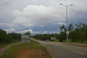
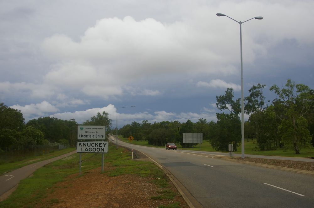
Suburbs and Towns of the Litchfield Municipality | Northern Territory Outer Darwin: Bees Creek · Coolalinga · Freds Pass · Girraween · Holtze · Howard Springs · Humpty Doo · Knuckey Lagoon · McMinns Lagoon · Noonamah · Virginia
Mickett CreekWestern Rural: Berry Springs · Blackmore · Channel Island · Darwin River · Fly Creek · Livingstone · Southport · Tumbling Waters · Weddell · Wickham ·Eastern Rural: Acacia Hills · Black Jungle · Gunn Point · Herbert · Hughes · Lambells Lagoon · Lloyd Creek · Manton · Middle Point · Murrumujuk · Daly · Glyde Point · Koolpinyah · Shoal Bay · Wak Wak
Local Government Areas of the Northern Territory Darwin Region Belyuen · Coomalie · Darwin · Darwin Rates Act Area · Litchfield · Palmerston · Tiwi Islands · Unincorporated Top End Region · WagaitKatherine Region Katherine · Victoria Daly · Roper GulfArnhem Land Barkly Tableland Central Australia Coordinates: 12°25′36″S 131°02′27″E / 12.4266°S 131.0409°E
Categories:- Populated places established in 1985
- 1985 establishments in Australia
- Local Government Areas of the Northern Territory
- Northern Territory geography stubs

Wikimedia Foundation. 2010.