- Coolalinga, Northern Territory
-
Coolalinga
Darwin, Northern Territory
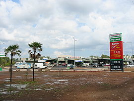
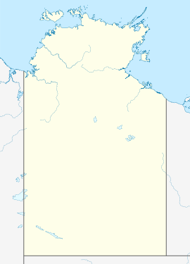
Coolalinga shopsPostcode: 0835 Location: - 29.9 km (19 mi) from Darwin
- 10 km (6 mi) from Palmerston
LGA: Litchfield Municipality Suburbs around Coolalinga: Virginia Howard Springs Girraween Virginia Coolalinga Girraween Bees Creek Humpty Doo Humpty Doo Coolalinga is an outer suburban area in Darwin. It is 29km South-east of Darwin. Its Local Government Area is the Litchfield Municipality. The name derives it name used by Len Cant for his Store and Caravan park on the Stuart Highway. Since Coolalinga Store, the area has become an important commercial centre for the Shire.
External links
 Media related to Coolalinga, Northern Territory at Wikimedia Commons
Coordinates: 12°31′27″S 131°02′32″E / 12.524085°S 131.042105°E
Suburbs and Towns of the Litchfield Municipality | Northern Territory Outer Darwin: Bees Creek · Coolalinga · Freds Pass · Girraween · Holtze · Howard Springs · Humpty Doo · Knuckey Lagoon · McMinns Lagoon · Noonamah · Virginia
Mickett CreekWestern Rural: Berry Springs · Blackmore · Channel Island · Darwin River · Fly Creek · Livingstone · Southport · Tumbling Waters · Weddell · Wickham ·Eastern Rural: Acacia Hills · Black Jungle · Gunn Point · Herbert · Hughes · Lambells Lagoon · Lloyd Creek · Manton · Middle Point · Murrumujuk · Daly · Glyde Point · Koolpinyah · Shoal Bay · Wak Wak
Categories:- Suburbs of Darwin
Wikimedia Foundation. 2010.

