- Coomalie
Infobox Australian Place | type = lga
name = Coomalie Community Government Council
state = nt

imagesize= 150
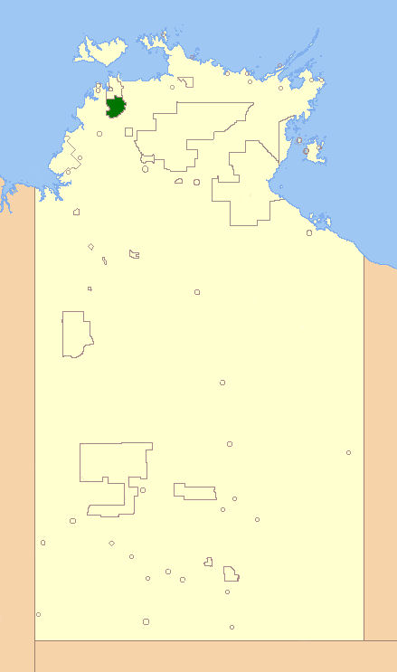
caption = Location of the Commalie Government Council
pop = 1,643 cite web
publisher =lgant
title=Local government association of the Northern Territory
url = http://www.lgant.nt.gov.au/lgant/content/view/full/482
accessdate = 2007-04-17 ]
area = 1500
est = 1990
seat =
mayor =Wendy Leach
region = outer Darwin
logosize =
url = http://www.coomalie.nt.gov.au/
stategov =
fedgov = Solomon
near-nw =
near-n = Litchfield
near-ne =
near-e =
near-w =
near-sw =
near-s =
near-se = The Coomalie Community Government Council is a Local Government Area in theNorthern Territory , situated south of Darwin and Palmerston. The council governs an area of 1,500km² and has a population of about 1,643.History
Coomalie Community Government Council was established on
December 7th ,1990 and its first elections were held in 1997. OnJuly 1st ,2008 , Coomalie Council became one of the 11 Shire councils in the territory, changed by theNorthern Territory Government .Wards
The council is divided up into six wards, which is governed by 9 councillors across the six wards:
* Batchelor Township Ward (3) (Batchelor)
* Adelaide River Township Ward (2) (Adelaide River)
* Batchelor Rural Ward (1)
* Adelaide River Rural Ward (1)
* Lake Bennett Ward (1) (Lake Bennett )
* Coomalie/Tortilla Ward (1)Townships
The Council area includes the localities of
* Batchelor
* Adelaide River.The boundary of this area extends from the
Manton Dam in the north, to the town of Adelaide River in the south and east from theAdelaide River , to theLitchfield National Park in the west.Meetings
Meetings are scheduled for the 3rd Tuesday of every month.
ee also
*
Local Government Areas of the Northern Territory References
External links
* [http://www.lgworks.net.au/council/Coomalie LGWORKS: Coomalie Community Government Council ]
Wikimedia Foundation. 2010.
