- Mueang Surat Thani District
-
Mueang Surat Thani
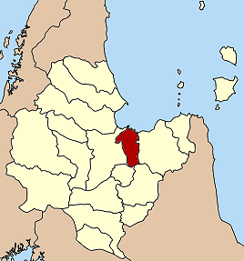
เมืองสุราษฎร์ธานี— Amphoe — Amphoe location in Surat Thani Province
Coordinates: 9°8′11″N 99°19′13″E / 9.13639°N 99.32028°ECoordinates: 9°8′11″N 99°19′13″E / 9.13639°N 99.32028°E Country  Thailand
Province Surat Thani Seat Talat Area - Total 233.8 km2 (90.3 sq mi) Population (2004) - Total 166,891 - Density 713.8/km2 (1,848.7/sq mi) Time zone THA (UTC+7) Postal code 84100 Geocode 8401 Mueang Surat Thani (Thai: เมืองสุราษฎร์ธานี) is the capital district (Amphoe Mueang) of Surat Thani Province in southern Thailand.
Contents
Geography
The district is located at the mouth of the Tapi River into the Bandon Bay of the Gulf of Thailand. Neighboring districts are (from the east clockwise) Kanchanadit, Ban Na San, Ban Na Doem and Phunphin.
To the east of the district the Thathong River marks the natural boundary to Kanchanadit, while the boundary to Phunphin is partially marked by the western arm of the Tapi river. The Khun Thale is a small lake located in the center of the district. The Khao Tha Phet non-hunting area protects 4.65 km² of a hill south of the city Surat Thani.
The Khun Thale swamp to the south of the district is the source of two short minor rivers which meander through the city, Khlong Makham Tia and Khlong Tha Kup.
History
The district was formed when in 1897 Mueang Chaiya and Kanchanadit were merged into a single province named Chaiya, with its administrative center located at Ban Don, with the district named Ban Don (บ้านดอน) accordingly. In 1915 the province was renamed to Surat Thani. In 1938 the district was renamed to Mueang Surat Thani, when all capital districts were named according to the corresponding province name.[1]
Administration
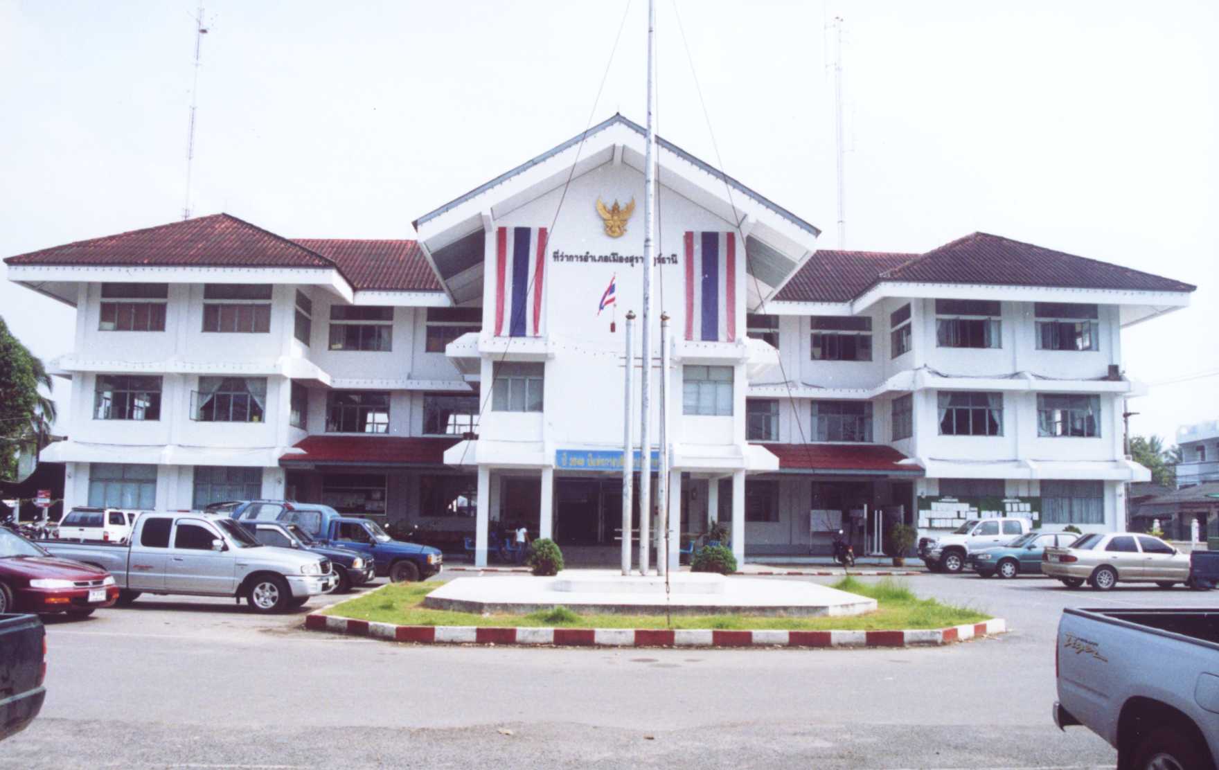
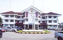 District office of Mueang Surat Thani
The district is subdivided into 11 subdistricts (tambon), which are further subdivided into 60 villages (muban). Surat Thani itself is a city (thesaban nakhon) and covers the tambon Talad and Bang Kung, and parts of the tambon Khlong Chanak, Bang Chana, Bang Bai Mai and Makham Tia. Wat Pradu has township (thesaban tambon) status. There are also 9 tambon administrative organizations (TAO), for each tambon except the two completely covered by the city.
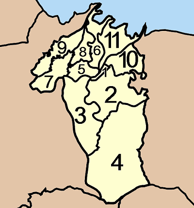
No. Name Thai name Villages Inh. 1. Talat ตลาด - 33,778 2. Makham Tia มะขามเตี้ย 8 64,569 3. Wat Pradu วัดประดู่ 10 11,750 4. Khun Thale ขุนทะเล 10 12,888 5. Bang Bai Mai บางใบไม้ 5 2,802 6. Bang Chana บางชนะ 6 3,610 8. Bang Sai บางไทร 4 2,016 7. Khlong Noi คลองน้อย 9 2,003 9. Bang Pho บางโพธิ์ 5 23,806 10. Bang Kung บางกุ้ง 5 4,680 11. Khlong Chanak คลองฉนาก 8 9,511 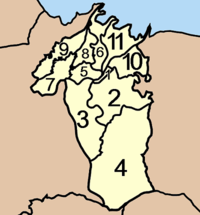
References
- ^ "พระราชกฤษฎีกาเปลี่ยนนามจังหวัด และอำเภอบางแห่ง พุทธศักราช ๒๔๘๑" (in Thai) (PDF). Royal Gazette 55 (0 ก): 658. November 14 1938. http://www.ratchakitcha.soc.go.th/DATA/PDF/2481/A/658.PDF.
External links
Mueang Surat Thani · Kanchanadit · Don Sak · Ko Samui · Ko Pha Ngan · Chaiya · Tha Chana · Khiri Rat Nikhom · Ban Ta Khun · Phanom · Tha Chang · Ban Na San · Ban Na Doem · Khian Sa · Wiang Sa · Phrasaeng · Phunphin · Chai Buri · Vibhavadi
Categories:- Surat Thani
- Amphoe of Surat Thani
Wikimedia Foundation. 2010.