- Chaiya District
-
This article is about the district. For the town, see Talad Chaiya. For the film, see Muay Thai Chaiya.
Chaiya
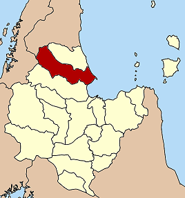
ไชยา— Amphoe — Amphoe location in Surat Thani Province
Coordinates: 9°23′12″N 99°12′0″E / 9.38667°N 99.2°ECoordinates: 9°23′12″N 99°12′0″E / 9.38667°N 99.2°E Country  Thailand
Province Surat Thani Seat Talad Chaiya Tambon Muban Amphoe established Area - Total 1,004.63 km2 (387.9 sq mi) Population (2007) - Total 47,750 - Density 47.52/km2 (123.1/sq mi) Time zone THA (UTC+7) Postal code 84110 Geocode 8406 Chaiya (Thai: ไชยา) is a district (Amphoe) and town in Surat Thani Province in southern Thailand. The town itself has a population of 13,133 (5,549 in Talad Chaiya and 7,582 in Phumriang) (2006), while the whole district has a population of 47,750.
Contents
Geography
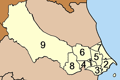
Neighboring districts are (from the south clockwise) Tha Chang, Kapoe (Ranong Province), Phato (Chumphon Province), and Tha Chana. To the east is the Gulf of Thailand, with the cape Sui marking the northern end of the Bandon Bay.
The eastern part of the district consists of mostly flat low coastal areas, while to the west are the mountains of the Phuket mountain range, including the Kaeng Krung National Park.
History
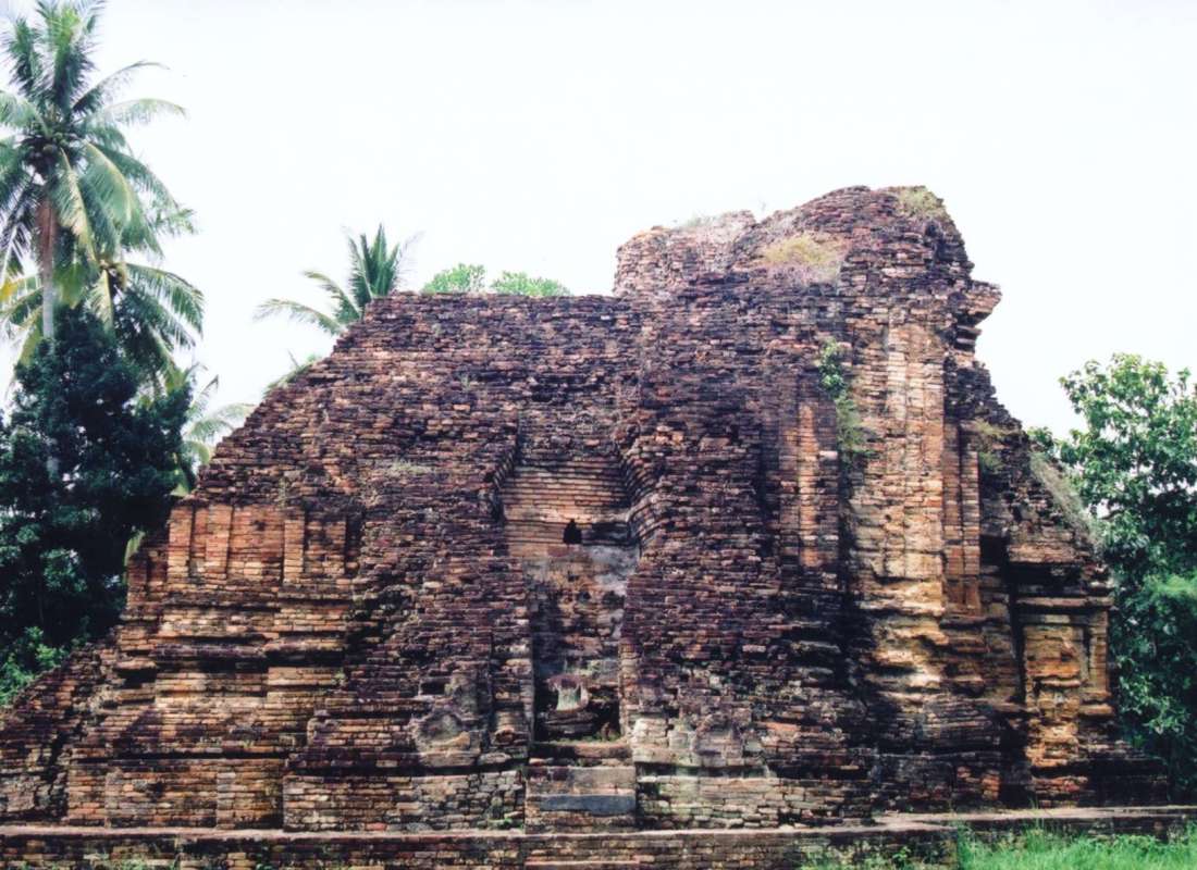
 Wat Phra Borom That
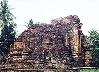
Chaiya is one of the oldest cities of Thailand. The name might be derived from its original Malay name "Cahaya" (means 'light', 'gleam', or 'glow'). However some scholars identify Chai-ya came from Sri-vi-ja-ya. It was a regional capital in the Srivijaya kingdom of the 5th to 13th century - some historians even claim that it was the capital for the kingdom for some time, but this is largely disputed. The temple Wat Phra Borom That is centered around a reconstructed stupa in Srivijaya style. The nearby branch of the National Museum has several relicts of that time on display. Two more former stupas nearby are now only brick mounds. Inscription 23, as it was labeled by Prince Damrong in his Collected Inscriptions of Siam, is now attributed to Wat Hua Wiang in Chaiya. Dated to the year 697 of the Mahasakkarat era (i.e. 775 CE), the inscription on a Bai Sema shaped stone tells about the King of Srivijaya having erected three stupas at that site that possibly the one at Wat Phra Borom That. But also be assumed as three stupas at Wat Hua Wiang (Hua Wiang temple), Wat Lhong (Lhong temple) and Wat Kaew (Kaew temple) found in the area of Chaiya ancient city, stand in the direction from north to south on the old sand dune.
Another important temple near Chaiya is the Wat Suan Mohkha Phalaram (also known by the short name Suan Mok, or Wat Than Nam Lai Monastery of Flowing Water), a forest temple. The temple was founded in 1932 by Phra Buddhadasa (1906-1993), a highly revered Buddhist teacher. In 1959 the temple was relocated to the present 150 acre (0.6 km²) site. These temples were believed to be used to store rice in large quantities, this was due to the invading Japanese at that time. These large Buddhist Rice temples are vary rare in the region and only one has be officially labeled as a rice storage tempels.Traffic
Chaiya is on the southern railway line, Chaiya Railway Station is the main railway station of the district; the Asian highway AH2 (Thailand Route 41) also passes the city.
Administration
The district Chaiya is subdivided into 9 subdistricts (tambon). These are further subdivided into 54 villages (muban). There are two townships (thesaban tambon) - Talad Chaiya covers most of tambon Talad Chaiya and parts of Lamet; Phumriang the whole tambon Phumriang.

No. Name Thai name Villages Inh. 1. Talat Chaiya ตลาดไชยา 5 5,549 6. Pa We ป่าเว 6 4,887 2. Phumriang พุมเรียง 5 7,582 7. Takrop ตะกรบ 5 3,649 3. Lamet เลม็ด 7 4,582 8. Mo Thai โมถ่าย 6 4,215 4. Wiang เวียง 5 3,365 9. Pak Mak ปากหมาก 7 8,975 5. Thung ทุ่ง 8 4,946 External links
- Chaiya National Museum
- Suan Mokkh - The garden of liberation
- Chaiya City Website
- Chaiya Witthaya School
Mueang Surat Thani · Kanchanadit · Don Sak · Ko Samui · Ko Pha Ngan · Chaiya · Tha Chana · Khiri Rat Nikhom · Ban Ta Khun · Phanom · Tha Chang · Ban Na San · Ban Na Doem · Khian Sa · Wiang Sa · Phrasaeng · Phunphin · Chai Buri · Vibhavadi
Categories:- Amphoe of Surat Thani
Wikimedia Foundation. 2010.