- Moutohora Island
-
Moutohora Island, Whale Island Moutohorā (Māori) 
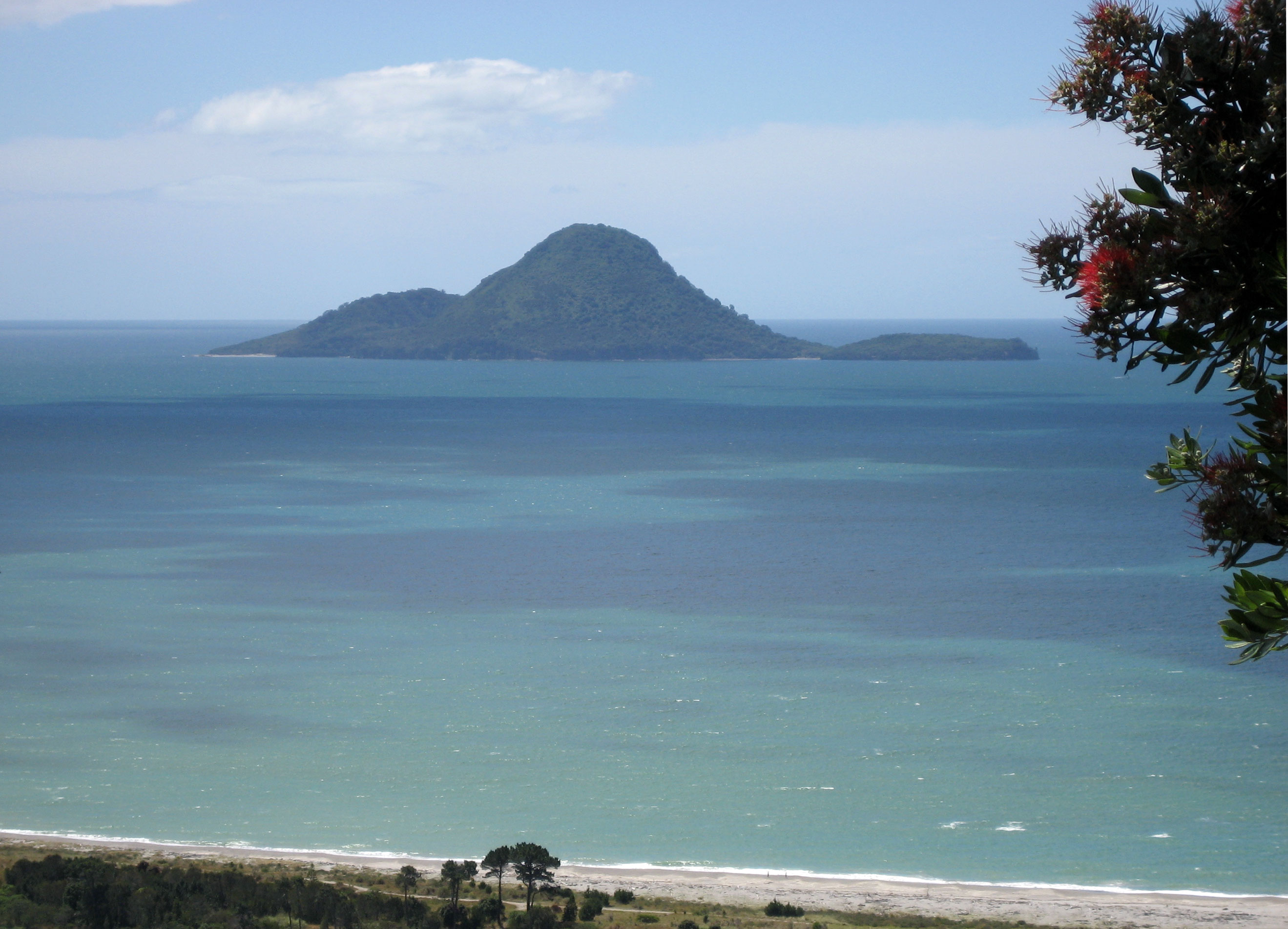
Moutohora Island seen from the south.Elevation 354 m (1,161 ft) Prominence 354 m (1,161 ft) Location Location Bay of Plenty, North Island, New Zealand Coordinates 37°51′S 176°59′E / 37.85°S 176.983°E Geology Type Complex volcano Last eruption Pleistocene Moutohora Island or Whale Island (Moutohorā in Māori) is a small uninhabited island located off the Bay of Plenty coast of New Zealand's North Island, about 12 kilometres (7.5 mi) north of the town of Whakatane. The 1.43 km2 (0.55 sq mi) island is a remnant of a complex volcano which has eroded, leaving two peaks. This is still an area of volcanic activity and there are hot springs on the island in Sulphur Valley, McEwans Bay, and Sulphur Bay.
Contents
Name
The Māori name, Moutohorā, is a contracted form of Motutohorā, meaning "Whale Island". The spelling with the macron is increasingly used in English, although the official name of the island currently omits it.
History

Numerous archaeological sites of both Māori and European origin have been recorded, including an extensive pa (fortified earthworks) site on Pa Hill and a number of house terraces and garden sites, middens (food refuse dumps), stone tool manufacture areas and stone walls. After permanent Maori occupation ceased in the early nineteenth century, Ngāti Awa and Tūhoe continued to visit the island for sea food and mutton birds and to collect stones for hāngi (underground ovens).
The first European occupation came in the 1830s with an unsuccessful attempt to establish a shore-based whaling station. The venture failed without a single whale being captured. Forty years later came attempts to make money from sulphur. It was extracted and sold to a refinery in Auckland over a number of years but was of poor quality, and the venture was abandoned in 1895. The next phase of industrial activity came in 1915, when quarrying provided rock for the construction of the Whakatane harbour wall. A total of 26,000 tonnes (25,589 long tons; 28,660 short tons) of rock was removed over five years.
Ecology
In 1965 Moutohorā was declared a wildlife refuge and the island was bought by the Crown in 1984. Once the goats which had been introduced to the island were eradicated, a planting programme began and 12,000 plants covering 45 species are now established. Today Moutohorā is covered with a mosaic of pōhutukawa, māhoe, kānuka, bracken and grassland.
There are 190 native and 110 introduced plant species. The island is now completely free of the goats, rats, cats and rabbits which previously devastated native plants and animals. The most significant feature of Moutohorā's current fauna is the breeding colony of grey-faced petrels. Sooty shearwaters, little blue penguins, the threatened New Zealand dotterel and variable oystercatchers also breed on the island. Threatened species which are occasional visitors are the Caspian tern, the North Island kaka and New Zealand falcon. Other species present include common forest birds, captive-bred red crowned parakeets, three lizard species and fur seals.
In March 1999 local Ngati Awa and the New Zealand Department of Conservation joined forces to see the fulfillment of a dream. Forty North Island saddleback (tieke) were transferred from Cuvier Island (Repanga), off the coast of the Coromandel Peninsula, to Moutohorā.
This relocation followed the traditional flight made centuries ago when the Mataatua waka (canoe) was accompanied by two tieke from Repanga to Whakatane. This flight followed the drowning of the twin sons of Muriwai, sister of Toroa, the captain of the waka. The two tieke settled briefly on Moutohorā before returning to Cuvier Island.
Access
Public access to Moutohorā is restricted to permit holders and approved tour parties and school groups. Permits must be obtained from the Department of Conservation office in Whakatane and during periods of high fire danger all access may be declined. Coastguard Whakatane holds a permit to conduct guided walks on each Sunday from the beginning of January until the end of March. The proceeds from the guided walks are a valuable contribution to the Coastguards funds.
Use in popular culture
Moutohorā is the home of a professional Quidditch team, the Moutohora Macaws, that operates within the fictional Harry Potter universe. The team players wear robes of red, yellow and blue.[1]
See also
References
- ^ Whisp, Kennilworthy (2001). Quidditch Through the Ages. WhizzHard Books. pp. 31–46. ISBN 1551924544.
Categories:- Uninhabited islands of New Zealand
- Volcanoes of New Zealand
- Bay of Plenty Region
- Complex volcanoes
- Pleistocene volcanoes
- Inactive volcanoes
- Whaling stations
- Whaling in New Zealand
- Archaeological sites in New Zealand

Wikimedia Foundation. 2010.