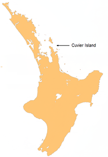
- Cuvier Island
-
Cuvier Island Repanga (Māori)
Location map of Cuvier Island.Geography Coordinates 36°26′S 175°46′E / 36.433°S 175.767°E Country Cuvier Island is a small island off the east coast of the North Island of New Zealand. It lies on the seaward end of the Colville Channel, 15 km (9.3 mi) north of the Mercury Islands and approximately 23 km (14 mi) south-east of Great Barrier Island. The island is a wildlife sanctuary, managed by the Department of Conservation and is the subject of an ongoing island restoration project to eliminate non-native mammals and restore the original ecosystem[1]. It is also the location of the Cuvier Island Lighthouse which was constructed in 1889.
Coordinates: 36°26′S 175°46′E / 36.433°S 175.767°E
See also
References
- ^ Cuvier Island restoration (from the Department of Conservation website)
External links
Categories:- Islands of New Zealand
- Island restoration
- Waikato Region geography stubs
Wikimedia Foundation. 2010.

