- Miranda do Douro Municipality
-
Miranda do Douro Miranda de l Douro Municipality (Concelho) 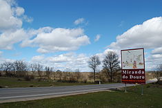 Welcome marker to the municipality of Mirando do Douro
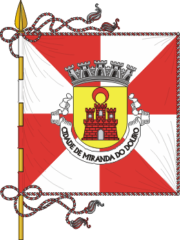
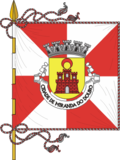 Flag
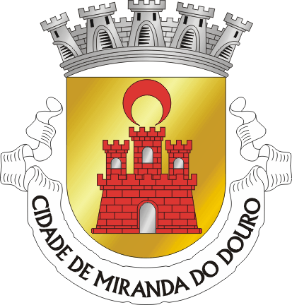
Flag Coat of arms
Official name: Concelho de Miranda do Douro Nickname: Cidade Museu (English: City Museum) Country  Portugal
Region Norte Subregion Alto Trás-os-Montes District Vila Real Municipality Miranda do Douro Civil Parishes Águas Vivas, Atenor, Barreiros, Cicouro, Constantim, Duas Igrejas, Genísio, Ifanes, Malhadas, Miranda do Douro, Palaçoulo, Paradela, Palancar, Pena Branca, Picote, Póvoa, São Martinho de Angueira, Sendim, Silva, Vale de Aguia, Vale de Mira, Vila Chã de Braciosa Center Miranda do Douro - elevation 752 m (2,467 ft) - coordinates 41°30′34″N 6°21′40″W / 41.50944°N 6.36111°W Length 37.38 km (23 mi), Southwest-Northeast Width 19.69 km (12 mi), Northwest-Southeast Area 487.18 km2 (188 sq mi) Population 7,707 (2001) Density 15.82 / km2 (41 / sq mi) LAU Concelho/Câmara Municipal - location Largo D. João III, Miranda do Douro, Miranda do Douro - elevation 649 m (2,129 ft) - coordinates 41°29′39″N 6°16′27″W / 41.49417°N 6.27417°W President Artur Manuel Rodrigues Nunes (PS) Municipal Chair Jacinta de Jesus Borrecho Raposo Fernandes (PS) Timezone WET (UTC0) - summer (DST) WEST (UTC+1) ISO 3166-2 code PT- Postal Zone 5210 - 190 Miranda do Douro Area Code & Prefix (+351) 273 XXX XXX Demonym Mirandês Patron Saint Santa Maria Maior Municipal Address Largo D. João III
5210 - 190 Miranda do DouroMunicipal Holidays 10 July 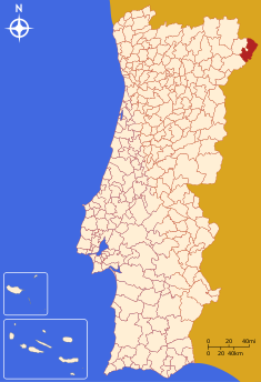 Location of the municipality of Miranda do Douro in continental Portugal
Wikimedia Commons: Miranda do Douro Website: http://www.cm-mdouro.pt/ Statistics from INE (2004); geographic detail from Instituto Geográfico Português (2010) Miranda do Douro is a municipality covering an area of 487.17 km², with a population of approximately 7,707 inhabitants in the northeast corner of Portugal. Referred to as the "Cidade Museu" of the Trás-os-Montes region, it is located 86 kilometres from the district capital, preserving many of its medieval and Renaissance-era traditions and architecture. Its seventeen civil parishes offer different facets of these traditions, that include a unique variant on the Portuguese language (Mirandês), in addition to cultural and historical discontinuity with the rest of the Portuguese state.
Contents
History
Around 716 A.D., the Moors defeated local Visigothic tribes, and occupied some of the lands, calling the area Mir-Hândul.[1]
By the late 11th century, Castile coveted the region as a stepping-stone to Portugal.[1] The settlement of the village of Miranda developed through the initiative of King Denis, in an area that lied between the lateral slopes of the Douro and Fresno Rivers. It was in Miranda that the Treaty of Alcanices was signed between Denis and Ferdinand IV of Castile, setting the border between the two kingdoms.[2] Miranda was founded on 18 December 1286, and immediately elevated to the status of vila (English: town), with one of its prerequistes declaring that the administrative division would be a Crown fief.[2] From this period forward, Miranda became progressively one of the most important towns that skirted the Trás-os-Montes region.[2]
The Castilians finally occupied Miranda do Douro during the late 14th century, and would remain there until they were expelled by John I of Portugal.[1]
On 10 July 1545, King John III elevated Miranda do Douro to the status of city, at the same time becoming the first diocese in Trás-os-Montes (in a papal bull on 22 May 1545 by Pope Paul III, which segmented a major part of the archdiocese of Braga.[2] Miranda, therefore, became the capital of the Trás-os-Montes, seat of the bishopric (that included the residence of the bishop, canons and ecclesiastical authorities), military governorship and civil centre.[2]
In 1762, during the Seven Years War, the army of Edward III invaded the Trás-os-Montes. During the course of his invasion, the gunpowder magazine (with over 500 barrels of powder) was hit by a cannon, destroying the four towers of the castle and many of the barrios in the vicinity.[1][2] Approximately a third of the city's population (about 400 residents) were killed, resulting in the ruin of the religious, demographic and urbanized portion of Miranda.[1][2] It was almost two years later (1764) that friar Aleixo Miranda Henriques (then the twenty-third bishop]] would abandon Miranda, moving to Bragança, which had become a rival episcopal seat in the northeast part of Portugal.[2] By 1680 it was the only ecclesiastical seat in the region.
Geography
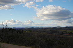 The rugged landscape of the Trás-os -Montes region, within Miranda do Douro
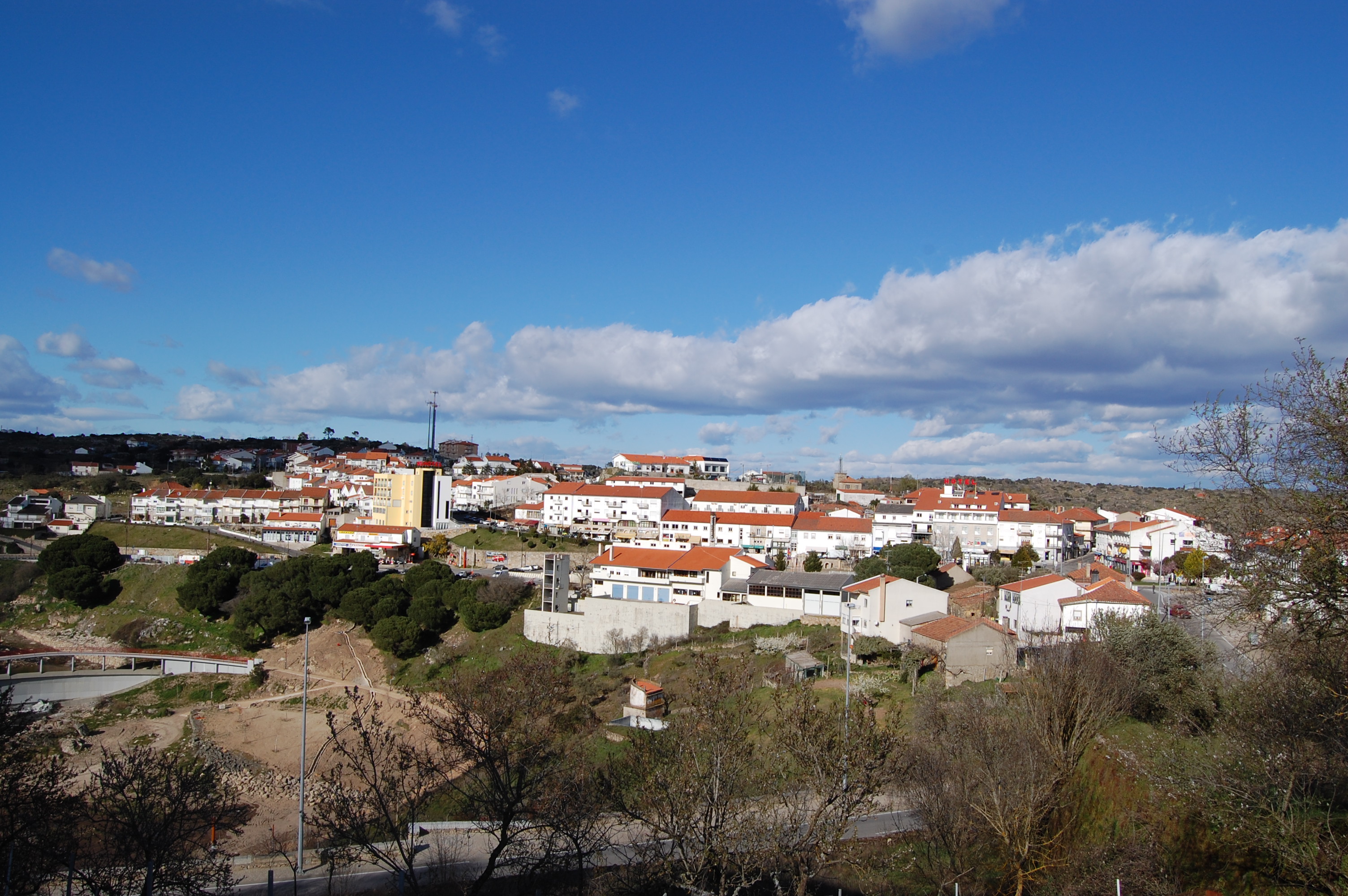
 The municipal seat and principal town of the municipality of Miranda do Douro
Physical geography
Miranda do Douro is located in a region that skirts the border between the Portuguese Trás-os-Montes region, and the Spanish autonomous community of Castile and León. The relief in this region is influenced by hard quartzite depoists near the border region, making erosion difficult, resulting in high escarpments and cliffs. The soils are composed of schists and granite bedrocks.
Ecoregions/Protectet areas
The Parque Natural do Douro Internacional (English: Douro International Nature Park), which encompasses the municipalities of Figueira de Castelo Rodrigo Municipality, Freixo de Espada à Cinta, Miranda do Douro and Mogadouro, includes an area of 85,150 hectares (328.8 sq mi), along the border portion of the Douro River. It was created on 11 May 1998 to encompass the constituent territories that encompass the Rivers Douro and Águeda, along the Spain-Portugal border that include similar geological and climatic conditions, and to help support flora and fauna in the region, while allowing appropriate human activities. The creation of the complementary Parque Natural de Arribes in Spain, allowed the systematic protection of an area that encompassed the larger ecosystem and biome.
Climate
Due to its place in the Nordeste Transmontano, the area is prone to extreme weather fluctuations. It is common for locals to refer to the climate in this region in these terms: Em Miranda há nove meses de Inverno e três de Inferno ("In Miranda there are seven months of winter and three months of Hell").[3] The summer tends to be dry and warm, while the winters are rigorously cold with frequent snowfalls.[3] Winters in Miranda are cold, with minimum temperatures hovering around 2°C (with 30-day consecutive cold temperatures that oscillate around 0°C), at times reaching into the negatives. Summer is completely opposite: hot, dry with maximum temperatures hovering around 32°C.[4]
Human geography
Population of
Miranda do Douro
(1801 - 2004)Year Pop. ±% 1801 7,706 — 1849 7,146 −7.3% 1900 10,639 +48.9% 1930 11,272 +5.9% 1960 18,972 +68.3% 1981 9,948 −47.6% 1991 8,697 −12.6% 2001 8,048 −7.5% 2004 7,707 −4.2% - Vale de Mira
- Vila Chã de Braciosa (Mirandese: Bila Chana de Barceosa)
It contains Miranda do Douro.
Twin towns — Sister cities
See also: List of twin towns and sister cities in PortugalMiranda do Douro is twinned with:
 Aranda de Duero, Autonomous Community of Castile and León, Spain[5]
- Bimenes, Principality of Asturias, Spain[5]
Notable citizens
- Leonel Vieira (c.1969), a film director, who apart from various films in the late 20th and early 21st century, also filmed the video Rosa Branca for fadist Mariza.
References
- Notes
- ^ a b c d e David J.J. Evans (2004), p.132
- ^ a b c d e f g h Câmara Municipal, ed (2008). "O Concelho: Historia" (in Portuguese). Miranda do Douro, Portugal: Câmara Municipal de Miranda do Douro. http://www.cm-mdouro.pt/historia/. Retrieved 10 May 2011.
- ^ a b Câmara Municipal, ed (2008). "O Concelho" (in Portuguese). Miranda do Douro, Portugal: Câmara Municipal de Miranda do Douro. http://www.cm-mdouro.pt/concelho/. Retrieved 10 May 2011.
- ^ Câmara Municipal, ed (2008). "O Concelho: Clima" (in Portuguese). Miranda do Douro, Portugal: Câmara Municipal de Miranda do Douro. http://www.cm-mdouro.pt/clima/. Retrieved 10 May 2011.
- ^ a b Câmara Municipal, ed (2008). "O Concelho: Cidades Geminadas" (in Portuguese). Miranda do Douro, Portugal: Câmara Municipal de Miranda do Douro. http://www.cm-mdouro.pt/gemina/. Retrieved 10 May 2011.
- Sources
- Evans, David J.J. (2004), Portugal, Wimbeldon, England: Cadogan Guides/New Holland Publishers, http://books.google.ca/books?id=I9ZxUKbxh-EC&pg=RA1-PA132&dq=miranda+do+douro&hl=en&ei=SznJTc2OM8z_-gbE9Ny_Bg&sa=X&oi=book_result&ct=result&resnum=2&ved=0CEkQ6AEwAQ#v=onepage&q=miranda%20do%20douro&f=false
Alfândega da Fé · Bragança · Carrazeda de Ansiães · Freixo de Espada à Cinta · Macedo de Cavaleiros
Miranda do Douro · Mirandela · Mogadouro · Torre de Moncorvo · Vila Flor · Vimioso · Vinhais Categories:
- Municipalities of Bragança


Wikimedia Foundation. 2010.