- Douro
-
For the municipality in the Philippines, see Duero, Bohol. For the Spanish wine region, see Ribera del Duero. For the Portuguese wine region, see Douro DOC. For the Portuguese NUTS3 subregion, see Douro Subregion.
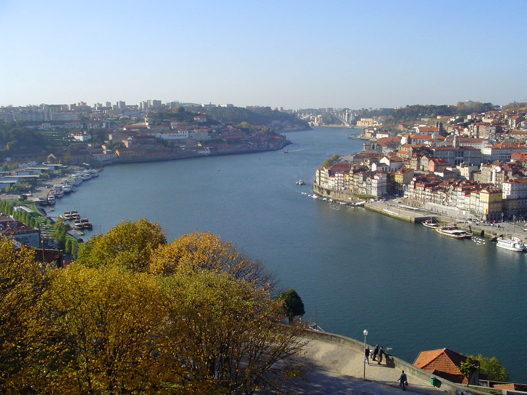
Douro Spanish: Duero, Portuguese: Douro River  The river between Porto (right) and Vila Nova de Gaia (left), facing west
Countries  Spain,
  Portugal
Source - location Picos de Urbión (Sistema Ibérico), Soria Province (  Castile and León), Spain
- coordinates 42°00′N 2°55′W / 42.00°N 2.91°W Mouth Atlantic Ocean - location Porto, Portugal - coordinates 41°08′N 8°40′W / 41.14°N 8.66°W Length 897 km (557 mi) Discharge for Porto - average 714 m3/s (25,215 cu ft/s) - max 17,000 m3/s (600,349 cu ft/s) Discharge elsewhere (average) - Pocinho 442 m3/s (15,609 cu ft/s) 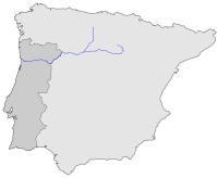
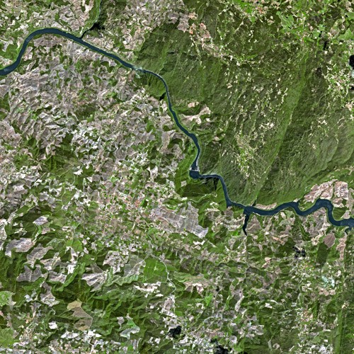
 The Douro seen from Spot Satellite
The Douro or Duero (Portuguese: Douro, IPA: [ˈðou̯ɾu] and [ˈðoɾu]; Spanish: Duero, IPA: [ˈdweɾo]; Latin: Durius) is one of the major rivers of the Iberian Peninsula, flowing from its source near Duruelo de la Sierra in Soria Province across northern-central Spain and Portugal to its outlet at Porto. Its total length is 897 km, of which only sections of the Portuguese reaches of the river are navigable, by light rivercraft.
It is the third largest river in the Iberian Peninsula after the Tagus and Ebro
The name, Latinized Durius, may have come from the Celtic tribes that inhabited the area before Roman times: the Celtic root is *dubro- and in modern Welsh dwr is "water" with cognate dobhar in Irish.
In its Spanish section, the Duero crosses the great Castilian meseta and meanders through five significant provinces of the autonomous community of Castile and León: Soria, Burgos, Valladolid, Zamora, and Salamanca, passing through the towns of Soria, Almazán, Aranda de Duero, Tordesillas, and Zamora.
In this region, there are few large tributaries of the Duero. The most important are the Pisuerga, passing through Valladolid, and the Esla, which passes through Zamora. This region, for the most part, is one of semi-arid plains planted with wheat and in some places, especially near Aranda de Duero, in wine grapes, in the Ribera del Duero wine region. Sheep rearing is also still important.
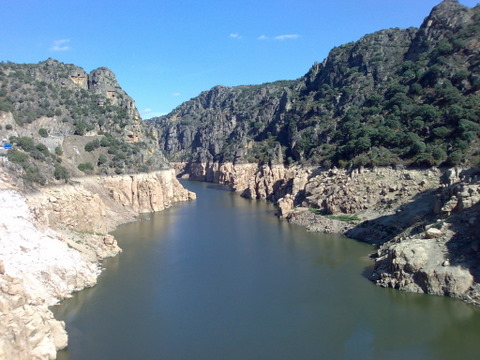
Then, for 112 km, the river forms part of the national border line between Spain and Portugal, in a region of narrow canyons, making it an historical barrier for invasions and a linguistic dividing line. This isolated area, in which the Aldeadávila Dam impounds the river, has now a protected status: the International Douro Natural Park on the Portuguese side, los Arribes del Duero Natural Park on the Zamoran bank. The Douro fully enters Portuguese territory just after the confluence with the Águeda River.
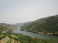
Once the Douro enters Portugal, major population centres are less frequent. Except for Porto and Vila Nova de Gaia at the river mouth, the only population centres of any note are Foz do Tua, Pinhão and Peso da Régua. Tributaries are small and flow into canyons to enter the larger river. The most important are Côa River, Tua River, Sabor River, Corgo River, Tavora River, Paiva River, Tâmega River, and Sousa River. None of these small, fast flowing rivers are navigable. The Douro vinhateiro, an area of the Douro Valley in Portugal, has been classified by UNESCO as a World Heritage Site.
These reaches of the Douro have a microclimate[specify] allowing for cultivation of olives, almonds, and especially grapes that are important for making the famous Port wine. The region around Pinhão and São João da Pesqueira is considered to be the centre of Port wine, with its picturesque quintas or farms clinging on to almost vertical slopes dropping down to the river. Many of these quintas are owned by multinational wine companies.
Traditionally, the wine was taken down river in flat-bottom boats called rabelos to be stored in barrels in cellars in Vila Nova de Gaia, just across the river from Porto. In the 1950s and 1960s, dams were built along the river ending this river traffic on Spanish and border sections. Now Port wine is transported in tanker trucks.
There are five dams on the Portuguese Douro alone functioning to make the flow of water uniform, generate hydroelectric power, and allow navigation. Ships with maximum length 83 m and width 11.4 m can pass through five locks. The highest one on Carrapatelo dam has a maximum lift 35 meters. Level of Pocinho lake reaches 125 m a.s.l. Recently, a prosperous tourist industry has developed based on river excursions from Porto to points along the Upper Douro valley.
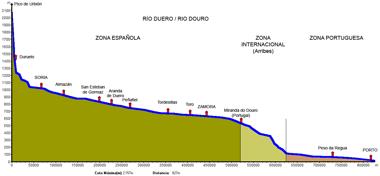
 Profile of the Douro River, from source to mouth
In Portugal, the Douro flows through the districts of Bragança, Guarda, Viseu, Vila Real, Aveiro and Porto. Porto is the main hub city in northern Portugal and its historic centre is declared as a UNESCO monumental place.
The railway Linha do Douro connects Porto, Rio Tinto, Ermesinde, Valongo, Paredes, Penafiel, Livração, Marco de Canaveses, Régua, Tua and Pocinho. Pocinho is near the city of Foz Côa, which is close to Vale Arqueológico do Côa, (an Archaeological pre-historic patrimony) another UNESCO Heritage Sight.
Major Spanish riverside towns include Soria, Almazán, Aranda de Duero, Tordesillas, Zamora and major Portuguese towns include Miranda do Douro, Foz Côa, Peso da Régua, Lamego, Vila Nova de Gaia, and Porto.
The most populous cities along the Douro River are Valladolid, Zamora in Spain and Porto and Vila Nova de Gaia in Portugal. The latter two are located at the mouth of the Douro.
Gallery
-

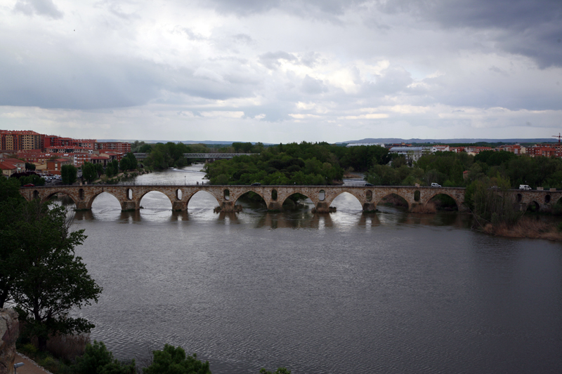
The Douro in Zamora (Spain)
-
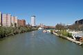
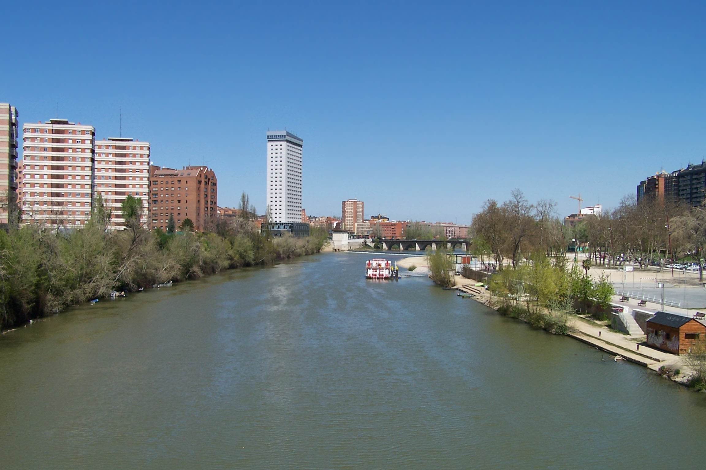
The Pisuerga River (tributary to the Duero) in Valladolid
-
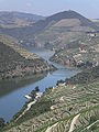
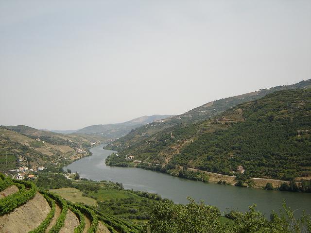
The Upper Douro valley where Port wine grapes grow
-
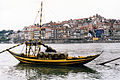
The typical rabelo boat and Porto historical district in background
-
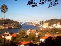
The river mouth from Porto's Crystal Palace Gardens, facing west
-
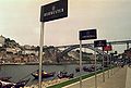
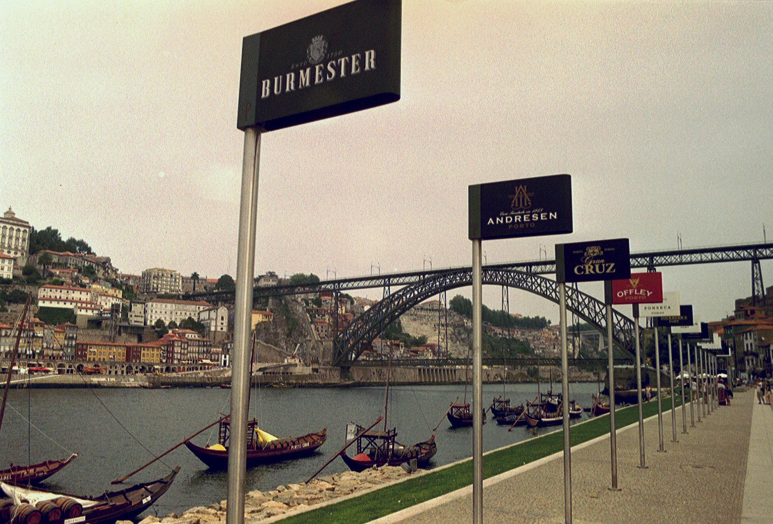
Port wine signs by the Douro River
-
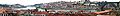
Panoramic view of Oporto
-
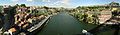
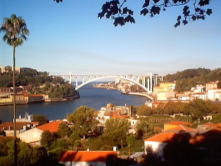
The river between Porto and Vila Nova de Gaia
-
The river near Régua, Portugal
-

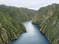
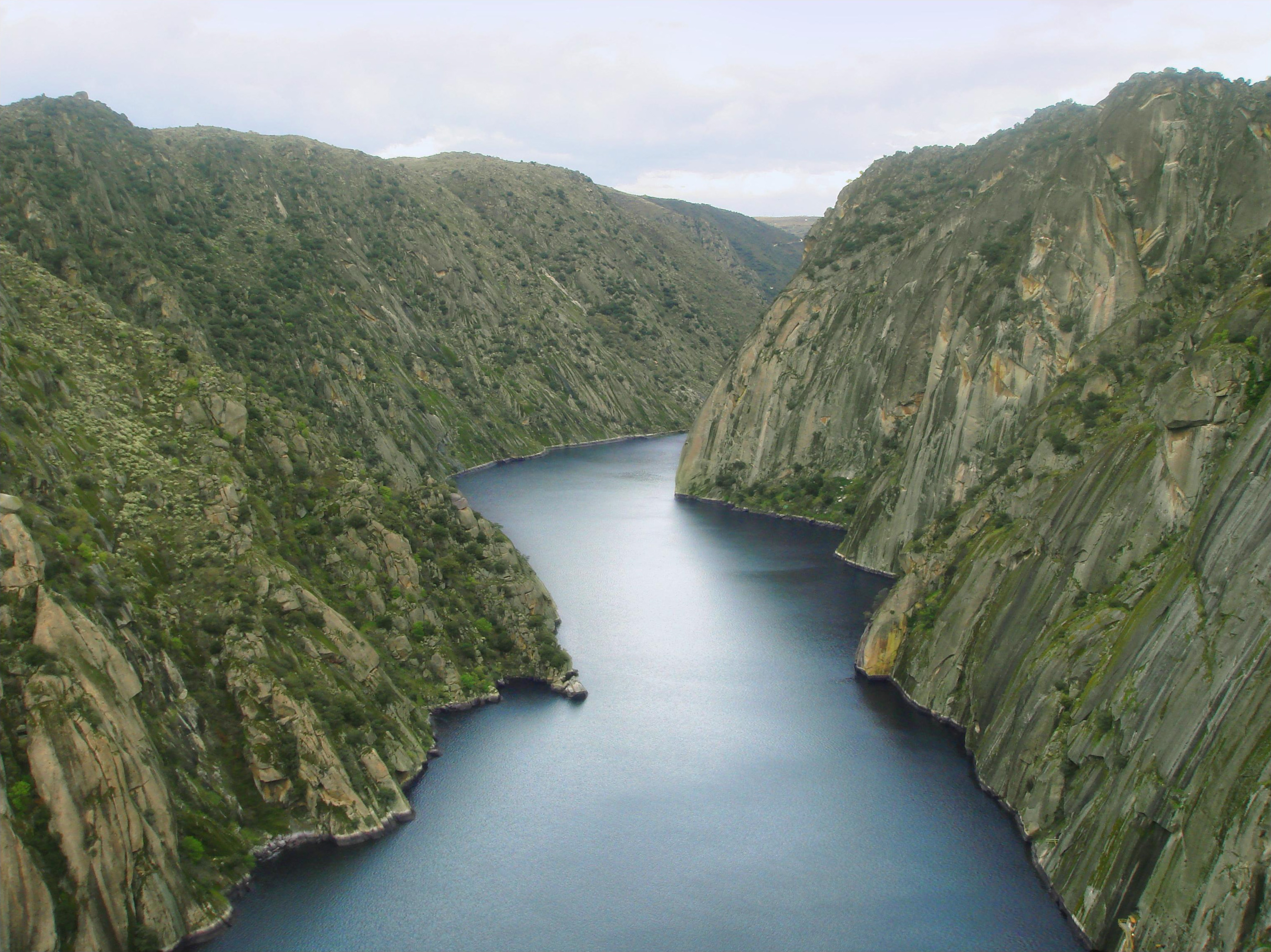
International Douro near Miranda
-
"Arribes del Duero" in Salamanca.
See also
- List of rivers of Spain
External links
Categories:- Douro basin
- Rivers of Spain
- Rivers of Portugal
- Wine regions of Portugal
- International rivers of Europe
- Portugal–Spain border
-


Wikimedia Foundation. 2010.