- Meade Islands
-
Meade Islands 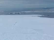
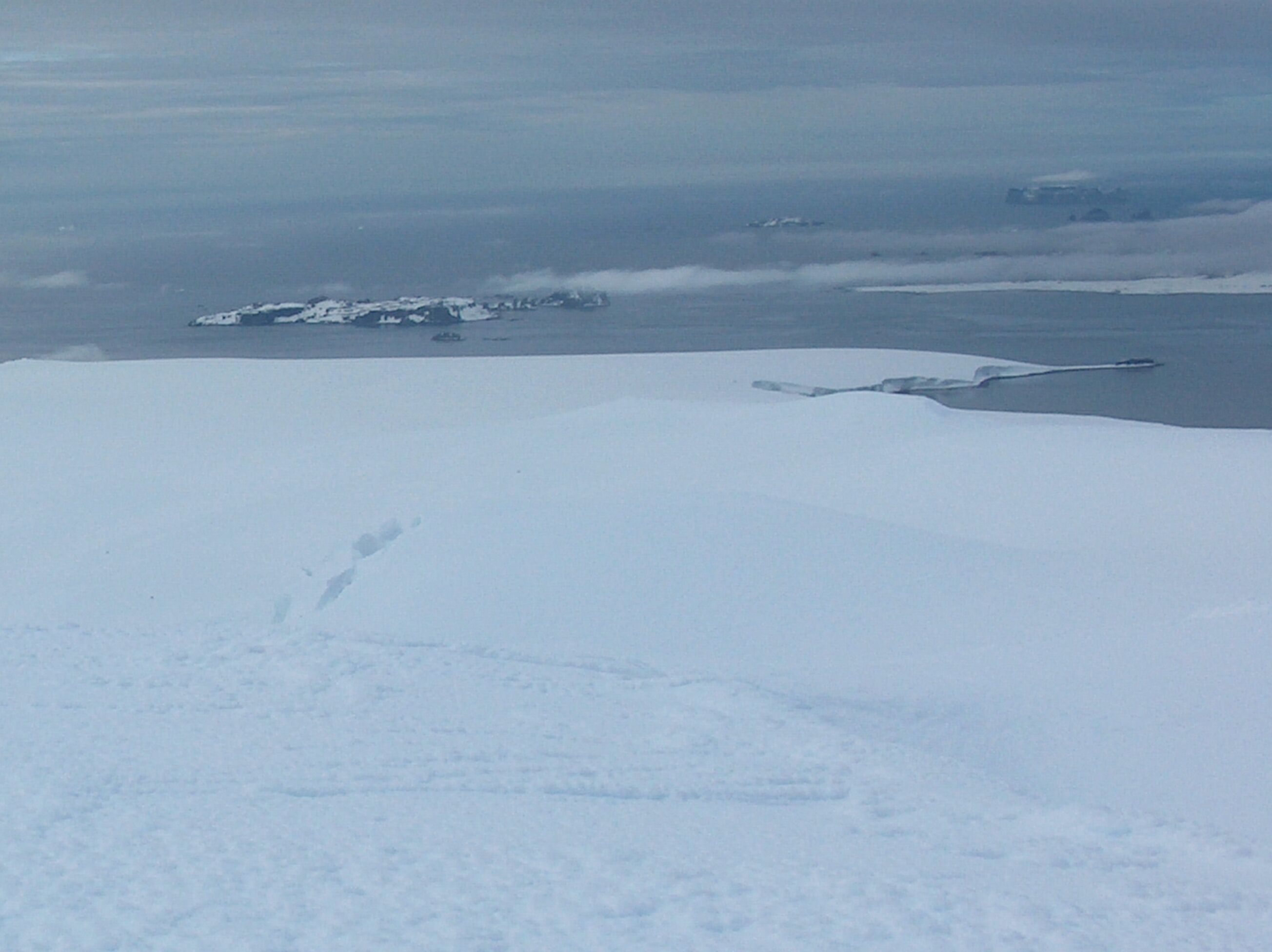
Meade Islands (in the background) from Miziya Peak, Livingston Island.
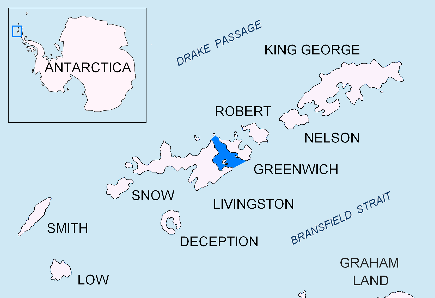
Location of McFarlane Strait in the South Shetland Islands.Geography Location Antarctica Coordinates 62°27′04.4″S 60°04′03″W / 62.451222°S 60.0675°W Archipelago South Shetland Islands Area 66 ha (160 acres)[1] Country Demographics Population 0 Additional information Administered under the Antarctic Treaty System Meade Islands is a group of two islands, the larger west one being Zverino Island and the smaller east one Cave Island, and rocks lying in the north entrance to McFarlane Strait in the South Shetland Islands, Antarctica. Their surface areas are 48 hectares (120 acres)[1] and 18 hectares (44 acres).[1] respectively. The area was visited by early 19th century sealers.
The islands were charted in 1935 by Discovery Investigations and named after C.M. Meade, Cartographer-in-charge in the Admiralty Hydrographic Office at that time.
Contents
Location
The midpoint of the group is located at 62°27′04.4″S 60°04′03″W / 62.451222°S 60.0675°W which is 1.98 km (1.23 mi) west of Duff Point, Greenwich Island, 3.73 km (2.32 mi) north of Pomorie Point, 3.5 km (2.2 mi) east of Williams Point, 4 km (2.5 mi) southeast of Zed Islands and 3.9 km (2.4 mi) south-southeast of Pyramid Island (British mapping in 1935 and 1968, Chilean in 1971, Argentine in 1980, Spanish in 1991, and Bulgarian in 2005 and 2009).
See also
- Composite Antarctic Gazetteer
- List of Antarctic islands south of 60° S
- SCAR
- Territorial claims in Antarctica
Map
- L.L. Ivanov et al. Antarctica: Livingston Island and Greenwich Island, South Shetland Islands. Scale 1:100000 topographic map. Sofia: Antarctic Place-names Commission of Bulgaria, 2005.
References
- ^ a b c L.L. Ivanov. Antarctica: Livingston Island and Greenwich, Robert, Snow and Smith Islands. Scale 1:120000 topographic map. Troyan: Manfred Wörner Foundation, 2009. ISBN 978-954-92032-6-4
External links
South Shetland Islands Major Minor - Aitcho
- (Barrientos
- Bilyana
- Cecilia
- Emeline
- Jorge
- Kilifarevo
- Pasarel
- Riksa)
- Araguez
- Astor
- Barlow
- Basso
- Bridgeman
- Chiprovtsi
- Cornwall
- Cornwallis
- Craggy
- Dee
- Desolation
- Dunbar
- (Aspis
- Balsha
- Zavala)
- Express
- Gibbs
- González
- Half Moon
- Heywood
- Kabile
- Meade
- (Zverino
- Cave)
- Miladinovi
- Montufar
- Ongley
- Onogur
- Penguin
- Pordim
- Pyramid
- Rogozen
- Romeo
- Rowett
- Rugged
- San Telmo
- Seal
- Sierra
- Stoker
- Table
- Tatul
- Treklyano
- Valchedram
- Window
- Withem
- Wood
- Zed
- (Esperanto
- Koshava
- Lesidren
- Phanagoria)
Rocks, stacks, reefs
spits and banks- Alepu
- Avren
- Belchin
- Bonert
- Bowler
- Buchino
- Caraquet
- Chaos
- Channel
- Chapman
- Cheshire
- Cone
- Cutler
- Dovizio
- Eddystone
- Eliza
- Folger
- Frederick
- Galiche
- Grace
- Graovo
- Henfield
- Hetty
- Holmes
- Ibar
- Koynare
- Letelier
- Liberty
- Lientur
- Long
- Lynx
- Maglizh
- Makresh
- Mellona
- Milev
- Mónica
- Morris
- Okol
- Opaka
- Orsoya
- Parry Patch
- Passage
- Pig
- Potmess
- Priboy
- Rabisha
- Raquelia
- Reyes
- Rongel
- Rosales
- Rusokastro
- Salient
- Sally
- Sewing-Machine Needles
- Skrino
- Stackpole
- Telish
- The Pointers
- Tooth
- Turmoil
- Tvarditsa
- Vardim
- Vergilov
- Vietor
- Voluyak
- Weeks

This South Shetland Islands location article is a stub. You can help Wikipedia by expanding it.