- Ongley Island
-
Ongley Island 
Ongley Island (in the background) from Barrientos Island, Aitcho Islands.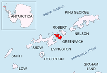
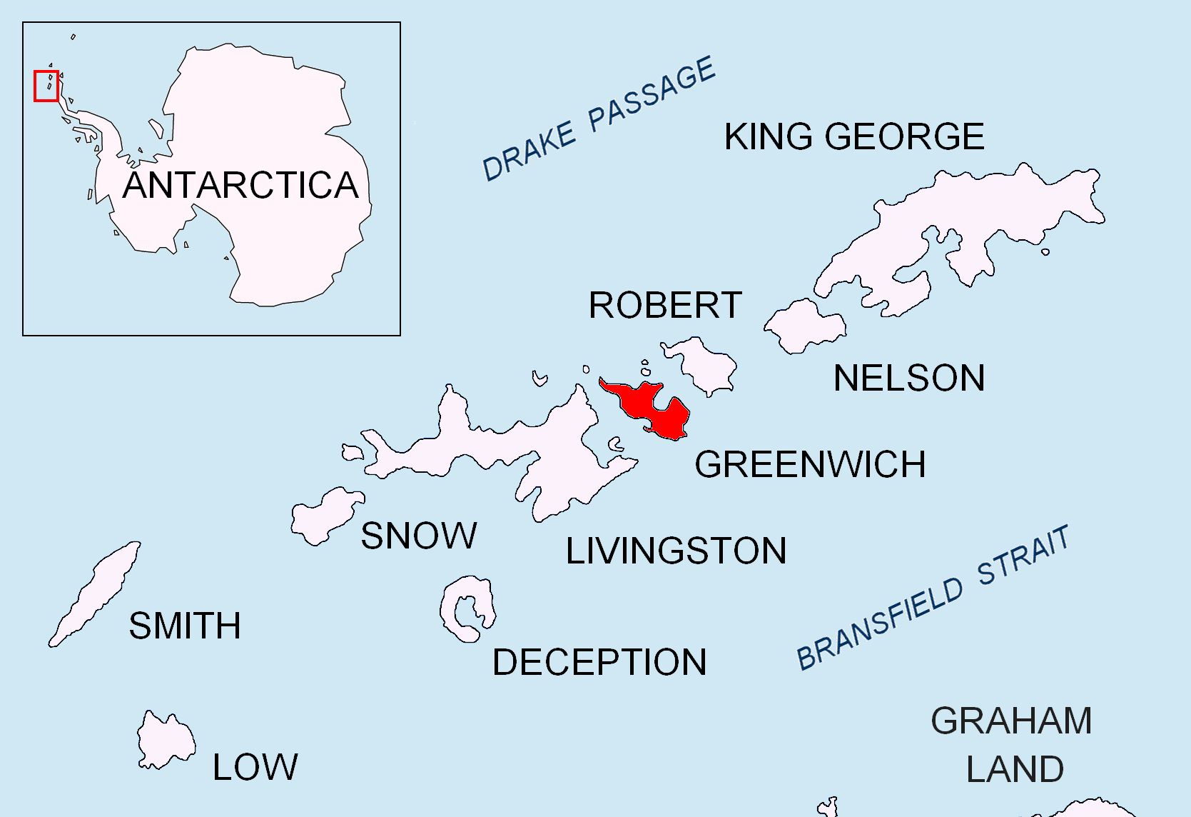
Location of Greenwich Island in the South Shetland Islands.Geography Location Antarctica Coordinates 62°25′48″S 59°53′14.6″W / 62.43°S 59.887389°W Archipelago South Shetland Islands Area 0.44 km2 (0.17 sq mi)
[1]Length 1.35 km (0.839 mi) Width 0.47 km (0.292 mi) Country Demographics Population 0 Additional information Administered under the Antarctic Treaty System Ongley Island is a rugged rocky island lying off the north coast of Greenwich Island in the South Shetland Islands, Antarctica. Extending 1.35 km (0.84 mi) in west-northwest direction and 470 m (510 yd) wide, with a surface area of 44 hectares (110 acres).[1] The area was visited by early 19th century sealers.
The feature is named after L.T. Ongley, cartographer in the Admiralty Hydrographic Department in 1935.
Contents
Location
The midpoint is located at 62°25′48″S 59°53′14.6″W / 62.43°S 59.887389°W and the island is lying 3.7 km (2.3 mi) west of Dee Island, 1.73 km (1.07 mi) north by east of Aprilov Point, Greenwich Island, 2.74 km (1.70 mi) northeast of Miletich Point, Greenwich Island, 2.52 km (1.57 mi) east-northeast of Kabile Island, 5.3 km (3.3 mi) south by east of Romeo Island and 3.7 km (2.3 mi) southwest of Stoker Island (British mapping in 1935 and 1968, Argentine in 1957, Chilean in 1971, and Bulgarian in 2005 and 2009).
See also
- Composite Antarctic Gazetteer
- Greenwich Island
- List of Antarctic islands south of 60° S
- SCAR
- South Shetland Islands
- Territorial claims in Antarctica
Map
- L.L. Ivanov et al. Antarctica: Livingston Island and Greenwich Island, South Shetland Islands. Scale 1:100000 topographic map. Sofia: Antarctic Place-names Commission of Bulgaria, 2005.
References
- ^ a b L.L. Ivanov. Antarctica: Livingston Island and Greenwich, Robert, Snow and Smith Islands. Scale 1:120000 topographic map. Troyan: Manfred Wörner Foundation, 2009. ISBN 978-954-92032-6-4
External links
South Shetland Islands Major Minor - Aitcho
- (Barrientos
- Bilyana
- Cecilia
- Emeline
- Jorge
- Kilifarevo
- Pasarel
- Riksa)
- Araguez
- Astor
- Barlow
- Basso
- Bridgeman
- Chiprovtsi
- Cornwall
- Cornwallis
- Craggy
- Dee
- Desolation
- Dunbar
- (Aspis
- Balsha
- Zavala)
- Express
- Gibbs
- González
- Half Moon
- Heywood
- Kabile
- Meade
- (Zverino
- Cave)
- Miladinovi
- Montufar
- Ongley
- Onogur
- Penguin
- Pordim
- Pyramid
- Rogozen
- Romeo
- Rowett
- Rugged
- San Telmo
- Seal
- Sierra
- Stoker
- Table
- Tatul
- Treklyano
- Valchedram
- Window
- Withem
- Wood
- Zed
- (Esperanto
- Koshava
- Lesidren
- Phanagoria)
Rocks, stacks, reefs
spits and banks- Alepu
- Avren
- Belchin
- Bonert
- Bowler
- Buchino
- Caraquet
- Chaos
- Channel
- Chapman
- Cheshire
- Cone
- Cutler
- Dovizio
- Eddystone
- Eliza
- Folger
- Frederick
- Galiche
- Grace
- Graovo
- Henfield
- Hetty
- Holmes
- Ibar
- Koynare
- Letelier
- Liberty
- Lientur
- Long
- Lynx
- Maglizh
- Makresh
- Mellona
- Milev
- Mónica
- Morris
- Okol
- Opaka
- Orsoya
- Parry Patch
- Passage
- Pig
- Potmess
- Priboy
- Rabisha
- Raquelia
- Reyes
- Rongel
- Rosales
- Rusokastro
- Salient
- Sally
- Sewing-Machine Needles
- Skrino
- Stackpole
- Telish
- The Pointers
- Tooth
- Turmoil
- Tvarditsa
- Vardim
- Vergilov
- Vietor
- Voluyak
- Weeks

This South Shetland Islands location article is a stub. You can help Wikipedia by expanding it.
