- Clarence Island (South Shetland Islands)
-
For other uses, see Clarence Island (disambiguation).
Clarence Island 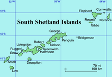
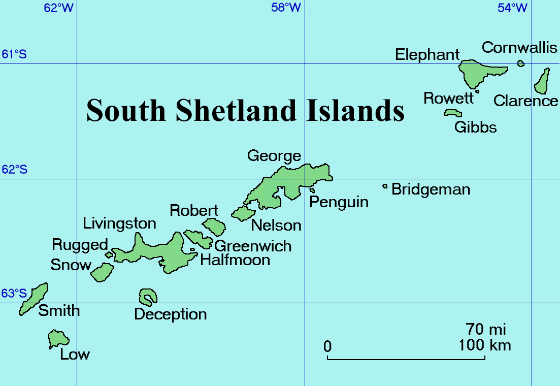
Location of Clarence Island
Location of Clarence IslandGeography Location Antarctica Coordinates 61°12′S 054°05′W / 61.2°S 54.083°WCoordinates: 61°12′S 054°05′W / 61.2°S 54.083°W Archipelago South Shetland Islands Length 19.3 km (11.99 mi) Highest elevation 2,300 m (7,500 ft) Highest point Mount Irving Country Demographics Population 0 Additional information Administered under the Antarctic Treaty System Clarence Island (61°12′S 054°05′W / 61.2°S 54.083°W) is 12 miles (19.3 km) long and the easternmost of the South Shetland Islands of the British Antarctic Territory. The name dates back to at least 1821 and is now established in international usage. Ernest Shackleton saw Clarence Island on his famous boat voyage but landed on Elephant Island. It is claimed by Argentina as part of "Departamento Islas del Atlántico Sur"
Mount Irving, 2,300 meters (7,546 ft) high, rises 3 km (1.9 mi) north of Cape Bowles, the southernmost point. There are two small islands 1.5 km (0.93 mi) east of Clarence Island, the northern one is named Sugarloaf Island, at 61°11'S, 054°00'W.
See also
- Composite Antarctic Gazetteer
- List of Antarctic islands south of 60° S
- SCAR
- Territorial claims in Antarctica
References
External links
South Shetland Islands Major Minor - Aitcho
- (Barrientos
- Bilyana
- Cecilia
- Emeline
- Jorge
- Kilifarevo
- Pasarel
- Riksa)
- Araguez
- Astor
- Barlow
- Basso
- Bridgeman
- Chiprovtsi
- Cornwall
- Cornwallis
- Craggy
- Dee
- Desolation
- Dunbar
- (Aspis
- Balsha
- Zavala)
- Express
- Gibbs
- González
- Half Moon
- Heywood
- Kabile
- Meade
- (Zverino
- Cave)
- Miladinovi
- Montufar
- Ongley
- Onogur
- Penguin
- Pordim
- Pyramid
- Rogozen
- Romeo
- Rowett
- Rugged
- San Telmo
- Seal
- Sierra
- Stoker
- Table
- Tatul
- Treklyano
- Valchedram
- Window
- Withem
- Wood
- Zed
- (Esperanto
- Koshava
- Lesidren
- Phanagoria)
Rocks, stacks, reefs
spits and banks- Alepu
- Avren
- Belchin
- Bonert
- Bowler
- Buchino
- Caraquet
- Chaos
- Channel
- Chapman
- Cheshire
- Cone
- Cutler
- Dovizio
- Eddystone
- Eliza
- Folger
- Frederick
- Galiche
- Grace
- Graovo
- Henfield
- Hetty
- Holmes
- Ibar
- Koynare
- Letelier
- Liberty
- Lientur
- Long
- Lynx
- Maglizh
- Makresh
- Mellona
- Milev
- Mónica
- Morris
- Okol
- Opaka
- Orsoya
- Parry Patch
- Passage
- Pig
- Potmess
- Priboy
- Rabisha
- Raquelia
- Reyes
- Rongel
- Rosales
- Rusokastro
- Salient
- Sally
- Sewing-Machine Needles
- Skrino
- Stackpole
- Telish
- The Pointers
- Tooth
- Turmoil
- Tvarditsa
- Vardim
- Vergilov
- Vietor
- Voluyak
- Weeks

This South Shetland Islands location article is a stub. You can help Wikipedia by expanding it.