- Bukit Jalil Highway
-
Federal Route 217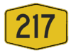
Bukit Jalil Highway Route information Existed: 1995 – present History: Completed in 1997 Major junctions West end: Puchong  Damansara-Puchong Expressway
B11 Jalan Puchong-Petaling Jaya
 Jalan Kompleks Sukan
 Kuala Lumpur-Seremban Expressway
 Sungai Besi Expressway
East end: Sungai Besi Location Primary
destinations:Bandar Kinrara
Kompleks Sukan Negara
Technology Park Malaysia
Bukit Jalil
Puncak JalilHighway system The Bukit Jalil Highway or Puchong-Sungai Besi Highway, Federal Route
 , is a major highway in Klang Valley, Malaysia. It is a second highway after Shah Alam Expressway
  . It connects the Sungai Besi Expressway near Selangor Turf Club in the east to Damansara-Puchong Expressway near Puchong Jaya in the west. The highway passing Bandar Kinrara and Bukit Jalil.
Contents
Route background
The Kilometre Zero of the highway starts at Puchong Jaya Interchange near Puchong, Selangor.
History
During 1998 Commonwealth Games in Kuala Lumpur, the highway became a second main route to National Sports Complex in Bukit Jalil after Shah Alam Expressway.
Features
Notable features
At most section, the Federal Route 217 was built under the JKR R5 road standard, allowing maximum speed limit of up to 90 km/h.
Overlaps
Alternate routes
List of Interchanges
km Exit Interchange To Remarks
0PUCHONG JAYA INTERCHANGE NORTHEAST
B11 JALAN PUCHONG-PETALING JAYA
Jalan Klang Lama
Kuchai Lama
Petaling Jaya
 DAMANSARA-PUCHONG EXPRESSWAY
NORTHWEST
Kepong
Damansara
Petaling Jaya
Bandar Sunway
Shah Alam
Klang
Pulau Indah
SOUTH
Puchong
Putrajaya
Cyberjaya
Kuala Lumpur International Airport (KLIA)Multi-level stacked interchange DAMANSARA-PUCHONG EXPRESSWAY
Start/End of expressway
Litrak border limit BUKIT JALIL HIGHWAY
Start/End of highway
JKR Petaling border limitKinrara Industrial Park T-junctions Bandar Kinrara T-junctions Bandar Kinrara Half diamond interchange Puncak Jalil T-junctions Awan Besar
Bukit Jalil Recreational Park
Bukit Jalil Golf and Country Club
Asian Football Confederation (AFC) main headquartersDiamond interchange JALAN KOMPLEKS SUKAN
Kompleks Sukan Negara
SOUTH
Technology Park MalaysiaDiamond interchange Sungai Kuyoh Bridge ASTRO All Asia Broadcast Centre (ASTRO) East bound KUALA LUMPUR-SEREMBAN EXPRESSWAY
NORTH
Kuala Lumpur
Petaling Jaya
SOUTH
 NORTH-SOUTH EXPRESSWAY SOUTHERN ROUTE
Kuala Lumpur International Airport (KLIA)
Seremban
Melaka
Johor BahruParcelo expressway interchange BUKIT JALIL HIGHWAY
Start/End of highway
DBKL border limit SUNGAI BESI EXPRESSWAY
Start/End of expressway
Besraya border limitSELANGOR TURF CLUB INTERCHANGE EAST
SELANGOR TURF CLUB

SUNGAI BESI EXPRESSWAY
NORTH
Kuala Lumpur
Sungai Besi
SOUTH
Mines Resort City
Seri Kembangan
Balakong
KajangRoundabout  Malaysian Federal Roads System
Main Federal Roads
(Peninsula Malaysia)1 2 3 4 5 6 7 8 9 10 11 12 13 14 15 16 17 18 19 20 23 24 26 27 28 29 30 31 32 33 50 51 53 54 55 56 57 58 59 60 61 62 63 64 65 66 67 68 69 70 71 72 73 74 75 76 77 78 79 80 81 82 83 84 85 86 87 88 89 90 91 92 93 94 95 96 97 98 99 100 101 102 103 104 105 106 107 108 109 110 111 112 113 114 115 116 117 118 119 120 121 122 123 124 125 126 127 128 129 130 131 132 133 134 135 136 137 138 139 140 141 142 143 144 145 146 147 148 149 150 151 152 153 154 155 156 157 158 159 160 161 162 163 164 165 166 167 168 169 170 171 172 173 174 175 176 177 178 179 180 181 182 183 184 185 186 187 188 189 190 191 192 193 194 195 196 197 198 199 200 201 202 203 204 205 206 207 208 209 210 211 212 213 214 215 216 217 218 219 220 221 222 223 225 228 231 2A 2B
FELDA/FELCRA Federal Roads
(Peninsula Malaysia)Industrial Federal Roads
(Peninsula Malaysia)Institutional Facilities Federal Roads
(Peninsula Malaysia)Main Federal Roads
(Sarawak)1 1-1 1-2 1-3 1-4 1-5 1-6 1-7 1-8 1-9 1-10 1-11 1-12 1-13 1-14 1-15 1-16 1-17 1-18 1-19 1-20 1-21 1-22 1-23 1-24 1-25 1-26 1-27 1-28 1-29 1-30 1-31 1-32 1-33 1-34 1-35 1-36 1-37 1-38 1-39 1-40 1-41 1-42 1-43 1-44 1-45 1-46 1-47 1-48 1-49 1-50 1-51 1-52 1-53 1-54 1-55 1-56 1-57 1-58 1-59 1-60 1-61 1-62 1-63 1-64 1-65 1-66 1-67 1-68 1-69 1-70 1-71 1-72 1-73 1-74 1-75 1-76 1-77 1-78 1-79 1-80 1-81 1-82 1-83 1-84 1-85 1-86 1-87 1-88 1-89 1-90 1-91 1-92Other Federal Roads
(Sarawak)Main Federal Roads
(Sabah)Main Federal Roads
(Labuan)700 701 702 703 704 705 706 707 708 709 710 711 712 713 714 715 716 717 718 719 720 721 722 723 724 725 726 728 729 730 731Categories:- Expressways and highways in the Klang Valley
- Highways in Malaysia


Wikimedia Foundation. 2010.