- Wittlaer
-
Wittlaer is an urban borough of Düsseldorf. It borders Stockum, Kalkum, Angermund, and the city of Duisburg. It is close to Düsseldorf Airport. Wittlaer has the lowest point in Düsseldorf, where the Schwarzbach flows into the river Rhine. It is 28 m above sea level.
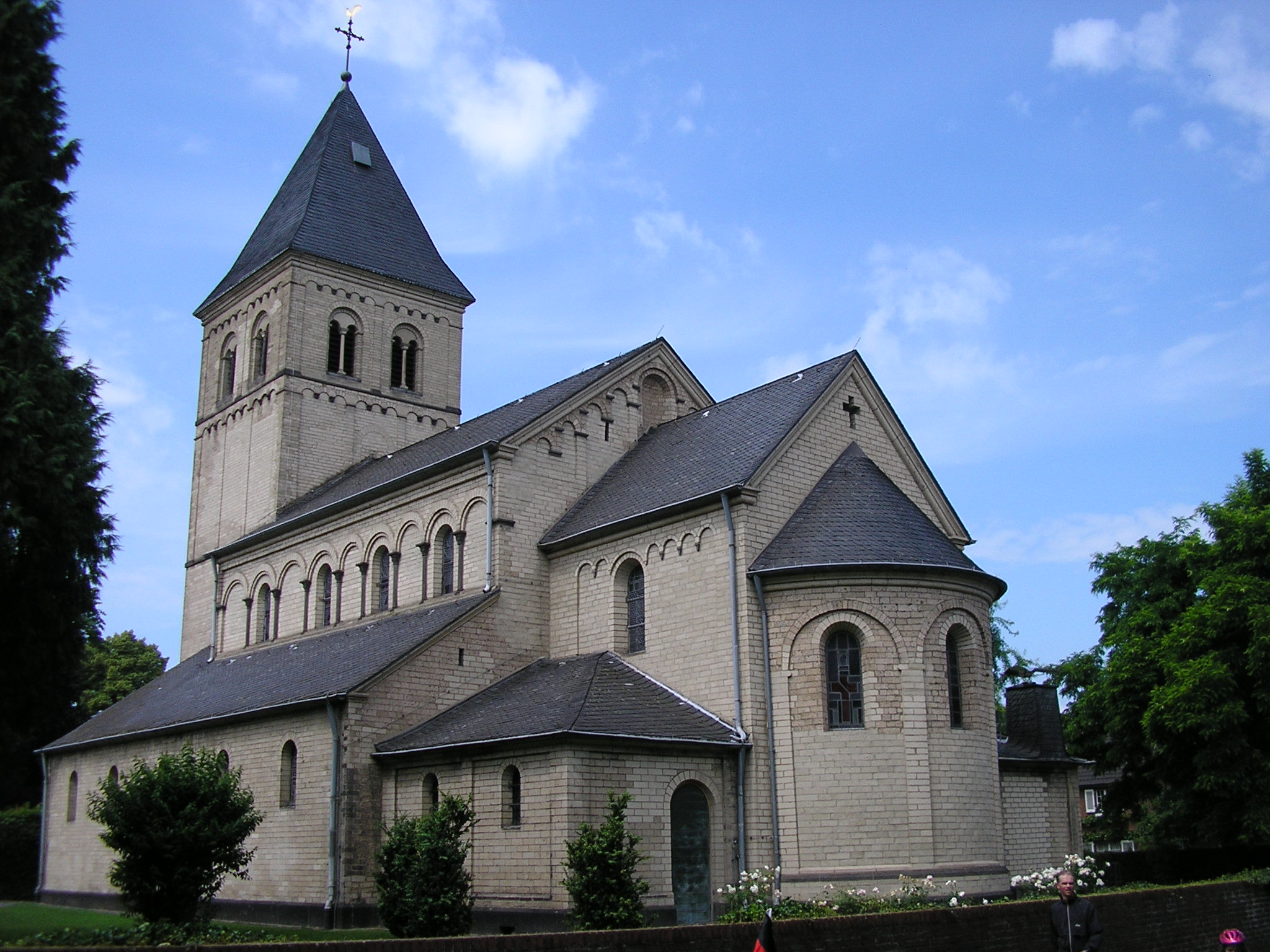
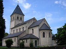 St Remigius in Wittlaer
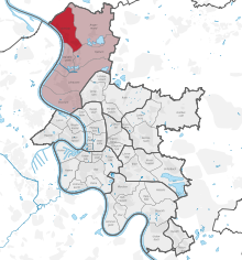 map of Düsseldorf, showing Wittlaer (in red) within District 5 (in pink)
The history of Wittlaer started at latest in the 12th century. For a long time it was an agricultural settlement. After World War II, Wittlaer grew as a suburb of Düsseldorf and Duisburg. In 1975, Wittlaer became a part of Düsseldorf.
The most prominent sight of Wittlaer is the Catholic Church St. Remigius, dating from the 13th century.
Wittlaer is connected to the airport by road and bus links, the federal road B 8 goes across Wittlaer. Wittlaer has an underground line station.
Wittlaer has two newer settlements, which are separated from the nucleus of Wittlaer:
- Froschenteich and
- Einbrungen
This article is based on a translation of an article from the German Wikipedia.
Districts of Düsseldorf District 1 · District 2 · District 3 · District 4 · District 5 · District 6 · District 7 · District 8 · District 9 · District 10 District 1: Altstadt · Derendorf · Golzheim · Carlstadt · Pempelfort · Stadtmitte | District 2: Düsseltal · Flingern-Nord · Flingern-Süd | District 3: Bilk · Flehe · Friedrichstadt · Hafen · Hamm · Oberbilk · Unterbilk · Volmerswerth | District 4: Heerdt · Lörick · Niederkassel · Oberkassel | District 5: Angermund · Kaiserswerth · Kalkum · Lohausen · Stockum · Wittlaer | District 6: Lichtenbroich · Mörsenbroich · Rath · Unterrath | District 7: Gerresheim · Grafenberg · Hubbelrath · Ludenberg | District 8: Eller · Lierenfeld · Unterbach · Vennhausen | District 9: Benrath · Hassels · Himmelgeist · Holthausen · Itter · Reisholz · Urdenbach · Wersten | District 10: Garath · HellerhofCategories:
- Urban districts and boroughs of Düsseldorf
- Düsseldorf


Wikimedia Foundation. 2010.