- District 4, Düsseldorf
-
For other uses, see District 4.
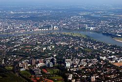
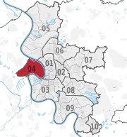
Stadtbezirk 4 — District of Düsseldorf — Aerial view of Düsseldorf-Oberkassel, looking East across the Rhine Location of District 4 shown in red Country  Germany
State  North Rhine-Westphalia
City  Düsseldorf
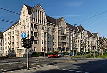
Area – Total 1,280 km2 (494.2 sq mi) Population (December 2009[1]) – Total 39,847 – Density 3,113/km2 (8,062.6/sq mi)  1911-built Kyffhäuserblock Block in Oberkassel
District 4 (German: Stadtbezirk 4) is a city district of Düsseldorf, the state capital of North Rhine-Westphalia, Germany. It covers an area of 12,80 square kilometres and (as of December 2009) has about 40,000 inhabitants.
District 4 is the city's only left-Rhenish district and its quarters are popular residential areas. Across the river, it shares borders with Düsseldorf districts 5, 1 and 3. West and South-west, the district is bordered by Rhein-Kreis Neuss and the city of Neuss.
Contents
Subdivisions
District 4 is made up of four Stadtteile (city parts):
# City part Population (2009) Area (km²) Pop. per km² 041 Oberkassel 17,154 3,87 4,433 042 Heerdt 9,368 4,15 2,257 043 Lörick 7,382 2,66 2,775 044 Niederkassel 5,589 2,05 2,674 source: Amt für Statistik und Wahlen der Landeshauptstadt Düsseldorf (German) Places of interest
Arts, Culture and Entertainment
- Largest Fair on the Rhine (only during July)
Landmarks
- St. Antonius, Oberkassel
Parks and open spaces
- Rheinwiesen
Transportation
The district is served by numerous railway stations and highway.[2] Stations include a dense net of both Düsseldorf Stadtbahn light rail- and Rheinbahn tram-stations. The district can also be reached via Bundesautobahn 57 and Bundesstraße 7.
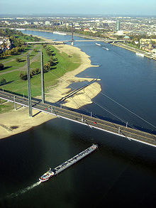
Rhine bridges
See also
References
- ^ Stadtbezirk 4, Landeshauptstadt Düsseldorf, 2009 (German)
- ^ Urban rail-transitmap Düsseldorf-Meerbusch, Verkehrsverbund Rhein-Ruhr
External links
 Media related to Districts of Düsseldorf at Wikimedia Commons
- Official webpage of the district (German)
Districts of Düsseldorf District 1 · District 2 · District 3 · District 4 · District 5 · District 6 · District 7 · District 8 · District 9 · District 10 District 1: Altstadt · Derendorf · Golzheim · Carlstadt · Pempelfort · Stadtmitte | District 2: Düsseltal · Flingern-Nord · Flingern-Süd | District 3: Bilk · Flehe · Friedrichstadt · Hafen · Hamm · Oberbilk · Unterbilk · Volmerswerth | District 4: Heerdt · Lörick · Niederkassel · Oberkassel | District 5: Angermund · Kaiserswerth · Kalkum · Lohausen · Stockum · Wittlaer | District 6: Lichtenbroich · Mörsenbroich · Rath · Unterrath | District 7: Gerresheim · Grafenberg · Hubbelrath · Ludenberg | District 8: Eller · Lierenfeld · Unterbach · Vennhausen | District 9: Benrath · Hassels · Himmelgeist · Holthausen · Itter · Reisholz · Urdenbach · Wersten | District 10: Garath · Hellerhof
Coordinates: 51°13′49″N 6°45′17″E / 51.23028°N 6.75472°ECategories:- Urban districts and boroughs of Düsseldorf
- North Rhine-Westphalia geography stubs
Wikimedia Foundation. 2010.


