- Dovrefjell–Sunndalsfjella National Park
-
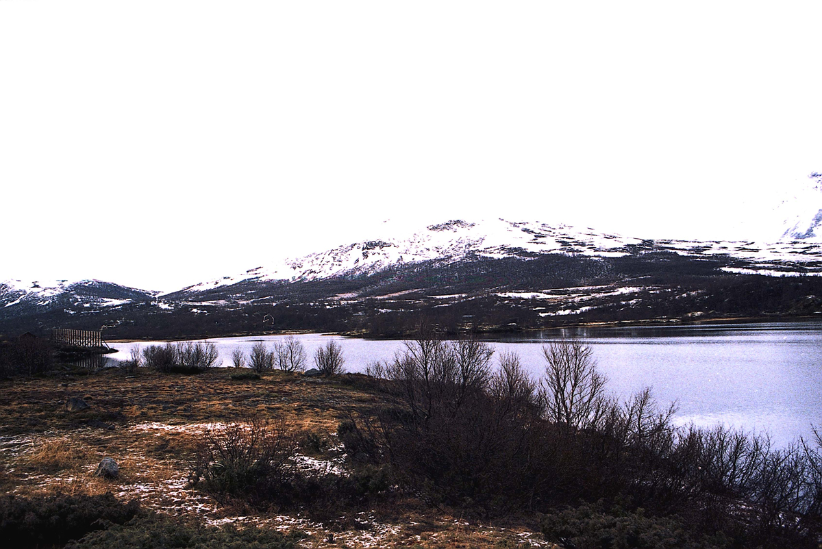
Dovrefjell–Sunndalsfjella National Park  Dovrefjell in late autumn
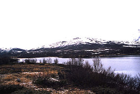
Location Oppland, Sør-Trøndelag, and Møre og Romsdal, Norway Nearest city Trondheim Coordinates 62°23′48″N 9°10′23″E / 62.39667°N 9.17306°ECoordinates: 62°23′48″N 9°10′23″E / 62.39667°N 9.17306°E[1] Area 1,693 km2 (654 sq mi) Established May 3, 2002 Governing body Dovrefjellrådet (Dovrefjell Council) Dovrefjell–Sunndalsfjella National Park is a National Park in Norway. It was founded in 2002 to replace and enlarge the former Dovrefjell National Park, originally founded in 1974. It occupies 1,693 km² and encompasses areas in three Norwegian counties: Oppland, Sør-Trøndelag, and Møre og Romsdal and includes large parts of the mountain range of Dovrefjell.
Contents
Ecology
The National Park was established to
- preserve a large, continuous and essentially untouched mountain area,
- preserve an alpine ecosystem with its natural biodiversity,
- preserve an important part of the range of the stocks of wild reindeer in Snøhetta and Knutshø,
- safeguard a variation in habitats,
- preserve the landscape morphology and its distinctive geological deposits,
- protect cultural heritage.
The public do have access to experience the nature through the exercise of the traditional and simple outdoor life, with technical infrastructure only established to a very modest extent.[2]In short: To preserve an intact alpine ecosystem with its indigenous wild reindeer. Together with the reindeer in Rondane National Park the last remaining population of wild Fennoscandian reindeer of Beringia origin (other wild Norwegian reindeer are of European origin and have interbred with domesticated reindeer to a various extent), wolverine, and various large birds as golden eagle and gyrfalcon can be seen, and also the recently (1930s) imported (and potentially dangerous) musk oxen. Some of the plant life predates the last ice age.
Although it is a harsh environment, the mountains, the highest being Snøhetta at 2,286 m, make for spectacular hiking during the summer and skiing in the winter. Due to rather long walks between mostly unstaffed huts, great areas without huts and trails and harsh and unstable weather conditions, this area is recommended for experienced and well-equipped wanderers only.
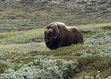 Musk ox in Dovre-Sunndalsfjella National Park.
Administration
The park is divided into a major western part and a minor eastern part by the European route E6 paralleled with the main railway between Oslo and Trondheim. Altogether the protected area amounts 4,365 km² and also includes areas in the county of Hedmark in addition to the three of the National Park.
The Park as well as it's five adjacent landscape protection areas and two biotope protected areas are managed by the National Park Board for Dovrefjell. This is a Governmental board, the members are from the same 8 municipalities and 4 counties as the former Dovrefjell Council, nominated by those and finally appointed by the Ministry for the Environment.
The former management model from July 2003 was a trial intended to last until July 2007. The final decision on the permanent management model was made in August 2010[3] and the new board was formally established on January 4th, 2011. The members are much the same persons (local mayors) as in the Dovrefjell council and one may still consider Dovrefjell-Sunndalsfjella National Park as being managed locally.
From 2007 up to 2011 the Dovrefjell Council did manage the National Park and co-ordinated the management of the other areas. The council consists of the eight involved municipalities and four counties, with political representatives, usually the mayors, elected by the members. Except for the National Park, the conservation areas were managed by the actual municipality / municipalities (some PAs comprises more than one municipality). The council has still the responsibility for coordinating regional planning and society development, mainly through the European Charter for Sustainable Tourism of The EUROPARC Federation. The council itself works to transfer also this tasks to the new board, but until now the Government has been reluctant.
References
- ^ Approx geographic centre
- ^ Cited & translated from the regulations of the park
- ^ letter from the Secretary of Environment to the Dovrefjell municipalities, August 11th, 2010 m%20nytt%20verneomr%C3%%5D A5destyre%20NETT.pdf Letter on new administration
See also
- Dovre National Park
- List of national parks of Norway
- Tourism in Norway
- Norwegian Mountain Touring Association
External links
- Dovrefjellrådet - the Dovrefjell Council. Management, information about regulations and restrictions, animal and plan life, outdoor life, etc. Norwegian text only.
- [1] Park regulations
- The park in Brief Norwegian Government's pages on the park - alas, the English page is down at present
- Map Interactive map of the Park and surrounding areas
- Turistforeningen Home pages of Norwegian Mountain Touring Association
- Norwegian Academy of Science: Dovre
Mainland Ånderdalen · Blåfjella–Skjækerfjella · Breheimen · Børgefjell · Dovre · Dovrefjel–Sunndalsfjella · Femundsmarka · Folgefonna · Forollhogna · Gutulia · Hallingskarvet · Hardangervidda · Jostedalsbreen · Jotunheimen · Junkerdal · Langsua · Lierne · Lomsdal–Visten · Møysalen · Øvre Anárjohka · Øvre Dividal · Øvre Pasvik · Rago · Reinheimen · Reisa · Rohkunborri · Rondane · Saltfjellet–Svartisen · Seiland · Sjunkhatten · Skarvan and Roltdalen · Stabbursdalen · Varangerhalvøya · Ytre Hvaler
Svalbard Forlandet · Indre Wijdefjorden · Nordenskiöld Land · Nordre Isfjorden · Nordvest-Spitsbergen · Sassen – Bünsow Land · Sør-SpitsbergenFormer Categories:- IUCN Category II
- National parks of Norway
- Protected areas established in 2002
- Protected areas of Oppland
- Protected areas of Sør-Trøndelag
- Protected areas of Møre og Romsdal
- Visitor attractions in Oppland
- Visitor attractions in Sør-Trøndelag
- Visitor attractions in Møre og Romsdal
- 2002 establishments in Norway


Wikimedia Foundation. 2010.