- Øvre Dividal National Park
-
Øvre Dividal National Park Øvre Dividal nasjonalpark IUCN Category II (National Park) Autumn colors in Dividal near the Anjajohka river
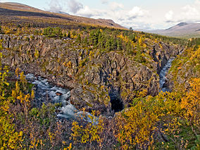
Location Målselv, Troms, Norway Nearest city Narvik Coordinates 68°38′N 19°52′E / 68.633°N 19.867°ECoordinates: 68°38′N 19°52′E / 68.633°N 19.867°E Area 750 km2 (290 sq mi) Established 9 July 1971 Governing body Directorate for Nature Management Øvre Dividal National Park (Northern Sami: Dieváidvuovddi álbmotmeahcci) lies in Målselv in Troms county, Norway. The park was opened in 1971 and has an area of 750 square kilometres (290 sq mi). The original intention was to preserve a very little disturbed inland valley and mountain area. The hiking trail Nordkalottruta passes through the national park.[1]
Contents
Name
The first element in the name Dividal is from Sami dievvá which means 'round and dry hill'. The last element is from the Norwegian word dal which means 'dale' or 'valley'. The word øvre means 'upper' in Norwegian, thus 'the upper part of Dividal'.
Nature
Flora
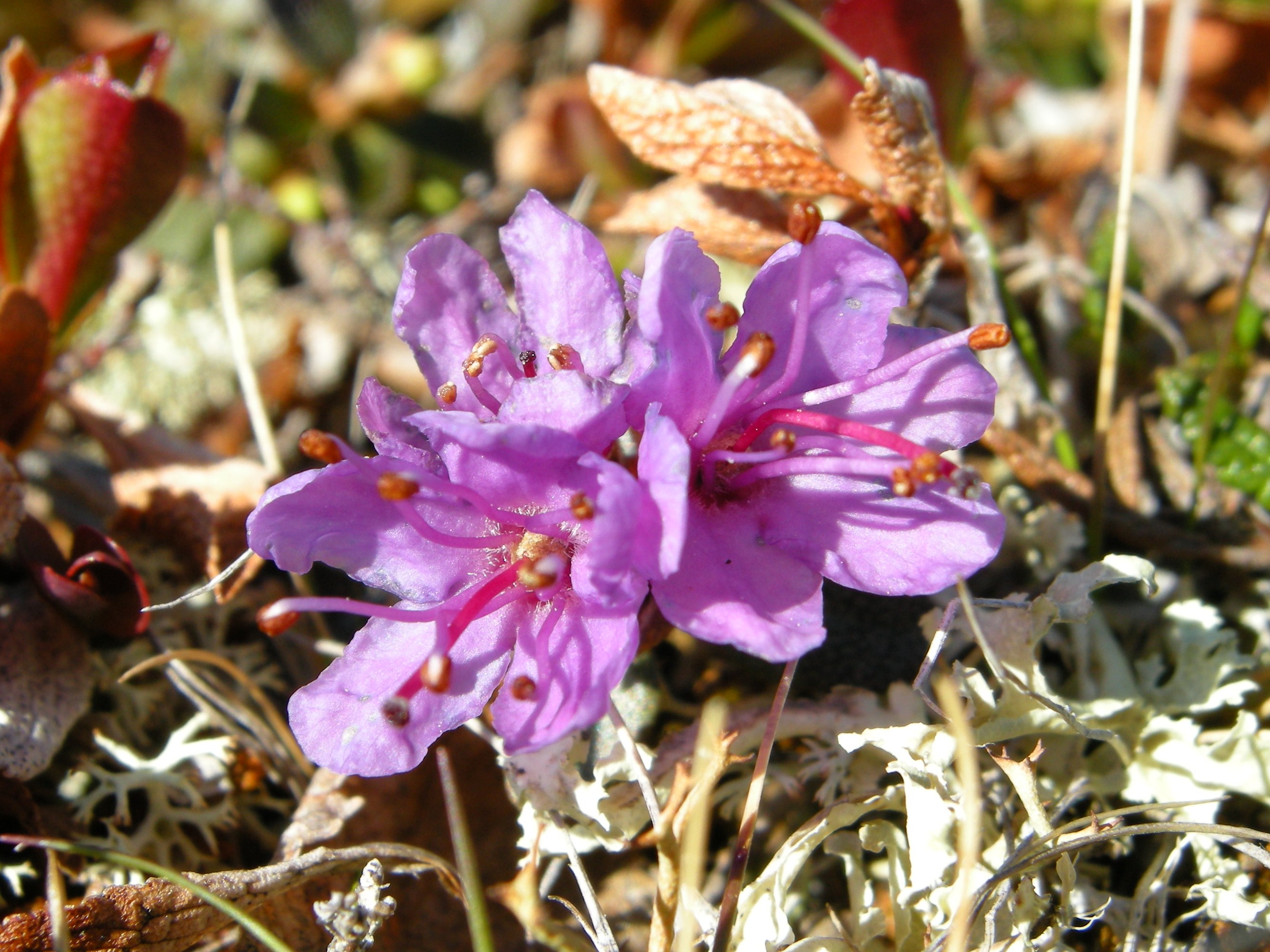
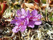 Arctic Rhododendron (Rhododendron lapponica)
Pine forests at the lowest elevations give way to mountain birch higher up, and finally willow and dwarf birch on the open alpine tundra. Some grey alder (Alnus Incata) grows along the Divi river. A total of 315 plant species have been recorded. Rhododendron (Rhododendron Lapponica) grows naturally in the area.
Fauna
All large predators on the mainland are represented in the park (brown bear, wolf, wolverine, lynx), although wolf is rare and probably has no permanent presence. The wolverine is especially numerous in this area. Reindeer (Sami owned) are common, as are moose, and the arctic fox used to be living in the area.
Climate
At 228 m (748 ft) above sea level, Dividalen is the second driest valley in Norway, with average annual precipitation only 282 millimetres (11.1 in). The monthly 24-hr averages for the same location varies form −9 °C (16 °F) in January to 13 °C (55 °F) in July with a mean annual of 0.8 °C (33.4 °F). There is no permafrost in the lower elevations of the park. At altitudes above 700 metres (2,300 ft), permafrost is common. The Øvre Dividal National Park starts at an elevation of about 300 m (980 ft) and reaches up to 1,600 m (5,200 ft). Together with areas in bordering Sweden, as well as almost undisturbed areas nearby in Norway, this park is part of a larger wilderness area.
Geology
The bedrock consists of conglomerate, sandstone and slate. Several rivers have carved ravines. A peculiarity is large rocks placed at unlikely locations. These were carried by the ice age glaciers, and deposited randomly at the end of the ice age.
References
- ^ Store norske leksikon. "Øvre Dividal nasjonalpark" (in Norwegian). http://www.snl.no/%C3%98vre_Dividal_nasjonalpark. Retrieved 2010-04-09.
External links
 Media related to Øvre Dividal National Park at Wikimedia Commons
- English language information about Øvre-Dividal-National park
- Unep: About Øvre Dividal National Park
National parks of Norway Mainland Ånderdalen · Blåfjella–Skjækerfjella · Breheimen · Børgefjell · Dovre · Dovrefjel–Sunndalsfjella · Femundsmarka · Folgefonna · Forollhogna · Gutulia · Hallingskarvet · Hardangervidda · Jostedalsbreen · Jotunheimen · Junkerdal · Langsua · Lierne · Lomsdal–Visten · Møysalen · Øvre Anárjohka · Øvre Dividal · Øvre Pasvik · Rago · Reinheimen · Reisa · Rohkunborri · Rondane · Saltfjellet–Svartisen · Seiland · Sjunkhatten · Skarvan and Roltdalen · Stabbursdalen · Varangerhalvøya · Ytre Hvaler
Svalbard Forlandet · Indre Wijdefjorden · Nordenskiöld Land · Nordre Isfjorden · Nordvest-Spitsbergen · Sassen – Bünsow Land · Sør-SpitsbergenFormer Categories:- IUCN Category II
- National parks of Norway
- Protected areas established in 1971
- Protected areas of Troms
- Visitor attractions in Troms
- 1971 establishments in Norway


Wikimedia Foundation. 2010.