- Dakpathar Barrage
-
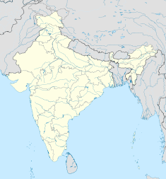
Dakpathar Barrage Location of Dakpathar Barrage Country India Location Dakpathar Coordinates 30°30′14″N 77°47′41″E / 30.50389°N 77.79472°ECoordinates: 30°30′14″N 77°47′41″E / 30.50389°N 77.79472°E Owner(s) Uttarakhand Jal Vidyut Nigam Dam and spillways Length 516.5 m (1,695 ft) Type of spillway Gate-controlled, 25-gates Power station Commission date 1965 Turbines Dhakrani: 3 x 11.25 MW Kaplan-type 3 x 17 MW Francis-type Installed capacity Dhakrani: 33.75 MW
Dhalipur: 51 MWThe Dakpathar Barrage is a concrete barrage across the Yamuna River adjacent to Dakpathar in Uttarakhand, India. In a run-of-the-river scheme, the barrage serves to divert water into the East Yamuna Canal for hydroelectric power production at the Dhakrani and Dhalipur Power Plants. The foundation stone for the dam was laid on 23 May 1949 by India's Prime Minister Jawaharlal Nehru.[1] The project was delayed due to funding and both power stations were commissioned in 1965. The barrage is controlled by 25 floodgates and has a length of 516.5 m (1,695 ft).[2]
The entrance to the canal is directly behind the dam on its left bank. After traveling 10 km (6 mi), water reaches the Dhakrani Power Plant at 30°27′21″N 77°44′10″E / 30.45583°N 77.73611°E and is utilized for power production. The 33.75 MW power plant contains three 11.25 MW Kaplan turbine-generators and has a design hydraulic head of 4 km (2 mi) along the canal before reaching the 51 MW Dhalipur Power Plant at 30°26′07″N 77°40′54″E / 30.43528°N 77.68167°E. This power plant contains three 17 MW Francis turbine-generators and has a design head of 30.48 m (100 ft). Both power plants were commissioned in 1965 and have a design discharge of 199 m3/s (7,028 cu ft/s). Water discharged from the Dhalipur Power Plant continues along the canal until it reaches the reservoir of the Asan Barrage.[3][4]
See also
- List of power stations in India
References
- ^ The National geographical journal of India, Volume 2. National Geographical Society of India. 1956. pp. 66. http://books.google.com/books?ei=DH8ZTrP_J4PnmAXQtKEf&ct=result&id=AhUsAAAAMAAJ&dq=dakpathar+barrage+nehru&q=Dak+Pathar#search_anchor.
- ^ Haberman, David L. (2006). River of love in an age of pollution : the Yamuna River of Northern India. Berkeley (Calif.): University of California press. pp. 65. ISBN 0520247892. http://books.google.com/books?id=63uDsPPr48gC&dq=dakpathar+barrage&source=gbs_navlinks_s.
- ^ "Dhalipur Power Plant (3x17=51 MW)". Uttarakhand Jal Vidyut Nigam Limited. http://www.uttarakhandjalvidyut.com/dhalipur.htm. Retrieved 10 July 2011.
- ^ "Dhakrani Power Plant (3x11.25=33.75 MW)". Uttarakhand Jal Vidyut Nigam Limited. http://www.uttarakhandjalvidyut.com/dhakrani.htm. Retrieved 10 July 2011.
Hydrology of Uttarakhand Rivers Lakes Dams/ Barrages Asan Barrage • Bhali Dam • Bhimgoda Barrage • Dakpathar Barrage • Ichari Dam • Koteshwar Dam • Maneri Dam • Pashulok Barrage • Ramganga Dam • Tehri DamGlaciers Gangotri • Kafni • Kalabaland • Meola • Milam • Namik • Panchchuli • Pindari • Ralam • Satopanth • SonaRelated topics GomukhCategories:- Dams in Uttarakhand
- Hydroelectric power stations in India
- Barrages
- Run-of-the-river power stations
- Yamuna River
- Dehradun district
Wikimedia Foundation. 2010.

