- Ichari Dam
-
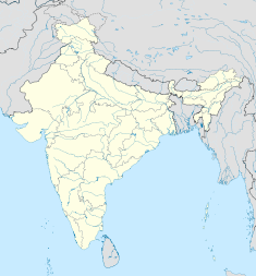
Ichari Dam Location of Ichari Dam Country India Location Dakpathar Coordinates 30°36′49″N 77°47′28″E / 30.61361°N 77.79111°ECoordinates: 30°36′49″N 77°47′28″E / 30.61361°N 77.79111°E Status Operational Opening date 1972 Owner(s) Uttarakhand Jal Vidyut Nigam Ltd (UJVN) Dam and spillways Type of dam Gravity Height 59 m (194 ft)[1] Length 155 m (509 ft) Volume 181,000 m3 (236,739 cu yd) Impounds Tons River Spillway capacity 13,500 m3/s (476,748 cu ft/s) Reservoir Creates Ichari Reservoir Capacity 8,930,000 m3 (7,240 acre·ft) Active capacity 5,110,000 m3 (4,143 acre·ft) Surface area 8 km2 (3 sq mi) Power station Commission date Chibro: 1975
Khodri: 1984Hydraulic head Chibro: 110 m (361 ft)
Khodri: 57.9 m (190 ft)Turbines Chibro: 4 x 60 MW Francis-type
Khodri: 4 x 30 MW Francis-typeInstalled capacity Chibro: 240 MW
Khodri: 120 MWThe Ichari Dam is a concrete gravity dam on the Tons River 13 km (8 mi) north of Dakpathar in Uttarakhand, India. The primary purpose of the dam is hydroelectric power production and it is a run-of-the-river-type. It was completed in 1972. The dam diverts water to the Chibro Power Station (240 MW) which is then returned to the Tons River before being fed to the Khodri Power Station (120 MW).
Contents
Design and operation
The dam is a 59 m (194 ft) tall and 155 m (509 ft) long concrete gravity type with a structural volume of 181,000 m3 (236,739 cu yd). The dam's spillway is located across its crest and is controlled by seven floodgates. It has a maximum discharge capacity of 13,500 m3/s (476,748 cu ft/s). The dam's reservoir has a 8,930,000 m3 (7,240 acre·ft) capacity, of which 5,110,000 m3 (4,143 acre·ft) is active (or "useful") capacity. The surface area of the reservoir is 8 km2 (3 sq mi).[2]
Chibro Power Plant
Adjacent to the dam and on its left bank, water is diverted into a 6.2 km (4 mi) head-race tunnel which leads south to the underground power station at 30°33′23″N 77°47′53″E / 30.55639°N 77.79806°E. There, the water powers four 60 MW Francis turbine-generators. The design hydraulic head of the station is 110 m (361 ft) and its design discharge is 200 m3/s (7,063 cu ft/s). The plant was commissioned in 1975 and was the first power plant built underground in Northern India.[3]
Khodri Power Plant
Water discharged from the Chibro Power Plant is returned into the Tons River just 100 m (328 ft) upstream of the intake for the Khodri Power Station. Water enters the intake and then travels south down a 7.5 km (5 mi) head-race tunnel which leads to the power station on the Yamuna River at 30°30′30″N 77°47′59″E / 30.50833°N 77.79972°E. There, the water powers four 30 MW Francis turbine-generators before being discharged into a tail-race channel behind the Dakpathar Barrage. The design hydraulic head of the station is 57.9 m (190 ft) and its design discharge is 200 m3/s (7,063 cu ft/s). The plant was commissioned in January 1984.[4]
See also
- List of power stations in India
References
- ^ "Anchoring slopes in the Himalayas". International Water Power & Dam Construction. 16 January 2008. http://www.waterpowermagazine.com/story.asp?sectionCode=46&storyCode=2048373. Retrieved 10 July 2011.
- ^ "India: National Register of Large Dams 2009". Central Water Commission. http://www.cwc.nic.in/main/downloads/National%20Register%20of%20Large%20Dams%202009.pdf. Retrieved 10 July 2011.
- ^ "Chibro Power Plant (4x60=240MW)". Uttaranchal Jal Vidyut Nigam Limited. http://www.uttarakhandjalvidyut.com/chibro.htm. Retrieved 10 July 2011.
- ^ "Khodri Power Plant (4x30=120 MW)". Uttaranchal Jal Vidyut Nigam Limited. http://www.uttarakhandjalvidyut.com/khodri.htm. Retrieved 10 July 2011.
Hydrology of Uttarakhand Rivers Lakes Dams/ Barrages Asan Barrage • Bhali Dam • Bhimgoda Barrage • Dakpathar Barrage • Ichari Dam • Koteshwar Dam • Maneri Dam • Pashulok Barrage • Ramganga Dam • Tehri DamGlaciers Gangotri • Kafni • Kalabaland • Meola • Milam • Namik • Panchchuli • Pindari • Ralam • Satopanth • SonaRelated topics GomukhCategories:- Dams in Uttarakhand
- Hydroelectric power stations in India
- Run-of-the-river power stations
- Gravity dams
Wikimedia Foundation. 2010.

