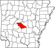
- Crows, Arkansas
-
Crows, Arkansas — Unincorporated community — Crows's position in Arkansas. Coordinates: 34°36′51″N 92°46′10″W / 34.61417°N 92.76944°WCoordinates: 34°36′51″N 92°46′10″W / 34.61417°N 92.76944°W Country  United States
State  Arkansas
County Saline Township Dyer Elevation[1] 125 m (410 ft) Time zone Central (CST) (UTC-6) – Summer (DST) CDT (UTC-5) Zip Code Area code(s) 870 GNIS feature ID 48236 U.S. Geological Survey Geographic Names Information System: Crows, Arkansas Crows is an unincorporated community in Dyer Township, Saline County, Arkansas, United States.[2] It is located at the intersection of Arkansas Highway 5 and Arkansas Highway 9.[3]
References
- ^ "Crows, Arkansas." Histopolis Retrieved June 25, 2011.
- ^ "Feature Detail Report for: Crows, Arkansas." USGS. U.S. Geological Survey Geographic Names Information System: Crows, Arkansas Retrieved June 25, 2011.
- ^ DeLorme. Arkansas Atlas and Gazetteer (Map) (Second ed.). Section 49.
Municipalities and communities of Saline County, Arkansas Cities Benton | Bryant | Haskell | Shannon Hills
Towns CDPs Avilla | East End | Hot Springs Village‡ | Salem
Unincorporated
communitiesFootnotes ‡This populated place also has portions in an adjacent county or counties
Categories:- Populated places in Saline County, Arkansas
- Unincorporated communities in Arkansas
- Arkansas geography stubs
Wikimedia Foundation. 2010.


