- East End, Arkansas
Infobox Settlement
official_name = East End, Arkansas
settlement_type = CDP
imagesize =
image_caption =
image_
imagesize =
image_caption =
image_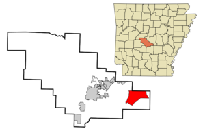
mapsize = 250px
map_caption = Location in Saline County and the state ofArkansas
mapsize1 =
map_caption1 =
subdivision_type = Country
subdivision_type1 = State
subdivision_type2 = County
subdivision_name =United States
subdivision_name1 =Arkansas
subdivision_name2 = Saline
government_type =
leader_title =
leader_name =
established_date =
area_magnitude =
area_total_km2 = 52.7
area_total_sq_mi = 20.3
area_land_km2 = 52.1
area_land_sq_mi = 20.1
area_water_km2 = 0.6
area_water_sq_mi = 0.2
elevation_ft = 351
elevation_m = 107
population_as_of = 2000
population_footnotes =
population_total = 5623
population_metro =
population_density_km2 = 106.7
population_density_sq_mi = 277
timezone = Central (CST)
utc_offset = -6
latd = 34 |latm = 33 |lats = 2 |latNS = N
longd = 92 |longm = 20 |longs = 8 |longEW = W
timezone_DST = CDT
utc_offset_DST = -5
postal_code_type =ZIP code
postal_code = 72065,72206,and 72103
area_code = 501
blank_name = FIPS code
blank_info = 05-20470
blank1_name = GNIS feature ID
blank1_info = 0048757
footnotes =
website =East End, also referred to as "Double E",fact|date=March 2008 is a
census-designated place (CDP) in Saline County,Arkansas ,United States . The population was 5,623 at the 2000 census. It is part of the Little Rock–North Little Rock–Conway Metropolitan Statistical Area.Geography
East End is located at coor dms|34|33|2|N|92|20|8|W|city (34.550639, -92.335662)GR|1.
According to the
United States Census Bureau , the CDP has a total area of 20.3square mile s (52.7km² ), of which, 20.1 square miles (52.1 km²) of it is land and 0.2 square miles (0.6 km²) of it (1.13%) is water.Demographics
As of the
census GR|2 of 2000, there were 5,623 people, 2,049 households, and 1,643 families residing in the CDP. Thepopulation density was 279.6 people per square mile (108.0/km²). There were 2,170 housing units at an average density of 107.9/sq mi (41.7/km²). The racial makeup of the CDP was 95.87% White, 0.87% Black or African American, 0.66% Native American, 0.87% Asian, 0.05% Pacific Islander, 0.32% from other races, and 1.35% from two or more races. 1.28% of the population were Hispanic or Latino of any race.There were 2,049 households out of which 41.0% had children under the age of 18 living with them, 67.1% were married couples living together, 9.2% had a female householder with no husband present, and 19.8% were non-families. 15.9% of all households were made up of individuals and 4.1% had someone living alone who was 65 years of age or older. The average household size was 2.74 and the average family size was 3.06.
In the CDP the population was spread out with 28.1% under the age of 18, 7.7% from 18 to 24, 33.4% from 25 to 44, 24.4% from 45 to 64, and 6.4% who were 65 years of age or older. The median age was 34 years. For every 100 females there were 103.0 males. For every 100 females age 18 and over, there were 98.8 males.
The median income for a household in the CDP was $46,678, and the median income for a family was $49,649. Males had a median income of $31,396 versus $24,831 for females. The
per capita income for the CDP was $19,198. About 4.3% of families and 6.1% of the population were below thepoverty line , including 8.3% of those under age 18 and 7.7% of those age 65 or over.Education
East End's schools are part of the Sheridan School District. The East End schools include East End Elementary grades k-2nd and East End Intermediate Grades 3rd-6th. East End has recently been talking about building a junior high school. fact|date=April 2008
References
External links
* http://eastend-ar.com/
* http://www.city-data.com/city/East-End-Arkansas.html
* http://www.oureastend.com/index.html
* http://www.topix.com/city/east-end-ar
Wikimedia Foundation. 2010.