- Bauxite, Arkansas
Infobox Settlement
official_name = Bauxite, Arkansas
settlement_type =Town
imagesize =
image_caption =
image_
imagesize =
image_caption =
image_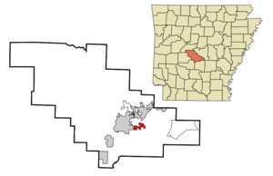
mapsize = 250px
map_caption = Location in Saline County and the state ofArkansas
mapsize1 =
map_caption1 =
subdivision_type = Country
subdivision_type1 = State
subdivision_type2 = County
subdivision_name =United States
subdivision_name1 =Arkansas
subdivision_name2 = Saline
government_type =
leader_title =
leader_name =
established_date =
area_magnitude =
area_total_km2 = 6.3
area_total_sq_mi = 2.5
area_land_km2 = 6.2
area_land_sq_mi = 2.4
area_water_km2 = 0.1
area_water_sq_mi = 0.1
elevation_ft = 344
elevation_m = 105
population_as_of = 2000
population_footnotes =
population_total = 432
population_metro =
population_density_km2 = 68.6
population_density_sq_mi = 172.8
timezone = Central (CST)
utc_offset = -6
latd = 34 |latm = 33 |lats = 33 |latNS = N
longd = 92 |longm = 30 |longs = 51 |longEW = W
timezone_DST = CDT
utc_offset_DST = -5
postal_code_type =ZIP code
postal_code = 72011
area_code = 501
blank_name = FIPS code
blank_info = 05-04090
blank1_name = GNIS feature ID
blank1_info = 0057342
footnotes =
website =Bauxite is a town in Saline County,
Arkansas ,United States . The population was 432 at the 2000 census. It is part of the Little Rock–North Little Rock–Conway Metropolitan Statistical Area. The town is named for the mineralbauxite , the source ore foraluminum , which was found in abundant quantities in the area and became a source of aluminum refining (two local roads are named Alcoa and Reynolds, after the major producers which later merged).Geography
Bauxite is located at coor dms|34|33|33|N|92|30|51|W|city (34.559107, -92.514038).GR|1
According to the
United States Census Bureau , the town has a total area of 6.3km² (2.5 mi²). 6.2 km² (2.4 mi²) of it is land and 0.2 km² (0.1 mi²) of it (2.45%) is water.Demographics
As of the
census GR|2 of 2000, there were 432 people, 161 households, and 127 families residing in the town. Thepopulation density was 69.8/km² (180.6/mi²). There were 171 housing units at an average density of 27.6/km² (71.5/mi²). The racial makeup of the town was 97.45% White, 0.69% Native American, 0.23% Asian, and 1.62% from two or more races. 2.31% of the population were Hispanic or Latino of any race.There were 161 households out of which 37.3% had children under the age of 18 living with them, 62.1% were married couples living together, 14.3% had a female householder with no husband present, and 20.5% were non-families. 17.4% of all households were made up of individuals and 10.6% had someone living alone who was 65 years of age or older. The average household size was 2.68 and the average family size was 3.05.
In the town the population was spread out with 25.9% under the age of 18, 7.6% from 18 to 24, 29.2% from 25 to 44, 24.8% from 45 to 64, and 12.5% who were 65 years of age or older. The median age was 37 years. For every 100 females there were 94.6 males. For every 100 females age 18 and over, there were 92.8 males.
The median income for a household in the town was $35,347, and the median income for a family was $37,153. Males had a median income of $28,500 versus $24,167 for females. The
per capita income for the town was $14,406. About 8.5% of families and 11.0% of the population were below thepoverty line , including 15.4% of those under age 18 and 11.3% of those age 65 or over.Noteworthy natives
*
Susan Dunn :Grammy Award winning operaticsoprano .References
External links
Wikimedia Foundation. 2010.