Macquarie County

Macquarie County
Macquarie
New South Wales
Macquarie NSW.PNG
Location in New South Wales
Lands administrative divisions around Macquarie
Vernon Dudley Pacific Ocean
Hawes Macquarie Pacific Ocean
Gloucester Gloucester Pacific Ocean

Macquarie County is one of the 141 Cadastral divisions of New South Wales, Australia. It is bordered to the north by the Apsley River, and to the south by the Manning River. It includes Port Macquarie and the area around it.

Macquarie County was named in honour of Governor Lachlan Macquarie (1762-1824).[1]

Parishes within this county

A full list of parishes found within this county; their current LGA and mapping coordinates to the approximate centre of each location is as follows:

Parish LGA Coordinates
Albert Port Macquarie-Hastings Council 31°20′54″S 152°30′04″E / 31.34833°S 152.50111°E / -31.34833; 152.50111 (Albert)
Arakoon Kempsey Shire Council 30°55′54″S 153°04′04″E / 30.93167°S 153.06778°E / -30.93167; 153.06778 (Arakoon)
Ballengarra Port Macquarie-Hastings Council 31°15′54″S 152°45′04″E / 31.265°S 152.75111°E / -31.265; 152.75111 (Ballengarra)
Barnard City of Greater Taree 31°36′54″S 152°07′04″E / 31.615°S 152.11778°E / -31.615; 152.11778 (Barnard)
Bellangry Port Macquarie-Hastings Council 31°17′54″S 152°28′04″E / 31.29833°S 152.46778°E / -31.29833; 152.46778 (Bellangry)
Beranghi Kempsey Shire Council 31°08′54″S 152°55′04″E / 31.14833°S 152.91778°E / -31.14833; 152.91778 (Beranghi)
Bobin City of Greater Taree 31°44′54″S 152°15′04″E / 31.74833°S 152.25111°E / -31.74833; 152.25111 (Bobin)
Bulga City of Greater Taree 31°36′54″S 152°17′04″E / 31.615°S 152.28444°E / -31.615; 152.28444 (Bulga)
Burrawan Port Macquarie-Hastings Council 31°29′54″S 152°46′04″E / 31.49833°S 152.76778°E / -31.49833; 152.76778 (Burrawan)
Burrawan Port Macquarie-Hastings Council 31°30′54″S 152°47′04″E / 31.515°S 152.78444°E / -31.515; 152.78444 (Burrawan)
Cairncross Port Macquarie-Hastings Council 31°20′54″S 152°44′04″E / 31.34833°S 152.73444°E / -31.34833; 152.73444 (Cairncross)
Camden Haven City of Greater Taree 31°37′54″S 152°44′04″E / 31.63167°S 152.73444°E / -31.63167; 152.73444 (Camden Haven)
Cogo Port Macquarie-Hastings Council 31°17′54″S 152°38′04″E / 31.29833°S 152.63444°E / -31.29833; 152.63444 (Cogo)
Comboyne Port Macquarie-Hastings Council 31°37′54″S 152°30′04″E / 31.63167°S 152.50111°E / -31.63167; 152.50111 (Comboyne)
Cowangara Port Macquarie-Hastings Council 31°29′54″S 152°29′04″E / 31.49833°S 152.48444°E / -31.49833; 152.48444 (Cowangara)
Cowangara Port Macquarie-Hastings Council 31°29′54″S 152°30′04″E / 31.49833°S 152.50111°E / -31.49833; 152.50111 (Cowangara)
Cundle City of Greater Taree 31°50′54″S 152°33′04″E / 31.84833°S 152.55111°E / -31.84833; 152.55111 (Cundle)
Dawson City of Greater Taree 31°46′54″S 152°25′04″E / 31.78167°S 152.41778°E / -31.78167; 152.41778 (Dawson)
Dawson City of Greater Taree 31°47′54″S 152°28′04″E / 31.79833°S 152.46778°E / -31.79833; 152.46778 (Dawson)
Debenham Port Macquarie-Hastings Council 31°29′54″S 152°15′04″E / 31.49833°S 152.25111°E / -31.49833; 152.25111 (Debenham)
Ellenborough Port Macquarie-Hastings Council 31°29′54″S 152°23′04″E / 31.49833°S 152.38444°E / -31.49833; 152.38444 (Ellenborough)
Forbes Port Macquarie-Hastings Council 31°16′54″S 152°23′04″E / 31.28167°S 152.38444°E / -31.28167; 152.38444 (Forbes)
Graeme Port Macquarie-Hastings Council 31°26′54″S 152°08′04″E / 31.44833°S 152.13444°E / -31.44833; 152.13444 (Graeme)
Harrington City of Greater Taree 31°49′54″S 152°41′04″E / 31.83167°S 152.68444°E / -31.83167; 152.68444 (Harrington)
Innes Port Macquarie-Hastings Council 31°32′54″S 152°24′04″E / 31.54833°S 152.40111°E / -31.54833; 152.40111 (Innes)
Jasper Port Macquarie-Hastings Council 31°20′54″S 152°17′04″E / 31.34833°S 152.28444°E / -31.34833; 152.28444 (Jasper)
Johns River Port Macquarie-Hastings Council 31°40′54″S 152°42′04″E / 31.68167°S 152.70111°E / -31.68167; 152.70111 (Johns River)
Kempsey Kempsey Shire Council 31°03′54″S 152°55′04″E / 31.065°S 152.91778°E / -31.065; 152.91778 (Kempsey)
Kerewong Port Macquarie-Hastings Council 31°37′54″S 152°23′04″E / 31.63167°S 152.38444°E / -31.63167; 152.38444 (Kerewong)
Khatambuhl City of Greater Taree 31°46′54″S 151°58′04″E / 31.78167°S 151.96778°E / -31.78167; 151.96778 (Khatambuhl)
Killawarra City of Greater Taree 31°53′54″S 152°17′04″E / 31.89833°S 152.28444°E / -31.89833; 152.28444 (Killawarra)
Kinchela Kempsey Shire Council 31°02′54″S 153°00′04″E / 31.04833°S 153.00111°E / -31.04833; 153.00111 (Kinchela)
Kindee Port Macquarie-Hastings Council 31°20′54″S 152°23′04″E / 31.34833°S 152.38444°E / -31.34833; 152.38444 (Kindee)
Kippara Port Macquarie-Hastings Council 31°11′54″S 152°29′04″E / 31.19833°S 152.48444°E / -31.19833; 152.48444 (Kippara)
Knorrit City of Greater Taree 31°48′54″S 152°07′04″E / 31.815°S 152.11778°E / -31.815; 152.11778 (Knorrit)
Kokomerican City of Greater Taree 31°32′54″S 152°08′04″E / 31.54833°S 152.13444°E / -31.54833; 152.13444 (Kokomerican)
Koree Port Macquarie-Hastings Council 31°27′54″S 152°43′04″E / 31.465°S 152.71778°E / -31.465; 152.71778 (Koree)
Koree Port Macquarie-Hastings Council 31°28′54″S 152°40′04″E / 31.48167°S 152.66778°E / -31.48167; 152.66778 (Koree)
Lansdowne City of Greater Taree 31°44′54″S 152°34′04″E / 31.74833°S 152.56778°E / -31.74833; 152.56778 (Lansdowne)
Lewis City of Greater Taree 31°49′54″S 152°12′04″E / 31.83167°S 152.20111°E / -31.83167; 152.20111 (Lewis)
Lincoln Kempsey Shire Council 31°12′54″S 152°52′04″E / 31.215°S 152.86778°E / -31.215; 152.86778 (Lincoln)
Lorne City of Greater Taree 31°36′54″S 152°35′04″E / 31.615°S 152.58444°E / -31.615; 152.58444 (Lorne)
Mackay City of Greater Taree 31°39′54″S 152°01′04″E / 31.665°S 152.01778°E / -31.665; 152.01778 (Mackay)
Macquarie Port Macquarie-Hastings Council 31°26′54″S 152°50′04″E / 31.44833°S 152.83444°E / -31.44833; 152.83444 (Macquarie)
Marlee City of Greater Taree 31°44′54″S 152°21′04″E / 31.74833°S 152.35111°E / -31.74833; 152.35111 (Marlee)
Marsh City of Greater Taree 31°41′54″S 152°21′04″E / 31.69833°S 152.35111°E / -31.69833; 152.35111 (Marsh)
Moorabark Port Macquarie-Hastings Council 31°14′54″S 152°16′04″E / 31.24833°S 152.26778°E / -31.24833; 152.26778 (Moorabark)
Morton Port Macquarie-Hastings Council 31°11′54″S 152°25′04″E / 31.19833°S 152.41778°E / -31.19833; 152.41778 (Morton)
Myall City of Greater Taree 31°34′54″S 152°15′04″E / 31.58167°S 152.25111°E / -31.58167; 152.25111 (Myall)
Oxley City of Greater Taree 31°54′54″S 152°35′04″E / 31.915°S 152.58444°E / -31.915; 152.58444 (Oxley)
Palmerston Kempsey Shire Council 31°14′54″S 152°55′04″E / 31.24833°S 152.91778°E / -31.24833; 152.91778 (Palmerston)
Pappinbarra Port Macquarie-Hastings Council 31°23′54″S 152°36′04″E / 31.39833°S 152.60111°E / -31.39833; 152.60111 (Pappinbarra)
Prospect Port Macquarie-Hastings Council 31°16′54″S 152°49′04″E / 31.28167°S 152.81778°E / -31.28167; 152.81778 (Prospect)
Queens Lake Port Macquarie-Hastings Council 31°33′54″S 152°48′04″E / 31.565°S 152.80111°E / -31.565; 152.80111 (Queens Lake)
Ralfe Port Macquarie-Hastings Council 31°33′54″S 152°42′04″E / 31.565°S 152.70111°E / -31.565; 152.70111 (Ralfe)
Redbank Port Macquarie-Hastings Council 31°24′54″S 152°44′04″E / 31.415°S 152.73444°E / -31.415; 152.73444 (Redbank)
Rowley City of Greater Taree 31°41′54″S 152°07′04″E / 31.69833°S 152.11778°E / -31.69833; 152.11778 (Rowley)
Stewart City of Greater Taree 31°44′54″S 152°42′04″E / 31.74833°S 152.70111°E / -31.74833; 152.70111 (Stewart)
Taree City of Greater Taree 31°51′54″S 152°41′04″E / 31.865°S 152.68444°E / -31.865; 152.68444 (Taree)
Tinebank Port Macquarie-Hastings Council 31°12′54″S 152°40′04″E / 31.215°S 152.66778°E / -31.215; 152.66778 (Tinebank)
Torrens Port Macquarie-Hastings Council 31°19′15″S 152°54′27″E / 31.32083°S 152.9075°E / -31.32083; 152.9075 (Torrens)
Vernon Walcha Council 31°08′54″S 152°15′04″E / 31.14833°S 152.25111°E / -31.14833; 152.25111 (Vernon)
Walibree Port Macquarie-Hastings Council 31°32′54″S 152°32′04″E / 31.54833°S 152.53444°E / -31.54833; 152.53444 (Walibree)
Walibree Port Macquarie-Hastings Council 31°33′54″S 152°30′04″E / 31.565°S 152.50111°E / -31.565; 152.50111 (Walibree)
Wingham City of Greater Taree 31°50′54″S 152°21′04″E / 31.84833°S 152.35111°E / -31.84833; 152.35111 (Wingham)
Wyoming City of Greater Taree 31°50′54″S 152°11′04″E / 31.84833°S 152.18444°E / -31.84833; 152.18444 (Wyoming)
Yarratt City of Greater Taree 31°42′54″S 152°23′04″E / 31.715°S 152.38444°E / -31.715; 152.38444 (Yarratt)

References

  1. ^ Geographical Names Board of NSW

Wikimedia Foundation. 2010.

Игры ⚽ Поможем написать реферат

Look at other dictionaries:

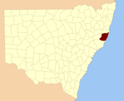
  • Macquarie County, New South Wales — Infobox Australian cadastral name = Macquarie state = New South Wales caption = Location in New South Wales near nw = Vernon near n = Dudley near ne = Pacific Ocean near e = Pacific Ocean near se = Pacific Ocean near s = Gloucester near sw =… …   Wikipedia

  • Macquarie — may refer to:* Division of Macquarie , an electoral district in the Australian House of Representatives in New South Wales * Macquarie, Australian Capital Territory, a suburb of Canberra, Australia * Macquarie Group, an Australian company,… …   Wikipedia

  • Port Macquarie, New South Wales — Infobox Australian Place | type = town name = Port Macquarie state = nsw caption = Location of Port Macquarie in New South Wales (red) lga = Port Macquarie Hastings Council county = Macquarie postcode = 2444 pop = 39,219 (2006)Census 2006 AUS |… …   Wikipedia

  • Northumberland County, New South Wales — Map of all coordinates from Google Map of all coordinates from Bing Export all coordinates as KML …   Wikipedia

  • Electoral district of Bathurst (County) — Bathurst (County) was an electoral district of the Legislative Assembly in the Australian state of New South Wales, named after Bathurst County and including the rural part of the county. Bathurst town was included in Western Boroughs, until… …   Wikipedia

  • Hawes County — Map of all coordinates from Google Map of all coordinates from Bing Export all coordinates as KML …   Wikipedia

  • Argyle County — Map of all coordinates from Google Map of all coordinates from Bing Export all coordinates as KML …   Wikipedia

  • Argyle County, New South Wales — Infobox Australian cadastral name = Argyle state = New South Wales caption = Location of Argyle near nw = Georgiana near n = Westmoreland near ne = Camden near w = King near e = St.Vincent near sw = Murray near s = Murray near se =… …   Wikipedia

  • Wellington County, New South Wales — Infobox Australian cadastral name = Wellington state = New South Wales caption = Location in New South Wales near nw = Gordon near n = Bligh near ne = Phillip near e = Roxburgh near se = Roxburgh near s = Bathurst near sw = Ashburnham near w =… …   Wikipedia

  • Gloucester County, New South Wales — Infobox Australian cadastral name = Gloucester state = New South Wales caption = Location in New South Wales near nw = Hawes near n = Macquarie near ne = Pacific Ocean near e = Pacific Ocean near se = Pacific Ocean near s = Northumberland near sw …   Wikipedia

Share the article and excerpts

Direct link
Do a right-click on the link above
and select “Copy Link”