Manara County

Manara County
Manara
New South Wales
Manara NSW.PNG
Location in New South Wales
Lands administrative divisions around Manara
Livingstone Woore Mossgiel
Perry Manara Mossgiel
Wentworth Kilfera Waljeers

Manara County is one of the 141 Cadastral divisions of New South Wales. It includes Ivanhoe.

Manara is believed to be derived from a local Aboriginal word and is also used for the nearby Manara Station.[1]

Parishes within this county

A full list of parishes found within this county; their current LGA and mapping coordinates to the approximate centre of each location is as follows:

Parish LGA Coordinates
Amoona Central Darling Shire 32°50′25″S 143°51′59″E / 32.84028°S 143.86639°E / -32.84028; 143.86639 (Amoona)
Baymore Balranald Shire 33°26′33″S 143°17′43″E / 33.4425°S 143.29528°E / -33.4425; 143.29528 (Baymore)
Billibah Balranald Shire 33°09′39″S 143°48′14″E / 33.16083°S 143.80389°E / -33.16083; 143.80389 (Billibah)
Bonton Central Darling Shire 32°38′35″S 143°53′35″E / 32.64306°S 143.89306°E / -32.64306; 143.89306 (Bonton)
Bonuna Central Darling Shire 32°37′49″S 144°14′49″E / 32.63028°S 144.24694°E / -32.63028; 144.24694 (Bonuna)
Burkett North Balranald Shire 33°33′06″S 143°16′45″E / 33.55167°S 143.27917°E / -33.55167; 143.27917 (Burkett North)
Burnaby Balranald Shire 33°16′11″S 143°36′48″E / 33.26972°S 143.61333°E / -33.26972; 143.61333 (Burnaby)
Casey Central Darling Shire 32°59′37″S 143°50′28″E / 32.99361°S 143.84111°E / -32.99361; 143.84111 (Casey)
Coonartha Central Darling Shire 32°34′13″S 143°43′39″E / 32.57028°S 143.7275°E / -32.57028; 143.7275 (Coonartha)
Darnick Central Darling Shire 32°52′15″S 143°41′04″E / 32.87083°S 143.68444°E / -32.87083; 143.68444 (Darnick)
Darwin Balranald Shire 33°15′30″S 144°08′10″E / 33.25833°S 144.13611°E / -33.25833; 144.13611 (Darwin)
Eildon Central Darling Shire 32°47′21″S 143°30′50″E / 32.78917°S 143.51389°E / -32.78917; 143.51389 (Eildon)
Gerathula Central Darling Shire 33°02′47″S 143°49′57″E / 33.04639°S 143.8325°E / -33.04639; 143.8325 (Gerathula)
Gol Gol Balranald Shire 33°32′37″S 143°24′43″E / 33.54361°S 143.41194°E / -33.54361; 143.41194 (Gol Gol)
Goondoola Balranald Shire 33°22′23″S 143°57′01″E / 33.37306°S 143.95028°E / -33.37306; 143.95028 (Goondoola)
Goorah Central Darling Shire 32°43′56″S 143°41′25″E / 32.73222°S 143.69028°E / -32.73222; 143.69028 (Goorah)
Griffin Balranald Shire 33°18′32″S 144°08′05″E / 33.30889°S 144.13472°E / -33.30889; 144.13472 (Griffin)
Gunarramby Balranald Shire 33°09′20″S 143°59′15″E / 33.15556°S 143.9875°E / -33.15556; 143.9875 (Gunarramby)
Kasserhill Wentworth Shire 33°02′59″S 143°28′50″E / 33.04972°S 143.48056°E / -33.04972; 143.48056 (Kasserhill)
Katabritoi Central Darling Shire 33°00′52″S 144°11′06″E / 33.01444°S 144.185°E / -33.01444; 144.185 (Katabritoi)
Khartoum Wentworth Shire 33°06′26″S 143°28′14″E / 33.10722°S 143.47056°E / -33.10722; 143.47056 (Khartoum)
Kilfera Central Darling Shire 32°35′45″S 144°04′38″E / 32.59583°S 144.07722°E / -32.59583; 144.07722 (Kilfera)
Leura Balranald Shire 33°11′53″S 143°37′45″E / 33.19806°S 143.62917°E / -33.19806; 143.62917 (Leura)
Manara Central Darling Shire unknown
Mandellman Balranald Shire 33°24′01″S 143°25′59″E / 33.40028°S 143.43306°E / -33.40028; 143.43306 (Mandellman)
Matheson Central Darling Shire 32°49′35″S 144°12′59″E / 32.82639°S 144.21639°E / -32.82639; 144.21639 (Matheson)
Moornanyah Central Darling Shire 33°06′05″S 143°59′47″E / 33.10139°S 143.99639°E / -33.10139; 143.99639 (Moornanyah)
Mulurula Balranald Shire 33°20′04″S 143°24′13″E / 33.33444°S 143.40361°E / -33.33444; 143.40361 (Mulurula)
Nangutyah Central Darling Shire 32°58′10″S 144°01′20″E / 32.96944°S 144.02222°E / -32.96944; 144.02222 (Nangutyah)
Oberwells Balranald Shire 33°25′52″S 143°45′13″E / 33.43111°S 143.75361°E / -33.43111; 143.75361 (Oberwells)
Pentole Central Darling Shire 32°58′37″S 143°40′06″E / 32.97694°S 143.66833°E / -32.97694; 143.66833 (Pentole)
Spencer Balranald Shire 33°29′00″S 144°06′39″E / 33.4833333°S 144.11083°E / -33.4833333; 144.11083 (Spencer)
Taylor Balranald Shire 33°14′03″S 143°47′37″E / 33.23417°S 143.79361°E / -33.23417; 143.79361 (Taylor)
Thumulah Central Darling Shire 32°42′23″S 143°53′13″E / 32.70639°S 143.88694°E / -32.70639; 143.88694 (Thumulah)
Till Till Balranald Shire 33°34′59″S 143°45′30″E / 33.58306°S 143.75833°E / -33.58306; 143.75833 (Till Till)
Umalee Central Darling Shire 32°43′32″S 144°03′30″E / 32.72556°S 144.05833°E / -32.72556; 144.05833 (Umalee)
Waugh Balranald Shire 33°25′32″S 144°04′48″E / 33.42556°S 144.08°E / -33.42556; 144.08 (Waugh)
Wellesley Balranald Shire 33°23′25″S 143°46′27″E / 33.39028°S 143.77417°E / -33.39028; 143.77417 (Wellesley)
Whitminbah Central Darling Shire 33°05′21″S 144°10′26″E / 33.08917°S 144.17389°E / -33.08917; 144.17389 (Whitminbah)
Woolpagerie North Balranald Shire 33°30′34″S 143°34′22″E / 33.50944°S 143.57278°E / -33.50944; 143.57278 (Woolpagerie North)
Yelty Central Darling Shire 32°55′48″S 144°11′55″E / 32.93°S 144.19861°E / -32.93; 144.19861 (Yelty)
Yhoul Balranald Shire unknown
Youngila South Balranald Shire 33°28′00″S 143°56′05″E / 33.4666667°S 143.93472°E / -33.4666667; 143.93472 (Youngila South)

References

  1. ^ Geographical Names Board of NSW

Wikimedia Foundation. 2010.

Игры ⚽ Нужен реферат?

Look at other dictionaries:

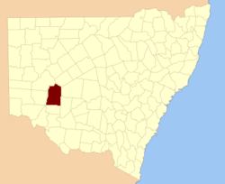
  • Manara County, New South Wales — Infobox Australian cadastral name = Manara state = New South Wales caption = Location in New South Wales near nw = Livingstone near n = Woore near ne = Mossgiel near e = Mossgiel near se = Waljeers near s = Kilfera near sw = Wentworth near w =… …   Wikipedia

  • Manara, Ohio —   Unincorporated community   …   Wikipedia

  • Mossgiel County, New South Wales — Infobox Australian cadastral name = Mossgiel state = New South Wales caption = Location in New South Wales near nw = Woore near n = Booroondarra near ne = Mouramba near e = Blaxland near se = Franklin near s = Waljeers near sw = Manara near w =… …   Wikipedia

  • Perry County, New South Wales — Infobox Australian cadastral name = Perry state = New South Wales caption = Location in New South Wales near nw = Menindee near n = Livingstone near ne = Manara near e = Manara near se = Kilfera near s = Wentworth near sw = Wentworth near w =… …   Wikipedia

  • Mossgiel County — Map of all coordinates from Google Map of all coordinates from Bing Export all coordinates as KML …   Wikipedia

  • Woore County — Map of all coordinates from Google Map of all coordinates from Bing Export all coordinates as KML …   Wikipedia

  • Werunda County — Map of all coordinates from Google Map of all coordinates from Bing Export all coordinates as KML …   Wikipedia

  • National Register of Historic Places listings in Fayette County, Ohio — Location of Fayette County in Ohio This is a list of the National Register of Historic Places listings in Fayette County, Ohio. This is intended to be a complete list of the properties and districts on the National Register of Historic Places in… …   Wikipedia

  • Concord Township, Fayette County, Ohio —   Township   Countryside in Concord Township …   Wikipedia

  • Marion Township, Fayette County, Ohio — Marion Township, Ohio   Township   Municipalities and townships of Fayette County …   Wikipedia

Share the article and excerpts

Direct link
Do a right-click on the link above
and select “Copy Link”