Werunda County

Werunda County
Werunda
New South Wales
Werunda NSW.PNG
Location in New South Wales
Lands administrative divisions around Werunda
Young Killara Rankin
Young Werunda Rankin
Livingstone Woore Woore

Werunda County is one of the 141 Cadastral divisions of New South Wales. The Darling River is the north-western boundary. It includes Poopelloe Lake, and the area to the east and south-east of Wilcannia.

The name Werunda is believed to be derived from a local Aboriginal word.[1]

Parishes within this county

A full list of parishes found within this county; their current LGA and mapping coordinates to the approximate centre of each location is as follows:

Parish LGA Coordinates
Calcoo Central Darling Shire 31°39′10″S 143°35′22″E / 31.65278°S 143.58944°E / -31.65278; 143.58944 (Calcoo)
Caltigeenaa Central Darling Shire 31°34′55″S 143°52′00″E / 31.58194°S 143.8666667°E / -31.58194; 143.8666667 (Caltigeenaa)
Chance Central Darling Shire 31°30′13″S 144°04′53″E / 31.50361°S 144.08139°E / -31.50361; 144.08139 (Chance)
Chirnside Central Darling Shire 31°57′38″S 143°45′13″E / 31.96056°S 143.75361°E / -31.96056; 143.75361 (Chirnside)
Coolmara Central Darling Shire 32°05′22″S 143°49′30″E / 32.08944°S 143.825°E / -32.08944; 143.825 (Coolmara)
Coonavittra Central Darling Shire 31°43′05″S 144°18′23″E / 31.71806°S 144.30639°E / -31.71806; 144.30639 (Coonavittra)
Coonoolcra Central Darling Shire 31°47′18″S 143°35′16″E / 31.78833°S 143.58778°E / -31.78833; 143.58778 (Coonoolcra)
Cowary Central Darling Shire unknown
Cultowa Central Darling Shire 31°53′50″S 144°05′40″E / 31.89722°S 144.09444°E / -31.89722; 144.09444 (Cultowa)
Curranyale Central Darling Shire unknown
Donald Cobar Shire 31°50′34″S 144°20′34″E / 31.84278°S 144.34278°E / -31.84278; 144.34278 (Donald)
Dunoon Central Darling Shire 31°31′41″S 143°37′36″E / 31.52806°S 143.62667°E / -31.52806; 143.62667 (Dunoon)
Goonalgaa Central Darling Shire 31°45′50″S 143°41′28″E / 31.76389°S 143.69111°E / -31.76389; 143.69111 (Goonalgaa)
Greenough Central Darling Shire 31°34′29″S 144°13′15″E / 31.57472°S 144.22083°E / -31.57472; 144.22083 (Greenough)
Gunyulka Central Darling Shire 31°41′55″S 143°29′55″E / 31.69861°S 143.49861°E / -31.69861; 143.49861 (Gunyulka)
Keiss Central Darling Shire 31°30′51″S 143°44′26″E / 31.51417°S 143.74056°E / -31.51417; 143.74056 (Keiss)
Manara Central Darling Shire 32°11′23″S 143°50′39″E / 32.18972°S 143.84417°E / -32.18972; 143.84417 (Manara)
Merry Central Darling Shire 31°25′16″S 144°01′55″E / 31.42111°S 144.03194°E / -31.42111; 144.03194 (Merry)
Moira Central Darling Shire 31°52′54″S 143°54′57″E / 31.88167°S 143.91583°E / -31.88167; 143.91583 (Moira)
Murtee Central Darling Shire 31°36′34″S 143°31′26″E / 31.60944°S 143.52389°E / -31.60944; 143.52389 (Murtee)
Paradise Central Darling Shire 31°59′18″S 143°51′37″E / 31.98833°S 143.86028°E / -31.98833; 143.86028 (Paradise)
Poopelloe Central Darling Shire 31°40′14″S 144°09′22″E / 31.67056°S 144.15611°E / -31.67056; 144.15611 (Poopelloe)
Ringrose Central Darling Shire 32°02′43″S 144°01′15″E / 32.04528°S 144.02083°E / -32.04528; 144.02083 (Ringrose)
Talyawalka Central Darling Shire 31°35′48″S 143°41′28″E / 31.59667°S 143.69111°E / -31.59667; 143.69111 (Talyawalka)
Warwick Cobar Shire 31°56′19″S 144°01′33″E / 31.93861°S 144.02583°E / -31.93861; 144.02583 (Warwick)
Weatherley Central Darling Shire 31°45′37″S 143°51′16″E / 31.76028°S 143.85444°E / -31.76028; 143.85444 (Weatherley)
Weeyoola Central Darling Shire 31°46′05″S 144°09′13″E / 31.76806°S 144.15361°E / -31.76806; 144.15361 (Weeyoola)
Werunda Central Darling Shire 31°29′34″S 143°50′56″E / 31.49278°S 143.84889°E / -31.49278; 143.84889 (Werunda)
Wilcannia South Central Darling Shire 31°36′12″S 143°23′41″E / 31.60333°S 143.39472°E / -31.60333; 143.39472 (Wilcannia South)
Wongolarroo Central Darling Shire 31°39′11″S 143°57′20″E / 31.65306°S 143.95556°E / -31.65306; 143.95556 (Wongolarroo)
Woore Cobar Shire unknown
Woytchugga Central Darling Shire 31°43′17″S 143°23′13″E / 31.72139°S 143.38694°E / -31.72139; 143.38694 (Woytchugga)
Yoree Central Darling Shire 31°44′13″S 144°01′56″E / 31.73694°S 144.03222°E / -31.73694; 144.03222 (Yoree)

References

  1. ^ Geographical Names Board of NSW

Wikimedia Foundation. 2010.

Игры ⚽ Поможем написать курсовую

Look at other dictionaries:

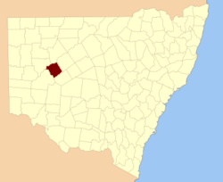
  • Werunda County, New South Wales — Infobox Australian cadastral name = Werunda state = New South Wales caption = Location in New South Wales near nw = Young near n = Killara near ne = Rankin near e = Rankin near se = Woore near s = Woore near sw = Livingstone near w = YoungWerunda …   Wikipedia

  • Woore County, New South Wales — Infobox Australian cadastral name = Woore state = New South Wales caption = Location in New South Wales near nw = Werunda near n = Rankin near ne = Booroondarra near e = Mossgiel near se = Mossgiel near s = Manara near sw = Livingstone near w =… …   Wikipedia

  • Woore County — Map of all coordinates from Google Map of all coordinates from Bing Export all coordinates as KML …   Wikipedia

  • Killara County, New South Wales — Infobox Australian cadastral name = Killara state = New South Wales caption = Location in New South Wales near nw = Fitzgerald near n = Fitzgerald near ne = Landsborough near e = Yanda near se = Rankin near s = Werunda near sw = Young near w =… …   Wikipedia

  • Livingstone County, New South Wales — Map of all coordinates from Google Map of all coordinates from Bing Export all coordinates as KML …   Wikipedia

  • Rankin County, New South Wales — Infobox Australian cadastral name = Rankin state = New South Wales caption = Location in New South Wales near nw = Killara near n = Landsborough near ne = Yanda near e = Robinson near se = Booroondarra near s = Woore near sw = Werunda near w =… …   Wikipedia

  • Young County, New South Wales — Infobox Australian cadastral name = Young state = New South Wales caption = Location in New South Wales near nw = Mootwingee near n = Yungnulgra near ne = Killara near e = Werunda near se = Livingstone near s = Livingstone near sw = Tandora near… …   Wikipedia

  • Killara County — Map of all coordinates from Google Map of all coordinates from Bing Export all coordinates as KML …   Wikipedia

  • Lands administrative divisions of New South Wales — The 141 counties of New South Wales, with the original Nineteen shown in pink …   Wikipedia

  • Cadastral divisions of New South Wales — refers to the 141 counties within the Australian state of New South Wales, which are further subdivided into 7,459 parishes. There are also three Land Divisions, around 100 Land Districts, and several other types of districts as well as land… …   Wikipedia

Share the article and excerpts

Direct link
Do a right-click on the link above
and select “Copy Link”