Woore County

Woore County
Woore
New South Wales
Woore NSW.PNG
Location in New South Wales
Lands administrative divisions around Woore
Werunda Rankin Booroondarra
Werunda Woore Mossgiel
Livingstone Manara Mossgiel

Woore County is one of the 141 Cadastral divisions of New South Wales.

Woore County was named in honour of Commissioner of Crown Lands John C Woore.[1]

Parishes within this county

A full list of parishes found within this county; their current LGA and mapping coordinates to the approximate centre of each location is as follows:

Parish LGA Coordinates
Baden Park Central Darling Shire 32°1034S 144°1243E / 32.17611°S 144.21194°E / -32.17611; 144.21194 (Baden Park)
Bambilla Central Darling Shire 32°1705S 144°1714E / 32.28472°S 144.28722°E / -32.28472; 144.28722 (Bambilla)
Banny Cobar Shire 32°0228S 144°1822E / 32.04111°S 144.30611°E / -32.04111; 144.30611 (Banny)
Barcham Cobar Shire 32°1950S 144°4559E / 32.33056°S 144.76639°E / -32.33056; 144.76639 (Barcham)
Berangabah Cobar Shire 32°1642S 144°3210E / 32.27833°S 144.53611°E / -32.27833; 144.53611 (Berangabah)
Boingadah Central Darling Shire 32°2200S 144°2359E / 32.3666667°S 144.39972°E / -32.3666667; 144.39972 (Boingadah)
Brougham Cobar Shire unknown
Bulla Cobar Shire 31°5038S 144°3433E / 31.84389°S 144.57583°E / -31.84389; 144.57583 (Bulla)
Bullberry Central Darling Shire 32°3406S 144°1940E / 32.56833°S 144.32778°E / -32.56833; 144.32778 (Bullberry)
Carrington Cobar Shire 32°0651S 144°4652E / 32.11417°S 144.78111°E / -32.11417; 144.78111 (Carrington)
Cathkin Central Darling Shire 32°1035S 144°0203E / 32.17639°S 144.03417°E / -32.17639; 144.03417 (Cathkin)
Cooruba Central Darling Shire 32°2743S 144°2845E / 32.46194°S 144.47917°E / -32.46194; 144.47917 (Cooruba)
Emerald Cobar Shire 31°5554S 144°4534E / 31.93167°S 144.75944°E / -31.93167; 144.75944 (Emerald)
Emerald Cobar Shire 31°5801S 144°4535E / 31.96694°S 144.75972°E / -31.96694; 144.75972 (Emerald)
Eurugabah Cobar Shire 32°1257S 144°4026E / 32.21583°S 144.67389°E / -32.21583; 144.67389 (Eurugabah)
Hann Central Darling Shire 32°0532S 144°0809E / 32.09222°S 144.13583°E / -32.09222; 144.13583 (Hann)
Hay Shire Council Central Darling Shire 32°2117S 143°5708E / 32.35472°S 143.95222°E / -32.35472; 143.95222 (Hay Shire Council)
Kerpa Central Darling Shire 32°1622S 143°5525E / 32.27278°S 143.92361°E / -32.27278; 143.92361 (Kerpa)
Kew Cobar Shire 32°0547S 144°2125E / 32.09639°S 144.35694°E / -32.09639; 144.35694 (Kew)
Koorinya Cobar Shire 32°0639S 144°3229E / 32.11083°S 144.54139°E / -32.11083; 144.54139 (Koorinya)
Kulki Cobar Shire 32°1231S 144°5632E / 32.20861°S 144.94222°E / -32.20861; 144.94222 (Kulki)
Lanty Cobar Shire 32°1001S 144°2730E / 32.16694°S 144.45833°E / -32.16694; 144.45833 (Lanty)
Manara Central Darling Shire unknown
Marfield Central Darling Shire 32°3048S 144°1227E / 32.51333°S 144.2075°E / -32.51333; 144.2075 (Marfield)
Moama Cobar Shire unknown
Nekarboo Cobar Shire unknown
Sandy Cobar Shire 32°1332S 144°2210E / 32.22556°S 144.36944°E / -32.22556; 144.36944 (Sandy)
Temounga Cobar Shire 32°0034S 144°4139E / 32.00944°S 144.69417°E / -32.00944; 144.69417 (Temounga)
Tiltagara Cobar Shire 31°5401S 144°3727E / 31.90028°S 144.62417°E / -31.90028; 144.62417 (Tiltagara)
Tooranie Central Darling Shire 32°1537S 144°0503E / 32.26028°S 144.08417°E / -32.26028; 144.08417 (Tooranie)
Warra Wigra Cobar Shire 32°2227S 144°3631E / 32.37417°S 144.60861°E / -32.37417; 144.60861 (Warra Wigra)
Widgee Central Darling Shire 32°2117S 144°1012E / 32.35472°S 144.17°E / -32.35472; 144.17 (Widgee)

References

  1. ^ Geographical Names Board of NSW

Wikimedia Foundation. 2010.

Игры ⚽ Нужно решить контрольную?

Look at other dictionaries:

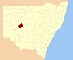
  • Woore County, New South Wales — Infobox Australian cadastral name = Woore state = New South Wales caption = Location in New South Wales near nw = Werunda near n = Rankin near ne = Booroondarra near e = Mossgiel near se = Mossgiel near s = Manara near sw = Livingstone near w =… …   Wikipedia

  • Woore — is a village and civil parish in the North Shropshire district of Shropshire, England. It had a population of 1,411 in the 2001 census. The name means boundary in ancient celtic and this fits nicely with the fact that it is on the boundary with… …   Wikipedia

  • Mossgiel County — Map of all coordinates from Google Map of all coordinates from Bing Export all coordinates as KML …   Wikipedia

  • Werunda County — Map of all coordinates from Google Map of all coordinates from Bing Export all coordinates as KML …   Wikipedia

  • Werunda County, New South Wales — Infobox Australian cadastral name = Werunda state = New South Wales caption = Location in New South Wales near nw = Young near n = Killara near ne = Rankin near e = Rankin near se = Woore near s = Woore near sw = Livingstone near w = YoungWerunda …   Wikipedia

  • Livingstone County, New South Wales — Map of all coordinates from Google Map of all coordinates from Bing Export all coordinates as KML …   Wikipedia

  • Mossgiel County, New South Wales — Infobox Australian cadastral name = Mossgiel state = New South Wales caption = Location in New South Wales near nw = Woore near n = Booroondarra near ne = Mouramba near e = Blaxland near se = Franklin near s = Waljeers near sw = Manara near w =… …   Wikipedia

  • Rankin County, New South Wales — Infobox Australian cadastral name = Rankin state = New South Wales caption = Location in New South Wales near nw = Killara near n = Landsborough near ne = Yanda near e = Robinson near se = Booroondarra near s = Woore near sw = Werunda near w =… …   Wikipedia

  • Booroondarra County, New South Wales — Infobox Australian cadastral name = Booroondarra state = New South Wales caption = Location in New South Wales near nw = Rankin near n = Yanda near ne = Robinson near e = Mouramba near se = Mossgiel near s = Mossgiel near sw = Woore near w =… …   Wikipedia

  • Manara County, New South Wales — Infobox Australian cadastral name = Manara state = New South Wales caption = Location in New South Wales near nw = Livingstone near n = Woore near ne = Mossgiel near e = Mossgiel near se = Waljeers near s = Kilfera near sw = Wentworth near w =… …   Wikipedia

Share the article and excerpts

Direct link
https://en-academic.com/dic.nsf/enwiki/11583985 Do a right-click on the link above
and select “Copy Link”