Wellington County, New South Wales
- Wellington County, New South Wales
Infobox Australian cadastral
name = Wellington
state = New South Wales
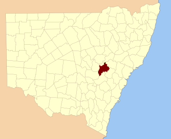
caption = Location in New South Wales
near-nw = Gordon
near-n = Bligh
near-ne = Phillip
near-e = Roxburgh
near-se = Roxburgh
near-s = Bathurst
near-sw = Ashburnham
near-w = Ashburnham
Wellington County is a county in New South Wales, Australia, which was one of the original Nineteen Counties. The town of Wellington is near the north-eastern edge. The Bell River is the boundary to the east, and the Gudgegong River to the north. It includes land on both sides of the Macquarie River.
It contains the town of Mudgee, where the first house was stated to have been built in 1837 by one [http://genealogy.wikia.com/wiki/John_Blackman_(1795-1867) John Blackman] .
There is a modern-day local government area called just "Wellington".
Wellington County was named in honour of Arthur Wellesley, Duke of Wellington (1769-1852). [ [http://www.gnb.nsw.gov.au/name_search/extract?id=KWQloesyuj Geographical Names Board of NSW] ]
= Parishes within this county=
A full list of parishes found within this county; their current LGA and mapping coordinates to the approximate centre of each location is as follows:
References
Wikimedia Foundation.
2010.
Look at other dictionaries:
Phillip County, New South Wales — Infobox Australian cadastral name = Phillip state = New South Wales caption = Location in New South Wales near nw = Bligh near n = Brisbane near ne = Brisbane near e = Hunter near se = Hunter near s = Roxburgh near sw = Wellington near w =… … Wikipedia
Roxburgh County, New South Wales — Infobox Australian cadastral name = Roxburgh state = New South Wales caption = Location in New South Wales near nw = Wellington near n = Phillip near ne = Hunter near w = Wellington near e = Cook near sw = Bathurst near s = Westmoreland near se … Wikipedia
Bathurst County, New South Wales — Infobox Australian cadastral name = Bathurst state = New South Wales caption = Location in New South Wales near nw = Ashburnham near n = Wellington near ne = Roxburgh near w = Forbes near e = Westmoreland near sw = Monteagle near s = King near se … Wikipedia
Bligh County, New South Wales — Infobox Australian cadastral name = Bligh state = New South Wales caption = Location in New South Wales near nw = Napier near n = Pottinger near ne = Buckland near e = Brisbane near se = Phillip near s = Wellington near sw = Gordon near w =… … Wikipedia
Ashburnham County, New South Wales — Infobox Australian cadastral name = Ashburnham state = New South Wales caption = Location in New South Wales near nw = Kennedy near n = Gordon near ne = Wellington near w = Cunningham near e = Bathurst near sw = Gipps near s = Forbes near se =… … Wikipedia
Gordon County, New South Wales — Map of all coordinates from Google Map of all coordinates from Bing Export all coordinates as KML … Wikipedia
New South Wales Legislative Assembly electoral districts — The New South Wales Legislative Assembly is elected from 93 single member electorates called districts. Current districts This is a list of districts for the 2007 general election.* Albury * Auburn * Ballina * Balmain (1880 1894: Balmain; 1894… … Wikipedia
Wellington County — * Wellington County, Ontario * Wellington County, New South Wales, a former county, containing the town of Mudgee … Wikipedia
North Yeoval, New South Wales — North Yeoval New South Wales … Wikipedia
Electoral district of Wellington (New South Wales) — Wellington was an electoral district of the Legislative Assembly in the Australian state of New South Wales, created in 1859 and named after and including Wellington. It replaced part of Wellington (County). It was abolished in 1904, with the… … Wikipedia