- County of Hampden, Victoria
-
Hampden
Victoria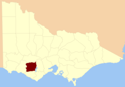
Location in VictoriaLands administrative divisions around Hampden Ripon Ripon Grenville Villiers Hampden Grenville Villiers Heytesbury Polwarth The County of Hampden is one of the 37 counties of Victoria which are part of the cadastral divisions of Australia, used for land titles. The County is in the Western District of Victoria bounded by Lake Corangamite in the east and the Hopkins River in the west. In the north and south the County was bounded approximately by the existing roads, now the Glenelg Highway and the Princes Highway. Larger towns include Terang and Skipton . The County was proclaimed in 1849.
Parishes
Parishes within the county:
- Borriyalloak
- Caramballuc South
- Chatsworth (part in the County of Villiers)
- Cobra Killuc
- Colongulac
- Connewarren
- Corangamite
- Darlington
- Darlington West
- Dunnawalla
- Eilyar
- Ellerslie
- Ettrick
- Framlingham East
- Galla
- Garvoc
- Geelengla
- Glenormiston
- Gnarkeet
- Hexham East
- Jellalabad
- Kariah
- Keilambete
- Kilnoorat
- Kolara
- Koort-koort-nong
- Kornong
- Ligar
- Lismore
- Marida Yallock
- Mortlake
- Nerrin Nerrin
- Panmure
- Pircarra
- Purrumbete North
- Skipton
- Struan
- Taaraak
- Terang
- Terrinallum
- Tooliorook
- Toorak
- Towanway
- Vite Vite
- Wooriwyrite
- Woorndoo
- [1]
References
- ^ Rootsweb Genealogy, Victorian Counties, http://freepages.genealogy.rootsweb.ancestry.com/~kenmac/victowns/viccounties.htm, retrieved 2008-09-20
- Research aids, Victoria 1910
- Map of the counties of Follett, Dundas, Ripon, Normanby, Villiers, Hampden, Heytesbury / John Sands
Coordinates: 37°59′S 143°00′E / 37.983°S 143°E
Counties of Victoria Anglesey • Benambra • Bendigo • Bogong • Borung • Bourke • Buln Buln • Croajingolong • Dalhousie • Dargo • Delatite • Dundas • Evelyn • Follett • Gladstone • Grant • Grenville • Gunbower • Hampden • Heytesbury • Kara Kara • Karkarooc • Lowan • Millewa • Moira • Mornington • Normanby • Polwarth • Ripon • Rodney • Talbot • Tambo • Tanjil • Tatchera • Villiers • Weeah • Wonnangatta
Categories:- Counties of Victoria (Australia)
- Victoria (Australia) geography stubs

Wikimedia Foundation. 2010.