- Ryan, California
-
For the former settlement with this name, see Lila C, California.
Ryan — Unincorporated community — Location in California
 Ryan
RyanCoordinates: 36°19′23″N 116°40′17″W / 36.32306°N 116.67139°WCoordinates: 36°19′23″N 116°40′17″W / 36.32306°N 116.67139°W Country United States State California County Inyo County Elevation[1] 3,045 ft (928 m) Ryan (formerly, Colemanite and Devair) is an unincorporated community in Inyo County, California.[1] It lies at an elevation of 3045 feet (928 m) south of the Amargosa Desert in the Mojave Desert.[1]
It was the terminus for the Death Valley Railroad, running from the Pacific Coast Borax Company borax works near Death Valley Junction, California in the early 20th century.
After production had stopped, in an effort to increase revenues on the Tonopah and Tidewater Railroad which had carried the borax ore, Pacific Coast Borax converted the miners' lodgings into tourist accommodations and gave tourists visiting Death Valley trips on the baby gauge rail line into the mine.[2]
References
Municipalities and communities of Inyo County, California City 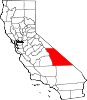
CDPs Big Pine | Cartago | Darwin | Dixon Lane-Meadow Creek | Furnace Creek | Homewood Canyon | Independence | Keeler | Lone Pine | Mesa | Olancha | Pearsonville | Round Valley | Shoshone | Tecopa | Trona | Valley Wells | West Bishop | Wilkerson
Unincorporated
communitiesAberdeen | Alabama Hills | Alico | Alta Vista | Ashford Junction | Aspendell | Badwater | Ballarat | Bartlett | Beatty Junction | Beveridge | Blackrock | Brockmans Corner | Calvada Springs | Coso | Coso Junction | Crater | Death Valley Junction | Deep Springs | Dolomite | Dunmovin | Evelyn | Fish Springs | Grant | Haiwee | Harrisburg | Homewood Canyon-Valley Wells | Indian Village | Junction Ranch | Kearsarge | Keough Hot Springs | Laws | Linnie | Little Lake | Millspaugh | Mock | Monola | Oteys Sierra Village | Owenyo | Panamint Springs | Park Village | Peterson Mill | Poleta | Reward | Rocking K | Rovana | Ryan | Scheelite | Scranton | Seven Pines | Stovepipe Wells | Sykes | Talus | Teakettle Junction | Whitney Portal | Zurich
Indian
reservationsBig Pine Reservation | Lone Pine Reservation
Ghost towns Ashford Mill | Avena | Bend City | Bradford Siding | Burnt Wagons | Carthage | Cerro Gordo Landing | Chloride City | Chrysopolis | Clark | Copperfield | Coso | Echo | Elna | Furnace | Furnace Creek Inn | Greenwater | Grestley | Horton | Intake | Jay | Kasson | Kearsarge | Lane Mill | Leadfield | Lee | Lila C | Lone Pine Station | Lookout City | Manzanar | Narka | Newburyport | Nine Mile Station | Noonday Camp | Owensville | Panamint | Reilly | San Carlos | Schwaub | Skidoo | Skyes | Sodan | Stewarts | Sunland | Swansea | Tule Station | White Mountain City
Categories:- Populated places in Inyo County, California
- Populated places in the Mojave Desert
- Unincorporated communities in California
- Mining communities in California
- History of the Mojave Desert region
- History of Inyo County, California
- Inyo County, California geography stubs


Wikimedia Foundation. 2010.